


<< Text Pages >> King's Castle (Wells) - Ancient Village or Settlement in England in Somerset
Submitted by AngieLake on Wednesday, 18 September 2013 Page Views: 4803
Multi-periodSite Name: King''s Castle (Wells)Country: England County: Somerset Type: Ancient Village or Settlement
Nearest Town: Wells
Map Ref: ST568456
Latitude: 51.207964N Longitude: 2.619786W
Condition:
| 5 | Perfect |
| 4 | Almost Perfect |
| 3 | Reasonable but with some damage |
| 2 | Ruined but still recognisable as an ancient site |
| 1 | Pretty much destroyed, possibly visible as crop marks |
| 0 | No data. |
| -1 | Completely destroyed |
| 5 | Superb |
| 4 | Good |
| 3 | Ordinary |
| 2 | Not Good |
| 1 | Awful |
| 0 | No data. |
| 5 | Can be driven to, probably with disabled access |
| 4 | Short walk on a footpath |
| 3 | Requiring a bit more of a walk |
| 2 | A long walk |
| 1 | In the middle of nowhere, a nightmare to find |
| 0 | No data. |
| 5 | co-ordinates taken by GPS or official recorded co-ordinates |
| 4 | co-ordinates scaled from a detailed map |
| 3 | co-ordinates scaled from a bad map |
| 2 | co-ordinates of the nearest village |
| 1 | co-ordinates of the nearest town |
| 0 | no data |
Be the first person to rate this site - see the 'Contribute!' box in the right hand menu.
Internal Links:
External Links:
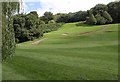
King's Castle is on a hill to the east of Wells. It is a small fortified settlement thought to be for only one family.
The holed stone at Wells and Mendip Museum originated near here:
Standing stone, west of Kings Castle, Wells:
ST 5653 4562 (ST 54 NE)
On Modern Antiquarian our own 'Hamish' says:
This is found in front of Wells Museum, it was brought from Tor hill in the east of Wells where it was being used as a gate post. It is a Hoker stone, people pledge oaths by joining hands through the hole.
Rhiannon on Modern Antiquarian says:
The Somerset Historic Environment record suggests the stone was originally at ST 5653 4562, at the foot of King's Castle hill. Also that in its new? or long-adopted? guise as Hoker Stone it stood on the green outside Well's cathedral. Couldn't people be bothered to walk all that way to seal their bargains? Or was it intentionally brought nearer the cathedral where any dubious goings-on could be quashed? Does anyone know when it was moved?
The Somerset HER is here
You may be viewing yesterday's version of this page. To see the most up to date information please register for a free account.
Do not use the above information on other web sites or publications without permission of the contributor.
Nearby Images from Geograph Britain and Ireland:

©2019(licence)
©2011(licence)

©2019(licence)

©2020(licence)

©2021(licence)
The above images may not be of the site on this page, they are loaded from Geograph.
Please Submit an Image of this site or go out and take one for us!
Click here to see more info for this site
Nearby sites
Key: Red: member's photo, Blue: 3rd party photo, Yellow: other image, Green: no photo - please go there and take one, Grey: site destroyed
Download sites to:
KML (Google Earth)
GPX (GPS waypoints)
CSV (Garmin/Navman)
CSV (Excel)
To unlock full downloads you need to sign up as a Contributory Member. Otherwise downloads are limited to 50 sites.
Turn off the page maps and other distractions
Nearby sites listing. In the following links * = Image available
1.6km W 278° St Andrew's Well (Wells)* Holy Well or Sacred Spring (ST5522745824)
1.6km W 270° Glastonbury Tor milestone at Wells* Modern Stone Circle etc (ST552456)
1.7km W 279° Wells Cathedral* Early Christian Sculptured Stone (ST5514645865)
1.7km W 280° Wells and Mendip Museum* Museum (ST551459)
2.8km E 92° Crapnell Stone Circle (ST596455)
3.1km N 350° Pen Hill Longbarrow* Long Barrow (ST563487)
4.2km WNW 299° Wookey Hole Caves Museum* Museum (ST531477)
4.3km WNW 303° Badger Hole (Somerset) Cave or Rock Shelter (ST53244795)
4.3km NNW 347° Drove Cottage Henge* Henge (ST559498)
4.3km WNW 303° Wookey Hole Caves* Cave or Rock Shelter (ST53194801)
4.5km ENE 69° Maesbury Castle* Hillfort (ST610472)
4.6km NNW 348° Hunter's Lodge Inn Barrow* Round Barrow(s) (ST559501)
4.6km NE 40° Whitnell Corner Barrows* Barrow Cemetery (ST5982849096)
4.7km SW 236° Harters Hill* Ancient Trackway (ST529430)
5.7km NNW 336° Fair Lady Well* Holy Well or Sacred Spring (ST54515079)
5.8km NNW 328° Eastwater Tumuli Round Barrow(s) (ST5377250539)
5.9km WNW 302° Deerleap Stones* Standing Stones (ST51804876)
6.6km NNW 334° Priddy Nine Barrows* Barrow Cemetery (ST53925149)
6.7km E 85° Beacon Hill (Oakhill) Barrows* Barrow Cemetery (ST63484616)
7.1km NNW 335° Ashen Hill Barrows* Barrow Cemetery (ST53905205)
7.2km NW 324° Priddy Church Barrows* Barrow Cemetery (ST526514)
7.3km NNW 341° Castle Farm Long Barrow* Long Barrow (ST54525255)
7.4km SSE 161° Glastonbury Stone Circle* Modern Stone Circle etc (ST59143858)
7.5km NNW 337° Priddy Circles S* Henge (ST53945255)
7.6km NW 314° Priddy long barrow* Long Barrow (ST5141550915)
View more nearby sites and additional images


 We would like to know more about this location. Please feel free to add a brief description and any relevant information in your own language.
 Wir möchten mehr über diese Stätte erfahren. Bitte zögern Sie nicht, eine kurze Beschreibung und relevante Informationen in Deutsch hinzuzufügen.
 Nous aimerions en savoir encore un peu sur les lieux. S'il vous plaît n'hesitez pas à ajouter une courte description et tous les renseignements pertinents dans votre propre langue.
 Quisieramos informarnos un poco más de las lugares. No dude en añadir una breve descripción y otros datos relevantes en su propio idioma.