Contributory members are able to log private notes and comments about each site
Sites Merlinsboy has logged. View this log as a table or view the most recent logs from everyone
Steinacleit
Trip No.1 Entry No.1 Date Added: 21st Jun 2026
Site Type: Chambered Tomb
Country: Scotland (Isle of Lewis)
Visited: Yes on 4th Jun 2026. My rating: Condition 2 Access 4
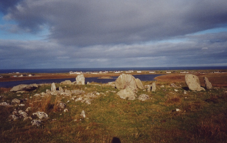
Steinacleit submitted by DrewParsons on 6th Nov 2008. Steinacleit with a broch just visible on the islet in the lake in the background.
(View photo, vote or add a comment)
Log Text: Did not have long here but very interesting.
I will be back!
Green Meadow Woods
Date Added: 11th Mar 2026
Site Type: Holy Well or Sacred Spring
Country: Wales (Monmouthshire (Sir Fynwy))
Visited: Yes on 7th Mar 2026. My rating: Condition 1 Ambience 4 Access 4
Log Text: As this site is very close by I visit often. It is council owned and open to the public. Not for those with mobility issues although the woodland is ringed by paths that are 75% accessible by chair or scooter. The paths are often muddy in wet weather.
The woodland itself is semi ancient with a mixture of trees but predominantly beech and oak. Laurel and holly are causing an issue along with litter. The woods are used daily by dog walkers and schoolchildren. You might see the odd dowser as well as a healthy population of birds.
The location on the map shown is INCORRECT. The correct coordinates are 51°39'15.54"N 3°03'10.64"W
Following on from what has already been written here, I can add that the condition of the 'well' has deteriorated since the archaeological excavations, some 13 years ago. That was according to Richard Davies who was mentioned in the previous piece. He and I have walked the woods after I had just started dowsing. By that time I had found a few things. My knowledge level has increased in the 18 months since our visit.
Many visits have built up up a fraction of the picture, a few pieces of the jigsaw here and there. I intend, before I leave this place for pastures new, to provide a start for anyone who may follow. The journey will be worthwhile.
Rhys, Merlin's boy