



Contributory members are able to log private notes and comments about each site
Sites stonetracker has logged. View this log as a table or view the most recent logs from everyone
Cairn de Menez Dregan
Trip No.1 Entry No.38 Date Added: 25th Oct 2026
Site Type: Chambered Cairn
Country: France (Bretagne:Finistère (29))
Visited: Yes on 1st Sep 2026. My rating: Condition 3 Ambience 5 Access 4
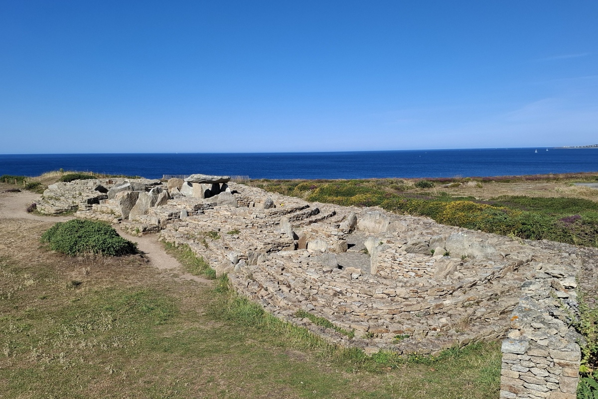
Cairn de Menez Dregan submitted by johnstone on 6th Sep 2025. Image taken July 4, 2025
(View photo, vote or add a comment)
Log Text: A fascinating chambered tomb containing a group of 5 passage graves constructed from the Middle Neolithic to nearly the early Bronze age. But unlike most of similar sites at Ile Carn and Barnenez, the covering cairn has been stripped away revealing the evolution of tomb architecture over the centuries.
To get there from the commune of Plouhinec, take Rue Lann Ilis south. In 3.4 km, turn right onto Route de Gwendez. Continue straight onto Rue de la Corniche for another 500 m. The large parking lot is a right hand turn and is signposted. There is a visitor center which was closed when I was there, but the grounds are open.
Grotte de Menez Dregan
Trip No.1 Entry No.37 Date Added: 21st Oct 2026
Site Type: Cave or Rock Shelter
Country: France (Bretagne:Finistère (29))
Visited: Yes on 1st Sep 2026. My rating: Ambience 5
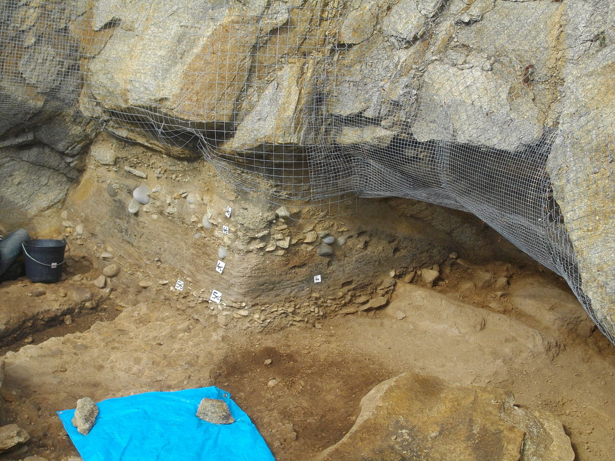
Grotte de Menez Dregan submitted by Creative Commons on 7th May 2016. Gisement de Menez Dregan ( commune de Plouhinec dans le Finistère)Ancienne grotte marine préhistorique
By Raphodon (Own work) [GFDL or CC BY-SA 3.0], via Wikimedia Commons
(View photo, vote or add a comment)
Log Text: This is a very interesting and very rare early Paleolithic site that deserves far more description even though close access is prohibited (see photos for more info). To get there, see the visitor log for Cairn de Menez Dregan and park in the lot. There is a signposted trail that leads over the ledges about 200 m towards the sea and down a rather steep slope to a series of viewing platforms. The archaeological excavation site is in a cave on the side of the cliffs. It is all fenced off and inaccessible but you can get within 100 m of the habitation site and acquire some sense of the layout. This site is more important for what was discovered there and not so much for what can actually be seen by visitors.
Dolmens de Menez Dregan 2
Trip No.1 Entry No.36 Date Added: 18th Oct 2026
Site Type: Burial Chamber or Dolmen
Country: France (Bretagne:Finistère (29))
Visited: Yes on 1st Sep 2026. My rating: Condition 2 Ambience 2 Access 4

Dolmens de Menez Dregan 2 submitted by karolus on 11th Jan 2018. Site in Bretagne:Finistère (29) France
(View photo, vote or add a comment)
Log Text: Not much has changed here. This dolmen, although fairly easily to find, is so overgrown that access to the passage is difficult. For that reason, winter may be the best time to see it. All of the capstones are gone and only half of the passage or orthostats are visible.
To get there, park in the lot for Cairn de Menez Dregan (see visitor log for that site), cross the road, and walk left for about 100 m. You will see a large lay by or pull off area on the side of the road near a house. There is a dirt track at the rear of the pulloff. Walk down there for a few meters and you will see some stones of the site on the right in the brambles. Watch the thorns if you try to enter it !
Kerbalanec Allée Couverte
Trip No.1 Entry No.35 Date Added: 15th Oct 2026
Site Type: Passage Grave
Country: France (Bretagne:Finistère (29))
Visited: Yes. My rating: Condition 3 Ambience 5 Access 5
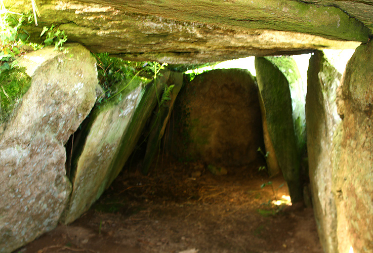
Kerbalanec allée couverte submitted by paulcall on 21st May 2009. A view from the inside looking in the opposite direction
(View photo, vote or add a comment)
Log Text: Well-preserved allee couverte between two farm fields, likely built in the late Neolithic but used into the early Bronze Age judging by the artifacts.
To get there from Kernevez, take D7 west for 3 km and take a right onto Kerbalanec Rd. At this point, you wind your way through a maze of farms and gravel rds for about 1 km to the site. Most navigation apps should lead you there successfully.
You can park within 200 ft of the site on the edge of a field, so access for the mobility impaired is possible.
Carn menhir (Loperhet)
Trip No.1 Entry No.34 Date Added: 15th Oct 2026
Site Type: Standing Stone (Menhir)
Country: France (Bretagne:Finistère (29))
Visited: Saw from a distance on 1st Sep 2026. My rating: Condition 3 Ambience 4

Carn menhir (Loperhet) submitted by peulven on 28th Oct 2024. Site in Bretagne:Finistère (29) France
(View photo, vote or add a comment)
Log Text: This was drive-by remote viewing only as I was en route to Brest and this site happened to be on the way. Unclear where to park, not that I had the time on this trip.
Site looked unchanged from photos.
Lesconil allée couverte
Trip No.1 Entry No.33 Date Added: 14th Oct 2026
Site Type: Passage Grave
Country: France (Bretagne:Finistère (29))
Visited: Yes on 1st Sep 2026. My rating: Condition 3 Ambience 5 Access 4

Lesconil allée couverte submitted by johnstone on 23rd Aug 2025. Picture June 26, 2025
(View photo, vote or add a comment)
Log Text: Perhaps the best preserved of a handful of arc-boutee style Allee couvertes in Brittany. In these, there are no capstones. The side slabs lean inward until their tops touch, creating a long tent-like appearance. This greatly reduces the "stand up" room inside the chamber. The site was built in the late Neolithic era and likely used into the Bronze Age and beyond.
The site has its own parking area nearby and is signposted with interpretation. To get there from the center of Douarnenez, take D7 south and west for approximately 4 km and then take a right onto Lenn a Voa. In 700 m stay left at the fork onto Lesconil. At the end of this road, take a left at the intersection and the site pkg area will appear shortly afterwards on the right.
Lagatjar alignements
Trip No.1 Entry No.32 Date Added: 13th Oct 2026
Site Type: Stone Row / Alignment
Country: France (Bretagne:Finistère (29))
Visited: Yes on 1st Sep 2026. My rating: Condition 3 Ambience 4 Access 4
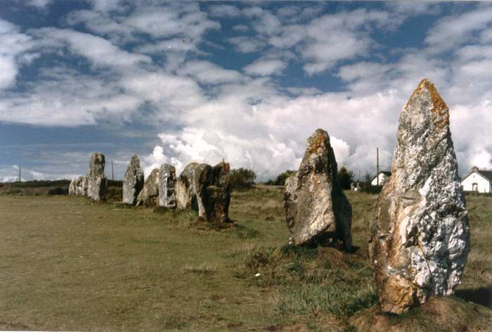
Lagatjar Alignements submitted by thecaptain on 18th Oct 2004. Lagatjar Alignements.
West of the fishing town of Camaret, in the far west of the Crozon Peninsula, Finisterre Brittany.
If memory serves me right, these stones form part of a sort of large stone square.
(View photo, vote or add a comment)
Log Text: There aren't many stone alignments left in Finistere, but this is probably the best preserved of the lot and is on the Crozon Peninsula. About 80 stones left, not all of the same size, most in pretty good condition. All white quartz which I believe was locally sourced. Historical accounts describe a site ten times the length of what you see today. Many of the stones were likely appropriated for houses or building materials over time.
To get there from the center of Camaret sur Mer, take D8 (Rue Andre Antoine) west from the roundabouts for approximately 1 km to D8A (Rue Saint-Pol Roux) and turn right. The site and on-street parking is on your left in about 200 meters. The main alignment is about a 100 m easy walk from the parking area in a field.
Ty ar Boudiquet Dolmen
Trip No.1 Entry No.31 Date Added: 12th Oct 2026
Site Type: Burial Chamber or Dolmen
Country: France (Bretagne:Finistère (29))
Visited: Yes on 1st Sep 2026. My rating: Condition 4 Ambience 5 Access 4
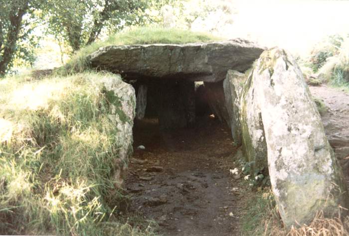
Ty ar Boudiquet dolmen submitted by thecaptain on 29th Oct 2004. Brennilis Dolmen, an Allee Couvert still partially buried under its mound.
Found just outside the small village of Brennilis, about halfway between Brasparts and Huelgoat in western Brittany
(View photo, vote or add a comment)
Log Text: An unusual V-shaped passage grave with most of its surrounding mound still intact. Site has its own signposted parking area with the monument just a short walk from there. To get there from the main roundabout in village of Brennilis, proceed north on D36 about 400 m and take a right onto Bellevue. The site parking lot is about 200 m down the road on the right.
Guinivrit
Trip No.1 Entry No.30 Date Added: 11th Oct 2026
Site Type: Passage Grave
Country: France (Bretagne:Finistère (29))
Visited: Yes on 1st Sep 2026. My rating: Condition 2 Ambience 4 Access 3
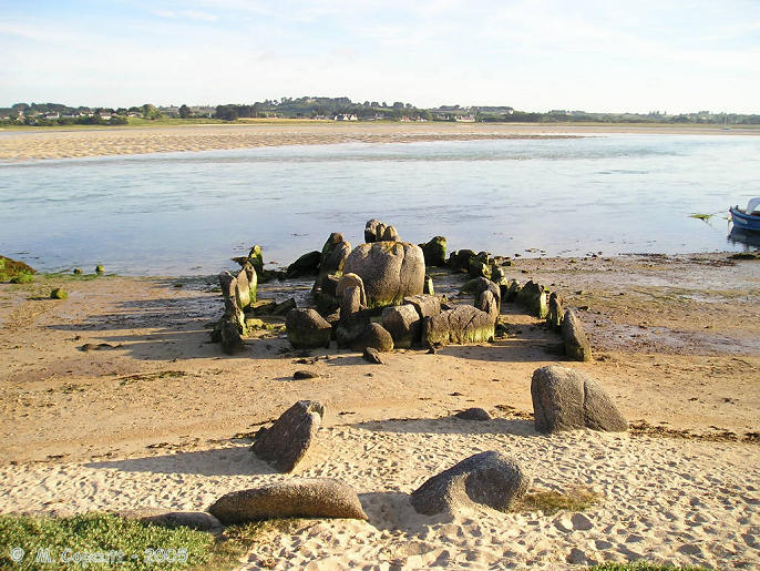
Guinivrit submitted by thecaptain on 25th Mar 2006. Guinivrit allée couverte.
The remains of this allée couverte clearly show the rise in sea level over the past 4000 odd years. Twice a day it gets a wash.
(View photo, vote or add a comment)
Log Text: Check the tide charts before you visit this site which is on the beach, although it certainly wasn't in the water in neolithic times. At high tide it is now mostly submerged and only partially visible. I took a chance and visited at mid tide. Got lucky as it was mostly visible.
The harder part was finding the car park for the site, as Google Maps decided to send me on a time-consuming wild goose chase. The free public beach parking lot is about 3 km west of the commune of Plouescat at 48.6586, -4.21898. There is also an RV camping area next to it if you happen to be staying there.
From the parking lot, walk about 300 meters southeast to the beach or follow the sand road about the same distance to the boat ramp. When you reach the beach look to your left (east). The site is about 100 m down the beach, literally rocks sticking out of the sand at 48.6568, -4.2159.
The allee couverte is in about as good shape as can be expected considering that it's been awash in moving tides for much of its history. All of the capstones are gone, but many of the orthostats, much of the surrounding peristalth, and even the cella are still extant.
Barnenez Cairn
Trip No.1 Entry No.29 Date Added: 7th Oct 2026
Site Type: Chambered Cairn
Country: France (Bretagne:Finistère (29))
Visited: Yes on 1st Sep 2026. My rating: Condition 3 Ambience 5 Access 4

Barnenez Cairn submitted by neolithique02 on 22nd Feb 2014. Cairn de Barnenez Site in Bretagne:Finistère (29) France
Image copyright: Néolithique02, hosted on Flickr and displayed under the terms of their API.
(View photo, vote or add a comment)
Log Text: Although significantly restored over the years with most of its passages now closed to visitation , this one was on my megalithic bucket list ! It remains one of the grandest and oldest chambered tombs in Europe. The headland on which it sits is fenced and access requires a nominal admission fee. Consult their web site as open hours can vary over the seasons. There is a small visitor's center, bookshop, museum, and rest rooms. Guided tours are offered - consult reception for details.
To get there from Plouezoc'h, drive 2.6 km NW on D76 and take a slight left onto Route de Barnenez. Parking is 1.3 km farther.
Mougau Bihan
Trip No.1 Entry No.28 Date Added: 3rd Oct 2026
Site Type: Passage Grave
Country: France (Bretagne:Finistère (29))
Visited: Yes on 1st Sep 2026. My rating: Condition 4 Ambience 5 Access 4

Mougau Bihan submitted by TheCaptain on 1st Dec 2007. View of the eastern side of Mougau Bihan allée couverte, which has been dated to 3000BC.
(View photo, vote or add a comment)
Log Text: A very well preserved allee couverte from the mid to late neolithic period with most of its orthostats and capstones still intact, although there is little trace of the covering mound and no surviving peristalth that I could see. Location is at the end of an easy trail that runs 70 m NE from a large parking lot. Some of the orthostats still have discernible engravings.
To get there from the commune of Commana, proceed S on D11 for 0.6 km to D764. Continue straight ahead onto Route du Mougau Bihan for another 1.2 km to the site parking lot on the right.
Kergadiou Menhirs
Trip No.1 Entry No.26 Date Added: 2nd Oct 2026
Site Type: Standing Stones
Country: France (Bretagne:Finistère (29))
Visited: Yes on 1st Sep 2026. My rating: Condition 4 Ambience 5 Access 4

Kergadiou menhirs submitted by thecaptain on 8th Jul 2006. The two giant menhirs of Kergadiou are a fine place to visit, and fairly easily found in a field a couple of kilometres north of the Aber Ildut estuary in furthest western Brittany.
(View photo, vote or add a comment)
Log Text: Two magnificent menhirs in a farm field, one upright and the other projecting at a very shallow angle and nearly recumbent. These are among the tallest/longest menhirs in France, let alone Brittany.
To get there from the commune of Brélès, drive west on D27 from the center for approximately 1.4 km. Turn R onto Route du Menhir and proceed N for about 1.3 km to its end and junction with the Hent ar Feunteun C1 road. There is limited parking on the side of the road at this intersection. Cross the road and follow one of the foot or cart paths N onto the farm field. The standing menhir is about 150 m directly NE of this point, and the leaning menhir about 200 m beyond that.
Kerloas Menhir
Trip No.1 Entry No.27 Date Added: 2nd Oct 2026
Site Type: Standing Stone (Menhir)
Country: France (Bretagne:Finistère (29))
Visited: Yes on 1st Sep 2026. My rating: Condition 4 Ambience 5 Access 4

Kerloas Menhir submitted by johnstone on 20th Sep 2024. Picture July 2, 2024
(View photo, vote or add a comment)
Log Text: Welcome to Kerloas, not just the tallest standing menhir in Brittany, France, or Europe but likely in the world. It sneaks past the height of the standing Kergadiou menhir by just under 1 m, and would have been 2 m higher if not for an unlucky stroke of lightning.
To get there from the commune of Plouarzel, drive east from the center on D5 about 2.4 km and turn right onto Route du Menhir. Continue for 1.5 km to a large signposted parking lot on the right and park here. Follow the trail from the parking lot a little over 200 m to the site.
Menhir de Prat-Joulou 1
Trip No.1 Entry No.25 Date Added: 2nd Oct 2026
Site Type: Standing Stone (Menhir)
Country: France (Bretagne:Finistère (29))
Visited: Would like to visit
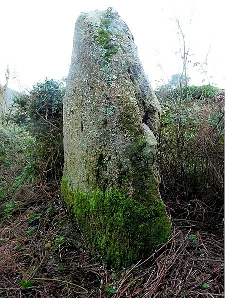
Menhir de Prat-Joulou 1 submitted by stonetracker on 1st Oct 2026. The 2.3 m high menhir is in back of a municipal public works building near a composting area.
(View photo, vote or add a comment)
Menhir de Prat-Joulou 2
Trip No.1 Entry No.24 Date Added: 2nd Oct 2026
Site Type: Standing Stone (Menhir)
Country: France (Bretagne:Finistère (29))
Visited: Would like to visit
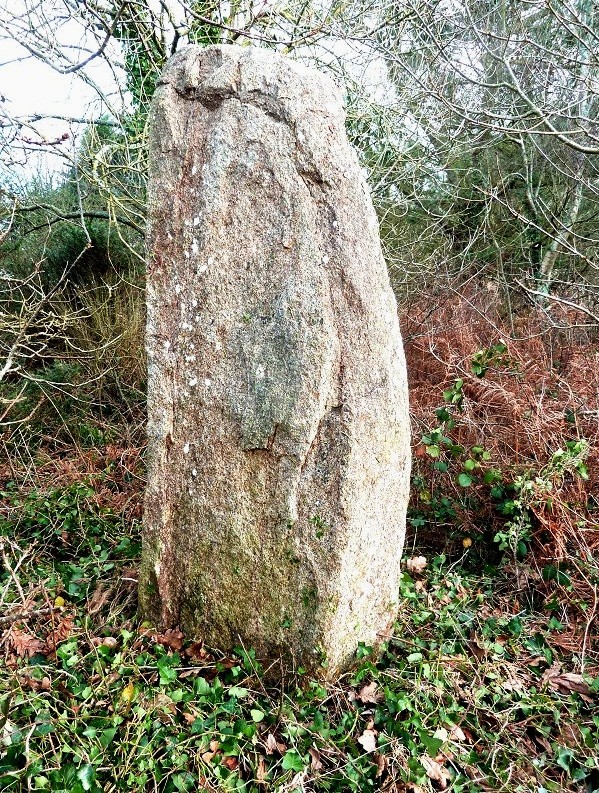
Menhir de Prat-Joulou 2 submitted by stonetracker on 1st Oct 2026. Menhir is on private property but can be viewed through a wire gate on the trail.
(View photo, vote or add a comment)
Kerivoret Menhir
Trip No.1 Entry No.23 Date Added: 1st Oct 2026
Site Type: Standing Stone (Menhir)
Country: France (Bretagne:Finistère (29))
Visited: Yes on 1st Sep 2026. My rating: Condition 4 Ambience 5 Access 4

Kerivoret menhir submitted by theCaptain on 20th Jun 2014. About 50 metres away from the Kerivoret dolmen is a nice menhir, which looks to have been shaped with a slanted top. It's about 3.5 metres tall.
(View photo, vote or add a comment)
Log Text: See my visitor log entry for the Kerivoret Dolmen for parking and directions. The menhir is a mere 40 meters east of the dolmen.
Kerivoret Dolmen
Trip No.1 Entry No.22 Date Added: 1st Oct 2026
Site Type: Burial Chamber or Dolmen
Country: France (Bretagne:Finistère (29))
Visited: Yes on 1st Sep 2026. My rating: Condition 3 Ambience 5 Access 4

Kerivoret dolmen submitted by theCaptain on 20th Jun 2014. This is a nice looking dolmen sitting in a pleasant field behind the houses. It is signposted from the road, and has a path to it from behind the houses, where there is room to park.
(View photo, vote or add a comment)
Log Text: A chamber composed of multiple orthostats with a very large capstone in good condition. Perhaps it was a full-fledged allee couverte at some point but there is no evidence of a passage today. What looks like an indicator menhir is perhaps 100 ft east of the dolmen and easily seen (see the separate entry on the MP for the Kerivoret Menhir).
To get there, drive south of the village of Porspoder on D27 about 1.2 km and take a right E onto the Route de Prat-Joulou. The "official" parking area is a large dirt turnout next to a farm field on the left side of the road in about 200 m. Park here and walk another 130 m on the paved road to a signposted trail head on the right. Take this wide trail about 120 m to the site (you will pass the Kerivoret Menhir on the way).
Note: There is a vacant field next to the signposted trailhead that may be a suitable parking area, but it looked privately owned.
Île Carn cairn
Trip No.1 Entry No.21 Date Added: 30th Sep 2026
Site Type: Chambered Cairn
Country: France (Bretagne:Finistère (29))
Visited: Yes on 1st Sep 2026. My rating: Condition 3 Ambience 5 Access 3

Île Carn cairn submitted by Martin_L on 23rd Jan 2023. Southern chamber. View towards the exceptionally beautiful corbelled roof. June 2022
(View photo, vote or add a comment)
Log Text: Access to this ancient island-based chambered tomb, despite all the warnings, was a bit easier than I expected. To be honest, I did consult the tide charts of the area carefully before I attempted the crossing. Parking is in a large dirt lot just north of Rue de Porsguen in the coastal town of Ploudalmezeau at 48.56995, -4.69041. This is about 1 km SSE of the Ile Carn site which is only accessible 60-90 minutes either side of low tide. A short sand trail leads roughly N to the beach and a small shallow boat harbor. From there it is relatively easy to skirt the boat harbor on the left and follow the sand tracks between banks of beached seaweed to the island. I would avoid the rocks to the right in order to mitigate slipping hazards. The last bit rises up a small knoll of cobbles to an obvious manmade drystone cairn straight ahead. The various German bunkers are partly to mostly buried and located about 100 to 200 meters to the east of the cairn.
I takes about an hour to investigate the cairn and enter the two accessible chambers and maybe a few minutes more to check out the German installations. To be on the safe side, I would leave the island no later than 30 minutes after dead low tide unless you don't mind wet feet or worse. Follow the route you came in back to the mainland. I was able to accomplish the above easily with time to spare.
I would not recommend attempting to access Ile Carn for the mobility impaired, as the trail is uneven and there are piles of cobbles to navigate.
Menhir du Guilligui
Trip No.1 Entry No.20 Date Added: 29th Sep 2026
Site Type: Standing Stone (Menhir)
Country: France (Bretagne:Finistère (29))
Visited: Yes on 1st Sep 2026. My rating: Condition 3 Ambience 3 Access 3

Menhir du Guilligui submitted by theCaptain on 20th Jun 2012. About 60 metres to the east of the Guilliguy headland and dolmen, is a little menhir, about 1.5 metres in height.
The well known burial chamber can be seen on the headland beside the cross.
(View photo, vote or add a comment)
Log Text: This is on the way to the Guilligui Allee Couverte along the trail from the parking area at the roundabout. It is next to an information sign 50-60 m east of the allee couverte and the highest point of the promontory. See the visitor log for the allee couverte for trail access.
Pointe de Guilligui allée couverte
Trip No.1 Entry No.19 Date Added: 29th Sep 2026
Site Type: Passage Grave
Country: France (Bretagne:Finistère (29))
Visited: Yes on 1st Sep 2026. My rating: Condition 3 Ambience 5 Access 2

Pointe de Guilligui allée couverte submitted by Martin_L on 27th Jan 2009. Site in Bretagne: Finistère (29): Standing beside the lateral passage. What a great site (May 2001)
(View photo, vote or add a comment)
Log Text: This turned out to be a little more of an adventure to find than I expected. The closest parking to the site on the hill is just west of the roundabout next to Portsall Harbor where Rue de Port and Rue de L'Eglise meet. There are 5-10 spaces in a little lot next to a Boulangerie-Patisserie called Abers. Just to the left of Abers is a small lane that goes straight up the hill, by a house on the left, and narrows to a dirt path. The Giilligui site is not signposted here to.my knowledge. After about 200-300 m of climbing, there is a jct with another unpaved trail. Take a right and continue about 150 m up another hill to the site. You will pass a menhir and some interpretation on the way.
Because of the moderate climb and uneven nature of the trails, this is probably not an option for the mobility impaired.