
, Aubrey Burl")
<< Other Photo Pages >> Charterhouse Warren Farm Shaft - Burial Chamber or Dolmen in England in Somerset
Submitted by Anne T on Sunday, 10 May 2026 Page Views: 112
Neolithic and Bronze AgeSite Name: Charterhouse Warren Farm Shaft Alternative Name: Charterhouse Warren Farm Swallet; Charterhouse WarrenCountry: England
NOTE: This site is 1.2 km away from the location you searched for.
County: Somerset Type: Burial Chamber or Dolmen
Nearest Town: Cheddar Nearest Village: Charterhouse-on-Mendip
Map Ref: ST4936054570
Latitude: 51.288001N Longitude: 2.727552W
Condition:
| 5 | Perfect |
| 4 | Almost Perfect |
| 3 | Reasonable but with some damage |
| 2 | Ruined but still recognisable as an ancient site |
| 1 | Pretty much destroyed, possibly visible as crop marks |
| 0 | No data. |
| -1 | Completely destroyed |
| 5 | Superb |
| 4 | Good |
| 3 | Ordinary |
| 2 | Not Good |
| 1 | Awful |
| 0 | No data. |
| 5 | Can be driven to, probably with disabled access |
| 4 | Short walk on a footpath |
| 3 | Requiring a bit more of a walk |
| 2 | A long walk |
| 1 | In the middle of nowhere, a nightmare to find |
| 0 | No data. |
| 5 | co-ordinates taken by GPS or official recorded co-ordinates |
| 4 | co-ordinates scaled from a detailed map |
| 3 | co-ordinates scaled from a bad map |
| 2 | co-ordinates of the nearest village |
| 1 | co-ordinates of the nearest town |
| 0 | no data |
Internal Links:
External Links:
")
Details of Site:
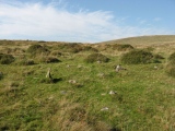
The bones of at least 37 men, women, and children, deliberately butchered, dismembered, and probably partly consumed, were dropped down a 20-metre vertical shaft on the Mendip plateau in a single Early Bronze Age episode between 2210 and 2010 cal BCE. The cattle bones tipped in alongside the human remains have been studied as part of the same event. This is the strongest published evidence in Britain for a single mass-killing of a Bronze Age community, and one of very few European sites with credible evidence for prehistoric cannibalism on this scale.
The 2024 Antiquity paper "The darker angels of our nature" by Schulting et al. identified cut marks, peri-mortem fractures, and blunt-force trauma to the skulls. The taphonomy points to a single rapid event: bodies were stripped of soft tissue and broken open before being thrown down the shaft, where they came to rest in a chaotic mixed deposit alongside cattle remains.
Earlier interpretations had read the deposits as either ritual offerings or routine secondary burial. The new study supports a darker reading - inter-community violence and the deliberate "othering" of the victims through the treatment of their bodies. The Charterhouse Warren shaft sits on a chalk-stripped Mendip ridge near other prehistoric sites including the Priddy Circles and a number of round barrows; it formed part of a sacred and contested landscape long after this single bloody episode.
The shaft is one of several Mendip vertical features (alongside Brimble Pit Swallet and others) that have produced prehistoric human remains. The vertical structure of the cave - requiring deliberate lowering or throwing of objects and bodies into the darkness - is itself part of the interpretation: a place to consign things irreversibly.
Location of Finds:
Wells and Mendip Museum, Wells - the principal regional museum for Mendip archaeology - holds material from earlier Charterhouse Warren explorations. The bone assemblage from the more recent University of Bristol studies is curated through that project; ultimate repository likely with Wells Museum or the University Museum.
References;
Pleiades, Charterhouse Warren Farm Shaft";
Cave Burial, "Charterhouse Warren Farm Swallet";
Mendip Cave Registry, "Charterhouse Warren Farm Swallet"l
Heritage Gateway, "Charterhouse Warren Farm Swallet"; and
Cambridge Core, "The darker angels of our nature’: Early Bronze Age butchered human remains from Charterhouse Warren, Somerset, UK, 16th December 2024" (pdf download available).
BBC Countryfile, "Butchered and cannibalised: 3,000 bones found in Somerset shaft suggest ‘othering’ of enemies in Bronze Age Britain",
Information for Visitors:
Condition: natural 20 m-deep shaft in limestone plateau; archaeological deposits removed; site is in Mendip Hills National Landscape / AONB
Ambience: Mendip Hills limestone plateau
Access: Charterhouse area, Mendip Hills; shaft entrance not casually accessible - requires permission and caving equipment
You may be viewing yesterday's version of this page. To see the most up to date information please register for a free account.
")
")
")
Do not use the above information on other web sites or publications without permission of the contributor.
Nearby Images from Geograph Britain and Ireland:

©2017(licence)

©2017(licence)

©2017(licence)

©2017(licence)

©2017(licence)
The above images may not be of the site on this page, they are loaded from Geograph.
Please Submit an Image of this site or go out and take one for us!
Click here to see more info for this site
Nearby sites
Key: Red: member's photo, Blue: 3rd party photo, Yellow: other image, Green: no photo - please go there and take one, Grey: site destroyed
Download sites to:
KML (Google Earth)
GPX (GPS waypoints)
CSV (Garmin/Navman)
CSV (Excel)
To unlock full downloads you need to sign up as a Contributory Member. Otherwise downloads are limited to 50 sites.
Turn off the page maps and other distractions
Nearby sites listing. In the following links * = Image available
1.3km NW 315° Longwood Tumulus* Round Barrow(s) (ST4841955518)
1.5km SW 228° Totty Pot Cave or Rock Shelter (ST48255358)
1.5km NE 42° Charterhouse settlement* Misc. Earthwork (ST504557)
1.6km NW 323° Gorsey Bigbury Henge* Henge (ST48435584)
1.9km NE 49° Nordrach Tumulus* Round Barrow(s) (ST5078755765)
2.0km NNE 14° Charterhouse Earthwork* Misc. Earthwork (ST49885651)
2.6km SE 143° Cheddar Head Stone Circle (ST509525)
2.6km WSW 255° Soldier's Hole Cave or Rock Shelter (ST468539)
2.7km W 259° Sun Hole* Cave or Rock Shelter (ST467541)
2.7km WSW 256° Goughs Cave (Cheddar)* Cave or Rock Shelter (ST4671053920)
2.8km WSW 256° Cheddar Museum of Prehistory* Museum (ST46655393)
2.8km SSW 206° Batcombe Hollow north stone* Standing Stone (Menhir) (ST4810452088)
2.8km NNW 341° Beacon Batch* Barrow Cemetery (ST48465726)
2.9km ENE 76° Whites Town Farm Tumulus* Round Barrow(s) (ST5223355265)
3.0km NW 307° Tynings Farm Barrow Group* Barrow Cemetery (ST47005635)
3.1km SSW 209° Batcombe Hollow south standing stone* Standing Stone (Menhir) (ST4782451823)
3.1km WSW 255° Flint Jack's Cave Cave or Rock Shelter (ST463538)
3.3km NW 320° Black Down barrows (Mendip)* Barrow Cemetery (ST473571)
3.3km SSE 150° Bristol Plain Farm Barrow Cemetery* Barrow Cemetery (ST5097951665)
3.3km E 91° Wright's Piece barrows (S)* Barrow Cemetery (ST527545)
3.5km S 182° Westbury Camp* Hillfort (ST49205112)
3.6km SE 143° Townsend Farm Barrow Cemetery* Barrow Cemetery (ST5152851658)
3.7km E 87° Wright's Piece barrows (N)* Barrow Cemetery (ST531547)
3.8km ENE 66° Fernhill Farm* Modern Stone Circle etc (ST52865606)
4.2km SSE 150° Priddy long barrow* Long Barrow (ST5141550915)
View more nearby sites and additional images


 We would like to know more about this location. Please feel free to add a brief description and any relevant information in your own language.
 Wir möchten mehr über diese Stätte erfahren. Bitte zögern Sie nicht, eine kurze Beschreibung und relevante Informationen in Deutsch hinzuzufügen.
 Nous aimerions en savoir encore un peu sur les lieux. S'il vous plaît n'hesitez pas à ajouter une courte description et tous les renseignements pertinents dans votre propre langue.
 Quisieramos informarnos un poco más de las lugares. No dude en añadir una breve descripción y otros datos relevantes en su propio idioma.