<< Our Photo Pages >> Ormonds Island - Standing Stones in Ireland (Republic of) in Co. Kerry
Submitted by frogcottage42 on Thursday, 04 March 2010 Page Views: 5034
Neolithic and Bronze AgeSite Name: Ormonds Island Alternative Name: CoornagillaghCountry: Ireland (Republic of) County: Co. Kerry Type: Standing Stones
Nearest Town: Kenmare Nearest Village: Tuosist
Map Ref: V79716512
Latitude: 51.825929N Longitude: 9.745474W
Condition:
| 5 | Perfect |
| 4 | Almost Perfect |
| 3 | Reasonable but with some damage |
| 2 | Ruined but still recognisable as an ancient site |
| 1 | Pretty much destroyed, possibly visible as crop marks |
| 0 | No data. |
| -1 | Completely destroyed |
| 5 | Superb |
| 4 | Good |
| 3 | Ordinary |
| 2 | Not Good |
| 1 | Awful |
| 0 | No data. |
| 5 | Can be driven to, probably with disabled access |
| 4 | Short walk on a footpath |
| 3 | Requiring a bit more of a walk |
| 2 | A long walk |
| 1 | In the middle of nowhere, a nightmare to find |
| 0 | No data. |
| 5 | co-ordinates taken by GPS or official recorded co-ordinates |
| 4 | co-ordinates scaled from a detailed map |
| 3 | co-ordinates scaled from a bad map |
| 2 | co-ordinates of the nearest village |
| 1 | co-ordinates of the nearest town |
| 0 | no data |
Internal Links:
External Links:
I have visited· I would like to visit
frogcottage42 has visited here
")
Set in good pasture to the North East is a triangular standing stone which has survived extensive cultivation.
Around 100m to the West is a small boulder burial in the fence line which will soon be lost to the sea. 80m further West is another standing stone and beyond is a ruined house. To the West of this house is another paddock containing a larger boulder burial and numerous prehistoric features. It would appear that many boulder burials once occupied this field but were cleared in antiquity and only those at the edges remain.
You may be viewing yesterday's version of this page. To see the most up to date information please register for a free account.
")
")
Do not use the above information on other web sites or publications without permission of the contributor.
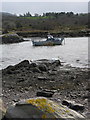
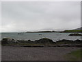
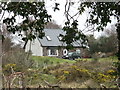
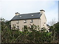
Nearby Images from Geograph Britain and Ireland:
©2008(licence)
©2008(licence)
©2009(licence)
©2009(licence)
©2010(licence)
The above images may not be of the site on this page, they are loaded from Geograph.
Please Submit an Image of this site or go out and take one for us!
Click here to see more info for this site
Nearby sites
Click here to view sites on an interactive map of the areaKey: Red: member's photo, Blue: 3rd party photo, Yellow: other image, Green: no photo - please go there and take one, Grey: site destroyed
Download sites to:
KML (Google Earth)
GPX (GPS waypoints)
CSV (Garmin/Navman)
CSV (Excel)
To unlock full downloads you need to sign up as a Contributory Member. Otherwise downloads are limited to 50 sites.
Turn off the page maps and other distractions
Nearby sites listing. In the following links * = Image available
2.1km SSE 158° Derrylough* Wedge Tomb (V80456315)
2.9km ENE 65° Tuosist* Stone Circle (V824663)
3.5km SE 125° Uragh SW* Stone Circle (V8251363033)
3.7km N 354° Derreenafoyle Standing Stones (V794688)
3.8km ESE 115° Uragh NE* Stone Circle (V8311763439)
4.1km ESE 109° Uragh North* Stone Circle (V83526368)
4.4km S 188° Drombohilly Stone Circle* Stone Circle (V7901060792)
4.6km S 187° Drombohilly Wedge Tomb* Wedge Tomb (V79016053)
4.7km SSW 193° Lehid* Standing Stone (Menhir) (V78506055)
4.9km S 180° Knockanoughanish* Wedge Tomb (V7956960174)
5.2km NE 40° Lomanagh Holy Well* Holy Well or Sacred Spring
5.7km S 190° Cummers West* Stone Circle (V7859359484)
6.4km ESE 107° Maulagowna* Wedge Tomb (V85826311)
7.1km NNW 331° Dromlusk* Standing Stone (Menhir)
7.7km E 93° Derrysallagh* Stone Row / Alignment (V874645)
7.9km E 91° Derryvorahig* Stone Row / Alignment (V8763564745)
8.0km SSW 200° Reenkilla* Stone Circle (V768577)
8.1km SSE 156° The Cave of the Scribing* Cave or Rock Shelter (V828576)
8.4km E 85° Dromroe* Stone Circle (V8810565708)
8.4km SSW 209° Cashelkeelty Standing Stones* Standing Stones (V75485784)
8.6km NNW 344° Gearha* Standing Stones (V7756473414)
9.0km SSW 212° Cashelkeelty E* Stone Circle (V74815757)
9.0km SSW 212° Cashelkeelty Stone Row* Stone Row / Alignment
9.0km SSW 212° Cashelkeelty W* Stone Circle
9.4km S 185° Clogherane* Standing Stones
View more nearby sites and additional images


 We would like to know more about this location. Please feel free to add a brief description and any relevant information in your own language.
 Wir möchten mehr über diese Stätte erfahren. Bitte zögern Sie nicht, eine kurze Beschreibung und relevante Informationen in Deutsch hinzuzufügen.
 Nous aimerions en savoir encore un peu sur les lieux. S'il vous plaît n'hesitez pas à ajouter une courte description et tous les renseignements pertinents dans votre propre langue.
 Quisieramos informarnos un poco más de las lugares. No dude en añadir una breve descripción y otros datos relevantes en su propio idioma.