

<< Our Photo Pages >> Uragh NE - Stone Circle in Ireland (Republic of) in Co. Kerry
Submitted by Tom_Bullock on Tuesday, 22 November 2011 Page Views: 19119
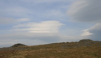
Neolithic and Bronze AgeSite Name: Uragh NECountry: Ireland (Republic of) County: Co. Kerry Type: Stone Circle
Nearest Town: Kenmare Nearest Village: Tuosist
Map Ref: V8311763439
Discovery Map Number: D84
Latitude: 51.811550N Longitude: 9.695514W
Condition:
| 5 | Perfect |
| 4 | Almost Perfect |
| 3 | Reasonable but with some damage |
| 2 | Ruined but still recognisable as an ancient site |
| 1 | Pretty much destroyed, possibly visible as crop marks |
| 0 | No data. |
| -1 | Completely destroyed |
| 5 | Superb |
| 4 | Good |
| 3 | Ordinary |
| 2 | Not Good |
| 1 | Awful |
| 0 | No data. |
| 5 | Can be driven to, probably with disabled access |
| 4 | Short walk on a footpath |
| 3 | Requiring a bit more of a walk |
| 2 | A long walk |
| 1 | In the middle of nowhere, a nightmare to find |
| 0 | No data. |
| 5 | co-ordinates taken by GPS or official recorded co-ordinates |
| 4 | co-ordinates scaled from a detailed map |
| 3 | co-ordinates scaled from a bad map |
| 2 | co-ordinates of the nearest village |
| 1 | co-ordinates of the nearest town |
| 0 | no data |
Internal Links:
External Links:
I have visited· I would like to visit
PAB eire 43559959 Jdmueller6 rrmoser would like to visit
kith visited on 1st Feb 2013 - their rating: Cond: 5 Amb: 5 Access: 4
Dubpunk visited on 11th Jun 2012 - their rating: Cond: 3 Amb: 5 Access: 4 Absolutely stunning setting. Whilst we were there, got chatting to the landowner who also informed us of a further stone circle up towards the farmhouse. Took a walk up the hill and found some large stones but it was quite difficult to decide if it was another stone circle.
Runemage visited - their rating: Cond: 5 Amb: 5 Access: 4
livingstone visited - their rating: Cond: 4 Amb: 5 Access: 3 My favourite place on Earth! This has got to be the most beautiful setting for any site. Access can be difficult if it has been raining since crossing a bog is essential to getting there. Take wellies and expect them to get pulled off your feet
I question the stone circle title as it appears to be much more akin to a collapsed cairn. Nevertheless it oozes ambience and the scenery is second to none.
jurassic_john visited - their rating: Cond: 3 Amb: 5 Access: 3
Average ratings for this site from all visit loggers: Condition: 4 Ambience: 5 Access: 3.6
")
Circle diameter: 8 feet, Number of stones: 5
Note: This is the location of 'Target Y' from our dowsing competition. See this page for more details.
You may be viewing yesterday's version of this page. To see the most up to date information please register for a free account.
")
")
")
")
")
")
")
")
")
")
")
")
")
")
")
Do not use the above information on other web sites or publications without permission of the contributor.
Click here to see more info for this site
Nearby sites
Click here to view sites on an interactive map of the areaKey: Red: member's photo, Blue: 3rd party photo, Yellow: other image, Green: no photo - please go there and take one, Grey: site destroyed
Download sites to:
KML (Google Earth)
GPX (GPS waypoints)
CSV (Garmin/Navman)
CSV (Excel)
To unlock full downloads you need to sign up as a Contributory Member. Otherwise downloads are limited to 50 sites.
Turn off the page maps and other distractions
Nearby sites listing. In the following links * = Image available
468m ENE 58° Uragh North* Stone Circle (V83526368)
726m SW 235° Uragh SW* Stone Circle (V8251363033)
2.7km W 262° Derrylough* Wedge Tomb (V80456315)
2.7km E 96° Maulagowna* Wedge Tomb (V85826311)
2.9km NNW 345° Tuosist* Stone Circle (V824663)
3.8km WNW 295° Ormonds Island* Standing Stones (V79716512)
4.4km ENE 75° Derrysallagh* Stone Row / Alignment (V874645)
4.7km ENE 73° Derryvorahig* Stone Row / Alignment (V8763564745)
4.8km SW 226° Knockanoughanish* Wedge Tomb (V7956960174)
4.9km SW 236° Drombohilly Stone Circle* Stone Circle (V7901060792)
5.0km SW 233° Drombohilly Wedge Tomb* Wedge Tomb (V79016053)
5.4km WSW 237° Lehid* Standing Stone (Menhir) (V78506055)
5.5km ENE 64° Dromroe* Stone Circle (V8810565708)
5.6km N 359° Lomanagh Holy Well* Holy Well or Sacred Spring
5.8km S 182° The Cave of the Scribing* Cave or Rock Shelter (V828576)
6.0km SW 227° Cummers West* Stone Circle (V7859359484)
6.5km NW 324° Derreenafoyle Standing Stones (V794688)
8.5km SW 226° Reenkilla* Stone Circle (V768577)
8.8km ESE 109° Tooreen bronze age copper mine* Ancient Mine, Quarry or other Industry
8.9km SSW 209° Clogherane* Standing Stones
9.4km SW 232° Cashelkeelty Standing Stones* Standing Stones (V75485784)
10.1km ESE 109° Crossferry east* Standing Stone (Menhir) (V9257459890)
10.1km ENE 73° Derrynacaheragh Wedge Tomb (V9288166088)
10.1km N 8° Rossacoosane* Rock Art (V848734)
10.1km SW 233° Cashelkeelty E* Stone Circle (V74815757)
View more nearby sites and additional images


 We would like to know more about this location. Please feel free to add a brief description and any relevant information in your own language.
 Wir möchten mehr über diese Stätte erfahren. Bitte zögern Sie nicht, eine kurze Beschreibung und relevante Informationen in Deutsch hinzuzufügen.
 Nous aimerions en savoir encore un peu sur les lieux. S'il vous plaît n'hesitez pas à ajouter une courte description et tous les renseignements pertinents dans votre propre langue.
 Quisieramos informarnos un poco más de las lugares. No dude en añadir una breve descripción y otros datos relevantes en su propio idioma.