Featured: Hare and Tabor T Shirts for discerning antiquarians

Hare and Tabor T Shirts for discerning antiquarians

Das Raetiastein GPS by Thomas Walli

Das Raetiastein GPS by Thomas Walli

Who's Online

There are currently, 387 guests and 4 members online.

You are a guest. To join in, please register for free by clicking here

Sponsors

<< Our Photo Pages >> Down Tor stone row - Stone Row / Alignment in England in Devon

Submitted by enkidu41 on Tuesday, 01 October 2002  Page Views: 18772

Neolithic and Bronze AgeSite Name: Down Tor stone row Alternative Name: Hingston Hill
Country: England County: Devon Type: Stone Row / Alignment
Nearest Town: Princetown  Nearest Village: Sheepstor
Map Ref: SX59026939  Landranger Map Number: 202
Latitude: 50.507286N  Longitude: 3.989525W
Condition:
5Perfect
4Almost Perfect
3Reasonable but with some damage
2Ruined but still recognisable as an ancient site
1Pretty much destroyed, possibly visible as crop marks
0No data.
-1Completely destroyed
5 Ambience:
5Superb
4Good
3Ordinary
2Not Good
1Awful
0No data.
5 Access:
5Can be driven to, probably with disabled access
4Short walk on a footpath
3Requiring a bit more of a walk
2A long walk
1In the middle of nowhere, a nightmare to find
0No data.
3 Accuracy:
5co-ordinates taken by GPS or official recorded co-ordinates
4co-ordinates scaled from a detailed map
3co-ordinates scaled from a bad map
2co-ordinates of the nearest village
1co-ordinates of the nearest town
0no data
5

Internal Links:
External Links:

I have visited· I would like to visit

PAB would like to visit

Catrinm visited on 30th Mar 2017 - their rating: Cond: 3 Amb: 4 Access: 2 300317

angieweekender visited on 13th Feb 2015 Fantastic site and great walk

SandyG visited on 16th Apr 2013 - their rating: Cond: 4 Amb: 5 Access: 3 Car parking is available at SX 56873 69307. From here walk along the track towards Middleworth. At SX 57478 69041 head up the hill towards Down Tor. Before reaching the top turn and walk east to the row. Well worth the effort.

jeffrep visited on 22nd May 2011 - their rating: Cond: 4 Amb: 5 Access: 2

graemefield visited - their rating: Cond: 5 Amb: 5 Access: 3

TheCaptain AngieLake TimPrevett cazzyjane heidavey have visited here

Average ratings for this site from all visit loggers: Condition: 4 Ambience: 4.75 Access: 2.5
Down Tor stone row
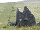
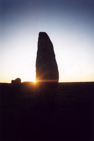
Down Tor stone row submitted by TimPrevett : This is where it all began for me: Down Tor, on Dartmoor. A chance encounter on a beautiful day and night with an awesome stone circle and row. This is where the stones bug bit me! Taken with a simple automatic 35mm camera. (Vote or comment on this photo)
Down Tor (Hingston Hill) stone row, SX 5902 6939 to SX 5868 6927.
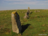
This spectacular row was re-erected in 1894 and must look much as it did when first erected. The 39' diameter cairn at the western end of the row has 27 irregularly spaced stones, the two tallest being 3'6" high. There are 2 flat slabs in the central hollow of the cairn which may be the remains of a kistvaen.

The huge pillar next to the cairn weighs about 3 tons. The whole site seems to have been chosen to enhance the impact of its appearance with the ground rising gradually towards both ends of the row from the lowest point at its centre.

Update November 2019: This stone row is featured on the Prehistoric Dartmoor Walks (PDW)website, - see their entries for the Hingston Hill (Down Tor) Stone Row, the Hingston Hill (Down Tor) Standing Stone, the Hingston Hill (Down Tor) Stone Row, and the Down Tor Stone Row and Cairn Circle.

The site is also recorded as Pastscape Monument No. 438583, as MDV3502 (Down Tor Stone Row, Walkhampton) on the Devon and Dartmoor HER, and scheduled as Historic England List Entry No. 1009090 (Stone alignment and cairn 830m east of Down Tor).

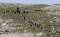
The row is also recorded on the Stone Rows of Great Britain website - see their entry for Hingston Hill, which includes a description, photographs (including one of the kerbed cairn at the upper end of the alignment, and another of the eastern cairn). The SRoGB also includes evidence and illustrations of how viewpoints appear and disappear as you walk along this 351m long row with its 157 stones.

The SRoGB also includes a separate entry for Sea Views at Hingston Hill, which discusses and illustrates the different views which are visible as you progress along the row.
You may be viewing yesterday's version of this page. To see the most up to date information please register for a free account.

Down Tor stone row
Down Tor stone row submitted by TheCaptain : The whole of the Hingston Hill cairn circle and stone row seen here looking east. The Narrator Brookhead enclosure and large cairn can be seen near the eastern end. (4 comments - Vote or comment on this photo)

Down Tor stone row
Down Tor stone row submitted by TheCaptain : Hingstone Hill or Down Tor stone row. Late afternoon, September 26 2010 (Vote or comment on this photo)

Down Tor stone row
Down Tor stone row submitted by cazzyjane : Down Tor stone row. (Vote or comment on this photo)

Down Tor stone row
Down Tor stone row submitted by TheCaptain : Looking west along the end of the Hingston Hill stone row, with the cairn circle beyond. (Vote or comment on this photo)

Down Tor stone row
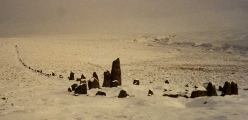
Down Tor stone row submitted by SandyG : In deep snow sometime in the mid 1990's. Can't remember how I got there or why!

Down Tor stone row
Down Tor stone row submitted by TheCaptain : The whole length of the Hingston Hill stone row seen here looking east from the western end. (3 comments)

Down Tor stone row
Down Tor stone row submitted by Ahdzib : Down Tor, Dartmoor, 2013 (1 comment)

Down Tor stone row
Down Tor stone row submitted by SandyG : Large boulders in the vicinity of the alignment were not used in its construction. View from west. (1 comment)

Down Tor stone row
Down Tor stone row submitted by crannog : Huge megalith around 9ft... amazing stone row especially in the mist!

Down Tor stone row
Down Tor stone row submitted by crannog : Down Tor stone row. Also circle cairn. So atmospheric walking to and finding as the mist was rising. Wonderful place. (1 comment)

Down Tor stone row
Down Tor stone row submitted by cazzyjane : Down Tor stone row taken June 2011.

Down Tor stone row
Down Tor stone row submitted by cazzyjane : Towards the top of the row was this little stone with a droopy nose.

Down Tor stone row
Down Tor stone row submitted by TheCaptain : The whole of the Hingston Hill cairn circle and stone row seen here within its moorland landscape. (1 comment)

Down Tor stone row
Down Tor stone row submitted by TheCaptain : Looking towards the western end of the stone row, with the cairn circle beyond.

Down Tor stone row
Down Tor stone row submitted by TheCaptain : The central part of the Hingston Hill stone row seen here looking west. Note the large cairn on the skyline beyond the end of the row.

Down Tor stone row
Down Tor stone row submitted by TheCaptain : The central part of the Hingston Hill stone row seen here looking west. (2 comments)

Down Tor stone row
Down Tor stone row submitted by TheCaptain : Down Tor (Hingstone Hill) stone row seen here looking westwards along its length.

Down Tor stone row
Down Tor stone row submitted by TimPrevett : 03/06/09 (2 comments)

Down Tor stone row
Down Tor stone row submitted by TimPrevett (1 comment)

Down Tor stone row
Down Tor stone row submitted by TimPrevett

Down Tor stone row
Down Tor stone row submitted by TimPrevett : This stone I am leaning against is where my interest in stones first became realised; all those years photographing trig points at sunset and sunrise was actually to do with this. This is my 'stones birth place' as it were! First revisit since that happened in mid 90s I think, 03/06/09.

Down Tor stone row
Down Tor stone row submitted by TimPrevett : 03/06/09

Down Tor stone row
Down Tor stone row submitted by SandyG : Looking eastward along the row.

Down Tor stone row
Down Tor stone row submitted by SandyG : The stone row leading towards the kerbed cairn. View from east.

These are just the first 25 photos of Down Tor stone row. If you log in with a free user account you will be able to see our entire collection.

Do not use the above information on other web sites or publications without permission of the contributor.
Click here to see more info for this site

Nearby sites

Click here to view sites on an interactive OS map

Key: Red: member's photo, Blue: 3rd party photo, Yellow: other image, Green: no photo - please go there and take one, Grey: site destroyed

Download sites to:
KML (Google Earth)
GPX (GPS waypoints)
CSV (Garmin/Navman)
CSV (Excel)

To unlock full downloads you need to sign up as a Contributory Member. Otherwise downloads are limited to 50 sites.

Stone Rows of Great Britain by Sandy Gerrard
Dartmoor Walks by Dave Parks
Prehistoric Monuments of Dartmoor by Bill Radcliffe


Turn off the page maps and other distractions

Nearby sites listing. In the following links * = Image available
 123m NE 47° Narrator Brookhead Enclosure* Ancient Village or Settlement (SX5911369471)
 183m ENE 71° Narrator Brookhead Cairn* Cairn (SX5919569446)
 360m WSW 249° Down Tor circle* Stone Circle (SX58686927)
 387m WSW 257° Down Tor cairn* Cairn (SX58646931)
 644m WNW 284° Down Tor North East (Eastern)* Cairn (SX5839769562)
 655m WNW 284° Down Tor North East (Northern)* Cairn (SX5838869568)
 656m WNW 284° Down Tor North East (Western)* Cairn (SX5838669565)
 731m SW 236° Down Tor Circular Settlement* Ancient Village or Settlement (SX5840069000)
 872m SW 218° Cuckoo Rock (Dartmoor)* Rock Art (SX5846668715)
 982m W 263° Down Tor Cist* Cist (SX58046929)
 1.2km NW 326° Crazy Well Cross* Ancient Cross (SX58387039)
 1.2km SE 129° Eylesbarrow* Barrow Cemetery (SX59976858)
 1.5km SW 221° Outholme Newtake* Cist (SX57996827)
 1.5km ENE 67° Siward's Cross* Ancient Cross (SX60456995)
 1.6km S 190° Leeden (Sheepstor)* Cairn (SX5869267838)
 1.9km S 172° Drizzlecombe cist 21* Cist (SX5922867476)
 2.0km ENE 57° Whiteworks Cairn Circle* Cairn (SX60767047)
 2.0km SSE 169° Standing Stone Near Cairn at Head of Drizzlecombe Row 4* Standing Stone (Menhir) (SX5937067374)
 2.1km SSE 169° Cairn At Head of Drizzlecombe Row 4* Cairn (SX5937467361)
 2.1km SSE 169° Drizzlecombe W row* Stone Row / Alignment (SX5937067360)
 2.1km SW 216° Yellowmead ring cairn* Ring Cairn (SX57776774)
 2.1km NNW 327° Raddick Hill Cist* Cist (SX57937116)
 2.1km SSE 167° Drizzlecombe Cairn 23* Cairn (SX5942367331)
 2.1km SW 223° Yellowmead cairn* Cairn (SX5753167863)
 2.2km S 171° Drizzlecombe Settlement* Ancient Village or Settlement (SX59306723)
View more nearby sites and additional images

<< Collard Tor W

Lakehead Hill E >>

Please add your thoughts on this site

Prehistoric Settlements

Prehistoric Settlements

Web Links for Down Tor stone row

Stone Rows of Great Britain by Sandy Gerrard
Dartmoor Walks by Dave Parks
Prehistoric Monuments of Dartmoor by Bill Radcliffe

Sponsors

Auto-Translation (Google)

Translate from English into:

"Down Tor stone row" | Login/Create an Account | 7 News and Comments
  
Go back to top of page    Comments are owned by the poster. We aren't responsible for their content.
Re: Down Tor stone row by Catrinm on Friday, 13 May 2022
(User Info | Send a Message)
Does anyone know what the settlement is marked on the OS map, south of Down Tor within a circular enclosure ( on way to the stone row) Went into it there are several structures but are they later medieval ,or something.? May 22
[ Reply to This ]

Re: Down Tor, or Hingston Hill? by AngieLake on Tuesday, 21 December 2010
(User Info | Send a Message)
In his book 'Dartmoor Sun', Jack Walker writes:

"Note: For some unknown reason the monuments on Hingston Hill are commonly referred to as being on Down Tor, which is quite wrong. Down Tor is the distinctive tor 700 metres west of Hingston Tor. On the Ordnance Survey, Outdoor Leisure 28, Dartmoor map, Hingston Tor is not identified, but the height of the tor is marked on the map as '372' metres and the stone row is shown clearly. Hingston Hill is the broad whale-backed ridge on which the row and circle lie. Hingston Tor (SX586692) is the rock at the highest point of Hingston Hill."

On the dust-jacket of the book we read: [quoting part of author description]
"Using his skills as a scientist and engineer, Jack set about proving to himself that prehistoric man's knowledge of the universe was fundamental to his way of life."
So Jack is obviously a man who likes to get his facts right!

Publishers are Halsgrove, and it is in the 'Halsgrove Discover Series' - my copy, 2005.

(Andy, I'm sure you'd sell some of these to folk who are interested in Dartmoor, and/or want a straightforward explanation of the calendrical aspect of stone circles and rows. Also the Jeremy Butler series of 'Dartmoor Atlas of Antiquities' are almost essential to understanding and exploring the Moor.)
[ Reply to This ]

Re: Down Tor stone row by TheCaptain on Sunday, 21 November 2010
(User Info | Send a Message)
Down Tor (Hingstone Hill) stone row, SX 5902 6939 to SX 5868 6927
Visited Sunday, 26th September 2010.
Access 3, Ambience 5, Condition 5

What can I say about this fabulous place? The whole thing is wonderful. Even the sun came out for me after a while, and stayed out for the rest of the evening, with a wonderful silvery light shining straight along the row at 5:00pm.

The row seems to have two cross set blocker stones at the eastern end, the large end stone being about 1.6 metres tall. The stones from here head west for 350 metres across the moor, and most of the stones are about knee height for much of its length.

At the western end, the stones progressively get larger, with the last few stones getting quite large and ending with a 2.8 metre stone which looks to have been shaped, and is standing just outside the adjoining cairn circle.

The western end of the row is terminated at a cairn circle about 12 metres in diameter, the 27 standing stones being well clear of the remaining cairn in the centre, which has a robbed out centre, which has some slab remains indicating a cist at one time.

It is absolutely lovely here, but a pity the cold and clouds came back just as I was trying to take photos and have dinner. However, the clouds then left, and a clear blue sky attended me for the rest of the day. I was able to get some wonderful photos from a bit further up the hill.
[ Reply to This ]
    Re: Down Tor stone row by Anonymous on Friday, 24 June 2016
    Wow! Simply amazing!

    What is this place? Celtic/Druid obviously, but has there been some real archaeology performed here? The tinning business must have begun in the Bronze Age, but this Neolithic site looks very important, and I don't know why.

    Stone rows as symbolic of the procession of ancestors... Druids immolating royalty, to rejoin their souls to the procession of the sun (that sinuous serpentine design on the 'Pattern Stone' at Bryn Celli Ddu reminiscent of rising tendrils of smoke; in which there is a small circular spiral pattern - the soul ascending... ???

    Who really bloody well knows?

    The mystery is truly wondrous. I am just engaging in this study (as is no doubt apparent) and I thank you all for this great site. I'm sure you are all familiar with Neil's work, ay? Some really great stuff - https://www.youtube.com/watch?v=UccI7RxBzVk
    [ Reply to This ]

Re: Down Tor by enkidu41 on Saturday, 05 June 2004
(User Info | Send a Message)
Condition:4
Ambience:5
Access:2
This spectacular row was re-erected in 1894 and must look much as it did when first erected. The 39' diameter cairn at the western end of the row has 27 irregularly spaced stones, the two tallest being 3'6" high. There are 2 flat slabs in the central hollow of the cairn which may be the remains of a kistvaen. The huge pillar next to the cairn weighs about 3 tons. The whole site seems to have been chosen to enhance the impact of its appearance with the ground rising gradually towards both ends of the row from the lowest point at its centre.
[ Reply to This ]

Your Name: Anonymous [ Register Now ]
Subject:


Add your comment or contribution to this page. Spam or offensive posts are deleted immediately, don't even bother

<<< What is five plus one as a number? (Please type the answer to this question in the little box on the left)
You can also embed videos and other things. For Youtube please copy and paste the 'embed code'.
For Google Street View please include Street View in the text.
Create a web link like this: <a href="https://www.megalithic.co.uk">This is a link</a>  

Allowed HTML is:
<p> <b> <i> <a> <img> <em> <br> <strong> <blockquote> <tt> <li> <ol> <ul> <object> <param> <embed> <iframe>

We would like to know more about this location. Please feel free to add a brief description and any relevant information in your own language.
Wir möchten mehr über diese Stätte erfahren. Bitte zögern Sie nicht, eine kurze Beschreibung und relevante Informationen in Deutsch hinzuzufügen.
Nous aimerions en savoir encore un peu sur les lieux. S'il vous plaît n'hesitez pas à ajouter une courte description et tous les renseignements pertinents dans votre propre langue.
Quisieramos informarnos un poco más de las lugares. No dude en añadir una breve descripción y otros datos relevantes en su propio idioma.