

<< Our Photo Pages >> Langstone Arch - Natural Stone / Erratic / Other Natural Feature in England in Devon
Submitted by Bladup on Wednesday, 06 May 2026 Page Views: 835
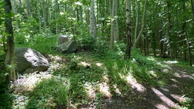
Natural PlacesSite Name: Langstone ArchCountry: England
NOTE: This site is 3.013 km away from the location you searched for.
County: Devon Type: Natural Stone / Erratic / Other Natural Feature
Map Ref: SX9789077950
Latitude: 50.592319N Longitude: 3.443931W
Condition:
| 5 | Perfect |
| 4 | Almost Perfect |
| 3 | Reasonable but with some damage |
| 2 | Ruined but still recognisable as an ancient site |
| 1 | Pretty much destroyed, possibly visible as crop marks |
| 0 | No data. |
| -1 | Completely destroyed |
| 5 | Superb |
| 4 | Good |
| 3 | Ordinary |
| 2 | Not Good |
| 1 | Awful |
| 0 | No data. |
| 5 | Can be driven to, probably with disabled access |
| 4 | Short walk on a footpath |
| 3 | Requiring a bit more of a walk |
| 2 | A long walk |
| 1 | In the middle of nowhere, a nightmare to find |
| 0 | No data. |
| 5 | co-ordinates taken by GPS or official recorded co-ordinates |
| 4 | co-ordinates scaled from a detailed map |
| 3 | co-ordinates scaled from a bad map |
| 2 | co-ordinates of the nearest village |
| 1 | co-ordinates of the nearest town |
| 0 | no data |
Internal Links:
External Links:
")
You may be viewing yesterday's version of this page. To see the most up to date information please register for a free account.
")
")
")
Do not use the above information on other web sites or publications without permission of the contributor.
Nearby Images from Geograph Britain and Ireland:

©2010(licence)

©2018(licence)

©2013(licence)

©2018(licence)

©2018(licence)
The above images may not be of the site on this page, they are loaded from Geograph.
Please Submit an Image of this site or go out and take one for us!
Click here to see more info for this site
Nearby sites
Key: Red: member's photo, Blue: 3rd party photo, Yellow: other image, Green: no photo - please go there and take one, Grey: site destroyed
Download sites to:
KML (Google Earth)
GPX (GPS waypoints)
CSV (Garmin/Navman)
CSV (Excel)
To unlock full downloads you need to sign up as a Contributory Member. Otherwise downloads are limited to 50 sites.
Turn off the page maps and other distractions
Nearby sites listing. In the following links * = Image available
5.8km WSW 250° Lidwell* Holy Well or Sacred Spring (SX924761)
5.8km W 259° Castle Dyke (Devon)* Ancient Village or Settlement (SX92147700)
6.1km SW 215° Teignmouth Cross Shaft* Ancient Cross (SX9432072980)
7.2km WSW 244° Whitewell Woods Well* Holy Well or Sacred Spring (SX913749)
9.8km N 352° Topsham Museum* Museum (SX9673987646)
10.4km W 273° Castle Dyke (Chudleigh)* Hillfort (SX875787)
10.8km NNE 28° Woodbury Castle* Hillfort (SY032874)
11.3km W 272° Pixie's Hole* Cave or Rock Shelter (SX86547865)
11.4km W 272° Cow Cave* Cave or Rock Shelter (SX86477866)
11.8km NE 36° Tor Barrow (Colaton Raleigh Common) Round Barrow(s) (SY05088737)
12.4km SW 229° Milber Down Camp* Hillfort (SX884699)
12.9km SW 224° Doda Well* Holy Well or Sacred Spring (SX887688)
13.1km WSW 238° Newton Abbot Museum* Museum (SX866712)
13.2km SSW 204° Stonehenge at Babbacombe Model Village* Modern Stone Circle etc (SX923660)
13.6km SSW 198° Walls Hill Field System* Ancient Village or Settlement (SX9338065140)
14.5km SSW 197° Kent's Cavern* Cave or Rock Shelter (SX93456418)
14.7km NE 56° High Peak* Ancient Village or Settlement (SY103859)
15.0km WSW 241° Newton Abbot Fort Hillfort (SX846710)
15.4km SSW 200° Torquay Museum* Museum (SX9232863616)
15.4km SW 231° Ladywell (Abbotskerswell)* Holy Well or Sacred Spring (SX858684)
15.6km NNW 338° St Martin's Well (Exeter) Holy Well or Sacred Spring (SX922925)
15.7km NNE 28° Aylesbeare Common tumulus* Round Barrow(s) (SY056916)
15.9km W 271° St Mary's Well (Bovey Tracey)* Holy Well or Sacred Spring (SX820786)
15.9km SSW 206° Torre Abbey Cross Shaft* Ancient Cross (SX9070063790)
16.0km NNW 338° Royal Albert Memorial Museum* Museum (SX922929)
View more nearby sites and additional images
King George V Storyteller's Chair and Stone Circle (Modern) >>


 We would like to know more about this location. Please feel free to add a brief description and any relevant information in your own language.
 Wir möchten mehr über diese Stätte erfahren. Bitte zögern Sie nicht, eine kurze Beschreibung und relevante Informationen in Deutsch hinzuzufügen.
 Nous aimerions en savoir encore un peu sur les lieux. S'il vous plaît n'hesitez pas à ajouter une courte description et tous les renseignements pertinents dans votre propre langue.
 Quisieramos informarnos un poco más de las lugares. No dude en añadir una breve descripción y otros datos relevantes en su propio idioma.