


<< Our Photo Pages >> Cronglwyd Fawr Barrow - Round Barrow(s) in Wales in Conwy
Submitted by TAlanJones on Friday, 30 June 2023 Page Views: 236
Neolithic and Bronze AgeSite Name: Cronglwyd Fawr Barrow Alternative Name: Cronglwyd Fawr TumulusCountry: Wales
NOTE: This site is 0.885 km away from the location you searched for.
County: Conwy Type: Round Barrow(s)
Nearest Town: Cerrigydrudion
Map Ref: SH9565047940
Latitude: 53.018551N Longitude: 3.557025W
Condition:
| 5 | Perfect |
| 4 | Almost Perfect |
| 3 | Reasonable but with some damage |
| 2 | Ruined but still recognisable as an ancient site |
| 1 | Pretty much destroyed, possibly visible as crop marks |
| 0 | No data. |
| -1 | Completely destroyed |
| 5 | Superb |
| 4 | Good |
| 3 | Ordinary |
| 2 | Not Good |
| 1 | Awful |
| 0 | No data. |
| 5 | Can be driven to, probably with disabled access |
| 4 | Short walk on a footpath |
| 3 | Requiring a bit more of a walk |
| 2 | A long walk |
| 1 | In the middle of nowhere, a nightmare to find |
| 0 | No data. |
| 5 | co-ordinates taken by GPS or official recorded co-ordinates |
| 4 | co-ordinates scaled from a detailed map |
| 3 | co-ordinates scaled from a bad map |
| 2 | co-ordinates of the nearest village |
| 1 | co-ordinates of the nearest town |
| 0 | no data |
Internal Links:
External Links:
")
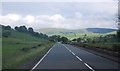
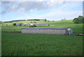
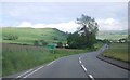
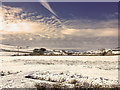
The barrow lies in a field about 0.5k south of Cerrigydrudion. It is visible as a raised grassy mound to the east of the A5 road that links Corwen with Betws Y Coed. The A5 is a busy road but a pavement runs along the western side of the road. A gate allows access to the site but this is private land and permission should be sought from Cronglwyd Farm.
The barrow is raised to about 1m and it appears to be sub circular. The circumference has been estimated to be 73 paces (Gwynnedd Archaeological Trust) and there are signs of interference.
You may be viewing yesterday's version of this page. To see the most up to date information please register for a free account.
")
")
")
Do not use the above information on other web sites or publications without permission of the contributor.
Nearby Images from Geograph Britain and Ireland:
©2012(licence)
©2012(licence)
©2012(licence)
©2012(licence)
©2019(licence)
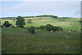
The above images may not be of the site on this page, they are loaded from Geograph.
Please Submit an Image of this site or go out and take one for us!
Click here to see more info for this site
Nearby sites
Key: Red: member's photo, Blue: 3rd party photo, Yellow: other image, Green: no photo - please go there and take one, Grey: site destroyed
Download sites to:
KML (Google Earth)
GPX (GPS waypoints)
CSV (Garmin/Navman)
CSV (Excel)
To unlock full downloads you need to sign up as a Contributory Member. Otherwise downloads are limited to 50 sites.
Turn off the page maps and other distractions
Nearby sites listing. In the following links * = Image available
984m SE 129° Pen-y-Gaer (Denbighshire) Stone Circle (SH964473)
1.2km E 90° Caer Caradog* Hillfort (SH96824792)
4.9km W 270° Moel Eglwys Cairn* Cairn (SH9071348011)
5.0km NE 34° Caer Ddunod* Hillfort (SH985520)
5.1km W 278° Cefnhirfynydd Uchaf Cairn 1* Cairn (SH9056048725)
5.2km W 277° Cefnhirfynydd Uchaf Cairn 2* Cairn (SH9054048710)
5.2km N 6° Hafod-y-llan Isaf Cairn Circle* Ring Cairn (SH963531)
5.3km W 279° Cefnhirfynydd Uchaf Enclosure* Ancient Village or Settlement (SH9037148889)
5.4km W 274° Cefnhirfynydd Uchaf Cairn 3* Cairn (SH9024848454)
5.5km NNW 345° Cerrig y Drudion Stone Circle (SH943533)
5.5km W 277° Cefnhirfynydd Uchaf Cairnfield* Barrow Cemetery (SH9016648725)
5.7km W 279° Cefnhirfynydd Uchaf Standing Stone* Standing Stone (Menhir) (SH9004348910)
6.3km W 275° Garn Prys* Cairn (SH89374866)
6.7km W 263° Caer Garn Cairn and Round Barrow* Barrow Cemetery (SH8897047270)
6.8km WNW 293° Carreg Nanw* Modern Stone Circle etc (SH8940550794)
7.3km ENE 65° Preseb y Fawch Frech* Stone Circle (SJ023509)
7.8km SSE 151° Cefn Caer Euni* Ring Cairn (SH993410)
7.9km SE 146° Caer Euni* Hillfort (SJ000413)
8.0km S 172° Coed y Bedo* Standing Stone (Menhir) (SH96664003)
8.1km NW 317° Bwlch y Garnedd Hut Circle* Ancient Village or Settlement (SH90305401)
8.1km NW 319° Lon Bwlch y Garnedd standing stones* Standing Stones (SH9046154197)
8.1km NW 319° Bwlch y Garnedd Menhir Standing Stone (Menhir) (SH9045254194)
8.1km NE 42° Y Foel Frech Stone Circle (SJ012539)
8.2km NNW 335° Nant Heilyn* Ring Cairn (SH92355543)
8.2km NW 322° Bwlch y Garnedd Cairn 3 Cairn (SH90695450)
View more nearby sites and additional images


 We would like to know more about this location. Please feel free to add a brief description and any relevant information in your own language.
 Wir möchten mehr über diese Stätte erfahren. Bitte zögern Sie nicht, eine kurze Beschreibung und relevante Informationen in Deutsch hinzuzufügen.
 Nous aimerions en savoir encore un peu sur les lieux. S'il vous plaît n'hesitez pas à ajouter une courte description et tous les renseignements pertinents dans votre propre langue.
 Quisieramos informarnos un poco más de las lugares. No dude en añadir una breve descripción y otros datos relevantes en su propio idioma.