

<< Our Photo Pages >> Moel Eglwys Cairn - Cairn in Wales in Conwy
Submitted by TAlanJones on Saturday, 01 July 2023 Page Views: 173
Neolithic and Bronze AgeSite Name: Moel Eglwys CairnCountry: Wales County: Conwy Type: Cairn
Nearest Town: Cerrigydrudion
Map Ref: SH9071348011
Latitude: 53.018203N Longitude: 3.630614W
Condition:
| 5 | Perfect |
| 4 | Almost Perfect |
| 3 | Reasonable but with some damage |
| 2 | Ruined but still recognisable as an ancient site |
| 1 | Pretty much destroyed, possibly visible as crop marks |
| 0 | No data. |
| -1 | Completely destroyed |
| 5 | Superb |
| 4 | Good |
| 3 | Ordinary |
| 2 | Not Good |
| 1 | Awful |
| 0 | No data. |
| 5 | Can be driven to, probably with disabled access |
| 4 | Short walk on a footpath |
| 3 | Requiring a bit more of a walk |
| 2 | A long walk |
| 1 | In the middle of nowhere, a nightmare to find |
| 0 | No data. |
| 5 | co-ordinates taken by GPS or official recorded co-ordinates |
| 4 | co-ordinates scaled from a detailed map |
| 3 | co-ordinates scaled from a bad map |
| 2 | co-ordinates of the nearest village |
| 1 | co-ordinates of the nearest town |
| 0 | no data |
Internal Links:
External Links:
")
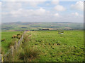
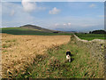
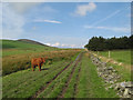
Situated just below the summit of Moel Eglwys the cairn lies below a small grassy spur on the NE side of the summit. Its position provides for very good views of the low lands to the north and east.
The cairn is mostly turf covered but there are numerous areas where the underlying stones are apparent. The cairn has a 6m diameter and it is raised to about 0.25m. There is a small depression of about 0.80m diameter at the top. There do not appear to be any kerb stones visible.
The cairn is difficult to access due to its location, i.e. atop a grassy mountain criss crossed with electrical fencing.
You may be viewing yesterday's version of this page. To see the most up to date information please register for a free account.
")
")
")
")
Do not use the above information on other web sites or publications without permission of the contributor.
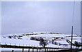
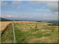
Nearby Images from Geograph Britain and Ireland:
©2006(licence)
©2008(licence)
©2008(licence)
©2008(licence)
©2008(licence)
The above images may not be of the site on this page, they are loaded from Geograph.
Please Submit an Image of this site or go out and take one for us!
Click here to see more info for this site
Nearby sites
Key: Red: member's photo, Blue: 3rd party photo, Yellow: other image, Green: no photo - please go there and take one, Grey: site destroyed
Download sites to:
KML (Google Earth)
GPX (GPS waypoints)
CSV (Garmin/Navman)
CSV (Excel)
To unlock full downloads you need to sign up as a Contributory Member. Otherwise downloads are limited to 50 sites.
Turn off the page maps and other distractions
Nearby sites listing. In the following links * = Image available
641m NW 312° Cefnhirfynydd Uchaf Cairn 3* Cairn (SH9024848454)
720m NNW 345° Cefnhirfynydd Uchaf Cairn 2* Cairn (SH9054048710)
730m NNW 347° Cefnhirfynydd Uchaf Cairn 1* Cairn (SH9056048725)
898m NW 321° Cefnhirfynydd Uchaf Cairnfield* Barrow Cemetery (SH9016648725)
941m NNW 337° Cefnhirfynydd Uchaf Enclosure* Ancient Village or Settlement (SH9037148889)
1.1km NW 322° Cefnhirfynydd Uchaf Standing Stone* Standing Stone (Menhir) (SH9004348910)
1.5km WNW 295° Garn Prys* Cairn (SH89374866)
1.9km WSW 246° Caer Garn Cairn and Round Barrow* Barrow Cemetery (SH8897047270)
3.1km NNW 334° Carreg Nanw* Modern Stone Circle etc (SH8940550794)
4.9km E 90° Cronglwyd Fawr Barrow* Round Barrow(s) (SH9565047940)
5.1km NW 315° Lon Mynydd Hiraethog* Ancient Trackway (SH8719051650)
5.7km E 96° Pen-y-Gaer (Denbighshire) Stone Circle (SH964473)
5.9km NW 319° Carreg Nant Y Foel* Natural Stone / Erratic / Other Natural Feature (SH8690152540)
6.0km N 355° Bwlch y Garnedd Hut Circle* Ancient Village or Settlement (SH90305401)
6.1km NNW 331° Hafod Y Garreg Cist* Cist (SH8790053400)
6.1km E 90° Caer Caradog* Hillfort (SH96824792)
6.1km NNW 338° Hafod y Dre* Stone Row / Alignment (SH88535371)
6.1km NNW 330° Hafod Y Garreg Earthworks and Cairns* Barrow Cemetery (SH8773053360)
6.1km NNW 332° Hafod Y Carreg Cairn Field* Barrow Cemetery (SH8793053470)
6.2km NNW 331° Hafod y Garreg Row* Stone Row / Alignment (SH87815345)
6.2km NNW 331° Ffridd Can Awen Cists* Cist (SH8786053480)
6.2km N 356° Bwlch y Garnedd Menhir Standing Stone (Menhir) (SH9045254194)
6.2km N 356° Lon Bwlch y Garnedd standing stones* Standing Stones (SH9046154197)
6.3km NNW 331° Ffridd Can Awen Cairn* Cairn (SH8774053620)
6.4km NNE 33° Cerrig y Drudion Stone Circle (SH943533)
View more nearby sites and additional images


 We would like to know more about this location. Please feel free to add a brief description and any relevant information in your own language.
 Wir möchten mehr über diese Stätte erfahren. Bitte zögern Sie nicht, eine kurze Beschreibung und relevante Informationen in Deutsch hinzuzufügen.
 Nous aimerions en savoir encore un peu sur les lieux. S'il vous plaît n'hesitez pas à ajouter une courte description et tous les renseignements pertinents dans votre propre langue.
 Quisieramos informarnos un poco más de las lugares. No dude en añadir una breve descripción y otros datos relevantes en su propio idioma.