

<< Our Photo Pages >> Lon Bwlch y Garnedd standing stones - Standing Stones in Wales in Conwy
Submitted by TAlanJones on Sunday, 26 November 2023 Page Views: 146
Neolithic and Bronze AgeSite Name: Lon Bwlch y Garnedd standing stonesCountry: Wales County: Conwy Type: Standing Stones
Nearest Village: Pentrefoelas
Map Ref: SH9046154197
Latitude: 53.073735N Longitude: 3.636474W
Condition:
| 5 | Perfect |
| 4 | Almost Perfect |
| 3 | Reasonable but with some damage |
| 2 | Ruined but still recognisable as an ancient site |
| 1 | Pretty much destroyed, possibly visible as crop marks |
| 0 | No data. |
| -1 | Completely destroyed |
| 5 | Superb |
| 4 | Good |
| 3 | Ordinary |
| 2 | Not Good |
| 1 | Awful |
| 0 | No data. |
| 5 | Can be driven to, probably with disabled access |
| 4 | Short walk on a footpath |
| 3 | Requiring a bit more of a walk |
| 2 | A long walk |
| 1 | In the middle of nowhere, a nightmare to find |
| 0 | No data. |
| 5 | co-ordinates taken by GPS or official recorded co-ordinates |
| 4 | co-ordinates scaled from a detailed map |
| 3 | co-ordinates scaled from a bad map |
| 2 | co-ordinates of the nearest village |
| 1 | co-ordinates of the nearest town |
| 0 | no data |
Internal Links:
External Links:
")
Situated along an ancient trackway that had probably also served the Romans, as well as becoming a coach road until its disuse in the early 1800 's, lie a selection of 'stones.' One in particular stands out as it remains upright demanding the attention of those who venture through this area of the Denbighshire Moor. The OS ref provided identifies this particular stone. However, there are many others that may or may not have 'the pedigree' of this stone. I have used the term selection of stones mainly due to the fact that this area has attracted quarrying and land clearances and .. well other contaminates that dilute the potency/credibility of some features.
One stone, about 300m north along the coach road that is now a challenging track, even the sheep avoid it, looks like it is associated with the quarrying industry. Anyway, I've posted some pics that I hope show how significant this environment would have been to our ancestors.
You may be viewing yesterday's version of this page. To see the most up to date information please register for a free account.
")
")
")
")
")
")
")
")
Do not use the above information on other web sites or publications without permission of the contributor.
Click here to see more info for this site
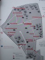
Nearby sites
Key: Red: member's photo, Blue: 3rd party photo, Yellow: other image, Green: no photo - please go there and take one, Grey: site destroyed
Download sites to:
KML (Google Earth)
GPX (GPS waypoints)
CSV (Garmin/Navman)
CSV (Excel)
To unlock full downloads you need to sign up as a Contributory Member. Otherwise downloads are limited to 50 sites.
Turn off the page maps and other distractions
Nearby sites listing. In the following links * = Image available
9m WSW 250° Bwlch y Garnedd Menhir Standing Stone (Menhir) (SH9045254194)
246m SW 219° Bwlch y Garnedd Hut Circle* Ancient Village or Settlement (SH90305401)
379m NE 36° Bwlch y Garnedd Cairn 3 Cairn (SH90695450)
797m NNE 20° Bwlch y Garnedd Round Cairn* Round Cairn (SH90755494)
1.4km NE 45° Bwlch y Garnedd Cairn 1* Cairn (SH91475517)
1.8km NE 43° Lon Bwlch y Garnedd Trackway* Ancient Trackway (SH9170055450)
1.9km NW 310° Pen Yr Orsedd Ring Cairn* Ring Cairn (SH8901055460)
2.0km WNW 283° Bryniau Duon Cairn on Hiraethog Trail* Cairn (SH8855054670)
2.0km WSW 255° Hafod y Dre* Stone Row / Alignment (SH88535371)
2.0km WNW 289° Moel Rhiwlug Recumbent* Natural Stone / Erratic / Other Natural Feature (SH8855954892)
2.2km W 268° Cefnen Wen Cairn East* Cairn (SH8824054160)
2.3km NE 55° Nant Heilyn* Ring Cairn (SH92355543)
2.3km W 268° Cefnen Wen Cairn and Cist* Cairn (SH8817054170)
2.3km WNW 299° Moel Rhiwlug Cairn 1* Cairn (SH88445538)
2.4km WNW 292° Moel Rhiwlug Cairn 2* Cairn (SH88295515)
2.5km W 262° Cefnen Wen Cairn Field* Barrow Cemetery (SH8796053890)
2.6km WSW 253° Hafod Y Carreg Cairn Field* Barrow Cemetery (SH8793053470)
2.7km WSW 251° Hafod Y Garreg Cist* Cist (SH8790053400)
2.7km WSW 253° Ffridd Can Awen Cists* Cist (SH8786053480)
2.7km WSW 253° Hafod y Garreg Row* Stone Row / Alignment (SH87815345)
2.8km WSW 257° Ffridd Can Awen Cairn* Cairn (SH8774053620)
2.8km WSW 252° Hafod Y Garreg Earthworks and Cairns* Barrow Cemetery (SH8773053360)
3.6km SSW 196° Carreg Nanw* Modern Stone Circle etc (SH8940550794)
3.9km WSW 244° Carreg Nant Y Foel* Natural Stone / Erratic / Other Natural Feature (SH8690152540)
3.9km ESE 102° Cerrig y Drudion Stone Circle (SH943533)
View more nearby sites and additional images


 We would like to know more about this location. Please feel free to add a brief description and any relevant information in your own language.
 Wir möchten mehr über diese Stätte erfahren. Bitte zögern Sie nicht, eine kurze Beschreibung und relevante Informationen in Deutsch hinzuzufügen.
 Nous aimerions en savoir encore un peu sur les lieux. S'il vous plaît n'hesitez pas à ajouter une courte description et tous les renseignements pertinents dans votre propre langue.
 Quisieramos informarnos un poco más de las lugares. No dude en añadir una breve descripción y otros datos relevantes en su propio idioma.