


<< Our Photo Pages >> Cefnhirfynydd Uchaf Cairn 2 - Cairn in Wales in Conwy
Submitted by TAlanJones on Thursday, 06 July 2023 Page Views: 179
Neolithic and Bronze AgeSite Name: Cefnhirfynydd Uchaf Cairn 2Country: Wales County: Conwy Type: Cairn
Nearest Town: Cerrigydrudion Nearest Village: Pentrefoelas
Map Ref: SH9054048710
Latitude: 53.024448N Longitude: 3.633429W
Condition:
| 5 | Perfect |
| 4 | Almost Perfect |
| 3 | Reasonable but with some damage |
| 2 | Ruined but still recognisable as an ancient site |
| 1 | Pretty much destroyed, possibly visible as crop marks |
| 0 | No data. |
| -1 | Completely destroyed |
| 5 | Superb |
| 4 | Good |
| 3 | Ordinary |
| 2 | Not Good |
| 1 | Awful |
| 0 | No data. |
| 5 | Can be driven to, probably with disabled access |
| 4 | Short walk on a footpath |
| 3 | Requiring a bit more of a walk |
| 2 | A long walk |
| 1 | In the middle of nowhere, a nightmare to find |
| 0 | No data. |
| 5 | co-ordinates taken by GPS or official recorded co-ordinates |
| 4 | co-ordinates scaled from a detailed map |
| 3 | co-ordinates scaled from a bad map |
| 2 | co-ordinates of the nearest village |
| 1 | co-ordinates of the nearest town |
| 0 | no data |
Internal Links:
External Links:
")
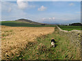
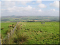
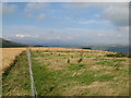
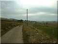
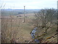
Situated on the eastern fringes of a large cairn field this is one of two funerary cairns lying at the corner of a pastoral field. A trackway meanders northwards towards the Cefnhirfynydd farm some few metres further east. Coflein has recorded the site as NPRN 509344.
The site has been disturbed resulting in it resembling a kidney shape. It measures 7m by 3.5m and it is raised to about 0.40m. It is turf covered with protruding stones around the S and W arcs of the kidney shape. It currently sports a large thistle on its south side arc.
As mentioned this is a pastoral landscape that does not attract many walkers. However, if you're comfortable with curious cattle and sheep then it may be worth a visit.
You may be viewing yesterday's version of this page. To see the most up to date information please register for a free account.
")
")
")
Do not use the above information on other web sites or publications without permission of the contributor.
Nearby Images from Geograph Britain and Ireland:
©2008(licence)
©2008(licence)
©2008(licence)
©2006(licence)
©2006(licence)
The above images may not be of the site on this page, they are loaded from Geograph.
Please Submit an Image of this site or go out and take one for us!
Click here to see more info for this site
Nearby sites
Key: Red: member's photo, Blue: 3rd party photo, Yellow: other image, Green: no photo - please go there and take one, Grey: site destroyed
Download sites to:
KML (Google Earth)
GPX (GPS waypoints)
CSV (Garmin/Navman)
CSV (Excel)
To unlock full downloads you need to sign up as a Contributory Member. Otherwise downloads are limited to 50 sites.
Turn off the page maps and other distractions
Nearby sites listing. In the following links * = Image available
25m NE 52° Cefnhirfynydd Uchaf Cairn 1* Cairn (SH9056048725)
246m NW 315° Cefnhirfynydd Uchaf Enclosure* Ancient Village or Settlement (SH9037148889)
373m W 271° Cefnhirfynydd Uchaf Cairnfield* Barrow Cemetery (SH9016648725)
388m SW 227° Cefnhirfynydd Uchaf Cairn 3* Cairn (SH9024848454)
534m WNW 291° Cefnhirfynydd Uchaf Standing Stone* Standing Stone (Menhir) (SH9004348910)
720m SSE 165° Moel Eglwys Cairn* Cairn (SH9071348011)
1.2km W 266° Garn Prys* Cairn (SH89374866)
2.1km SW 226° Caer Garn Cairn and Round Barrow* Barrow Cemetery (SH8897047270)
2.4km NNW 330° Carreg Nanw* Modern Stone Circle etc (SH8940550794)
4.4km NW 310° Lon Mynydd Hiraethog* Ancient Trackway (SH8719051650)
5.2km E 97° Cronglwyd Fawr Barrow* Round Barrow(s) (SH9565047940)
5.3km NW 315° Carreg Nant Y Foel* Natural Stone / Erratic / Other Natural Feature (SH8690152540)
5.3km N 356° Bwlch y Garnedd Hut Circle* Ancient Village or Settlement (SH90305401)
5.4km NNW 329° Hafod Y Garreg Cist* Cist (SH8790053400)
5.4km NNW 337° Hafod y Dre* Stone Row / Alignment (SH88535371)
5.4km NNW 330° Hafod Y Carreg Cairn Field* Barrow Cemetery (SH8793053470)
5.4km NNW 328° Hafod Y Garreg Earthworks and Cairns* Barrow Cemetery (SH8773053360)
5.5km NNW 329° Hafod y Garreg Row* Stone Row / Alignment (SH87815345)
5.5km NNW 329° Ffridd Can Awen Cists* Cist (SH8786053480)
5.5km N 358° Bwlch y Garnedd Menhir Standing Stone (Menhir) (SH9045254194)
5.5km N 358° Lon Bwlch y Garnedd standing stones* Standing Stones (SH9046154197)
5.6km NNW 329° Ffridd Can Awen Cairn* Cairn (SH8774053620)
5.8km NNW 332° Cefnen Wen Cairn Field* Barrow Cemetery (SH8796053890)
5.8km N 0° Bwlch y Garnedd Cairn 3 Cairn (SH90695450)
5.9km NNW 336° Cefnen Wen Cairn East* Cairn (SH8824054160)
View more nearby sites and additional images


 We would like to know more about this location. Please feel free to add a brief description and any relevant information in your own language.
 Wir möchten mehr über diese Stätte erfahren. Bitte zögern Sie nicht, eine kurze Beschreibung und relevante Informationen in Deutsch hinzuzufügen.
 Nous aimerions en savoir encore un peu sur les lieux. S'il vous plaît n'hesitez pas à ajouter une courte description et tous les renseignements pertinents dans votre propre langue.
 Quisieramos informarnos un poco más de las lugares. No dude en añadir una breve descripción y otros datos relevantes en su propio idioma.