 with our Megalithic Portal iPhone app")

<< Text Pages >> Y Foel Frech - Stone Circle in Wales in Denbighshire
Submitted by Tom_Bullock on Sunday, 22 September 2002 Page Views: 6905
Neolithic and Bronze AgeSite Name: Y Foel FrechCountry: Wales County: Denbighshire Type: Stone Circle
Map Ref: SJ012539 Landranger Map Number: 116
Latitude: 53.073163N Longitude: 3.476149W
Condition:
| 5 | Perfect |
| 4 | Almost Perfect |
| 3 | Reasonable but with some damage |
| 2 | Ruined but still recognisable as an ancient site |
| 1 | Pretty much destroyed, possibly visible as crop marks |
| 0 | No data. |
| -1 | Completely destroyed |
| 5 | Superb |
| 4 | Good |
| 3 | Ordinary |
| 2 | Not Good |
| 1 | Awful |
| 0 | No data. |
| 5 | Can be driven to, probably with disabled access |
| 4 | Short walk on a footpath |
| 3 | Requiring a bit more of a walk |
| 2 | A long walk |
| 1 | In the middle of nowhere, a nightmare to find |
| 0 | No data. |
| 5 | co-ordinates taken by GPS or official recorded co-ordinates |
| 4 | co-ordinates scaled from a detailed map |
| 3 | co-ordinates scaled from a bad map |
| 2 | co-ordinates of the nearest village |
| 1 | co-ordinates of the nearest town |
| 0 | no data |
Internal Links:
External Links:
Ancient site in Denbighshire
Have you visited this site? Please add a comment below.
You may be viewing yesterday's version of this page. To see the most up to date information please register for a free account.
Do not use the above information on other web sites or publications without permission of the contributor.
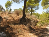
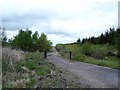
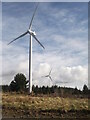
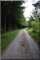
Nearby Images from Geograph Britain and Ireland:
©2006(licence)
©2024(licence)
©2013(licence)
©2006(licence)
©2018(licence)
The above images may not be of the site on this page, they are loaded from Geograph.
Please Submit an Image of this site or go out and take one for us!
Click here to see more info for this site
Nearby sites
Key: Red: member's photo, Blue: 3rd party photo, Yellow: other image, Green: no photo - please go there and take one, Grey: site destroyed
Download sites to:
KML (Google Earth)
GPX (GPS waypoints)
CSV (Garmin/Navman)
CSV (Excel)
To unlock full downloads you need to sign up as a Contributory Member. Otherwise downloads are limited to 50 sites.
Turn off the page maps and other distractions
Nearby sites listing. In the following links * = Image available
2.1km ENE 72° Capel Hiraethog III* Stone Circle (SJ032545)
2.5km ENE 75° Capel Hiraethog ring cairn* Ring Cairn (SJ036545)
2.9km NW 324° Maen Cleddau* Natural Stone / Erratic / Other Natural Feature (SH99515630)
2.9km NW 324° Brenig 6* Cairn (SH99525631)
3.0km NW 325° Brenig 5. Ring Cairn (SH995564)
3.2km SSE 159° Preseb y Fawch Frech* Stone Circle (SJ023509)
3.3km SW 234° Caer Ddunod* Hillfort (SH985520)
3.4km NW 315° Brenig 8* Round Barrow(s) (SH98805636)
3.5km NW 319° Brenig 51* Cairn (SH98985656)
3.6km ESE 118° Caerau One (Denbighshire) Ancient Village or Settlement (SJ0432252169)
3.6km NW 306° Brenig 14 Cairn (SH983561)
3.7km ESE 116° Caerau Two (Denbighshire)* Ancient Village or Settlement (SJ0446552227)
3.8km ESE 109° Bryn Beddau Stone Circle* Stone Circle (SJ0472952587)
3.9km ESE 112° Maen Llwyd (Denbighshire)* Standing Stone (Menhir) (SJ04795238)
3.9km E 100° Bryn Beddau North* Ring Cairn (SJ0508053130)
3.9km ESE 102° Bryn Beddau South* Cairn (SJ0505052970)
4.0km NW 318° Brenig 46* Cairn (SH98585691)
4.1km E 98° Bedd Emlyn* Cairn (SJ0525053240)
4.2km N 356° Twr-yr-Hill* Round Barrow(s) (SJ010581)
4.4km NW 318° Brenig 44* Timber Circle (SH98345720)
4.4km NW 318° Boncyn Arian* Round Barrow(s) (SH98305726)
4.5km NW 312° Brenig 41* Round Barrow(s) (SH97905702)
4.6km NW 323° Brenig Mesolithic Camp Site Ancient Village or Settlement (SH985576)
4.6km NW 306° Brenig 42* Round Barrow(s) (SH975567)
4.7km NW 312° Brenig 40* Round Barrow(s) (SH97785711)
View more nearby sites and additional images


 We would like to know more about this location. Please feel free to add a brief description and any relevant information in your own language.
 Wir möchten mehr über diese Stätte erfahren. Bitte zögern Sie nicht, eine kurze Beschreibung und relevante Informationen in Deutsch hinzuzufügen.
 Nous aimerions en savoir encore un peu sur les lieux. S'il vous plaît n'hesitez pas à ajouter une courte description et tous les renseignements pertinents dans votre propre langue.
 Quisieramos informarnos un poco más de las lugares. No dude en añadir una breve descripción y otros datos relevantes en su propio idioma.