


<< Our Photo Pages >> Longstone Hill cairn - Cairn in England in Devon
Submitted by TheCaptain on Wednesday, 27 April 2022 Page Views: 941
Neolithic and Bronze AgeSite Name: Longstone Hill cairnCountry: England
NOTE: This site is 0.161 km away from the location you searched for.
County: Devon Type: Cairn
Nearest Town: Okehampton Nearest Village: Meldon
Map Ref: SX56709113
Latitude: 50.702105N Longitude: 4.030617W
Condition:
| 5 | Perfect |
| 4 | Almost Perfect |
| 3 | Reasonable but with some damage |
| 2 | Ruined but still recognisable as an ancient site |
| 1 | Pretty much destroyed, possibly visible as crop marks |
| 0 | No data. |
| -1 | Completely destroyed |
| 5 | Superb |
| 4 | Good |
| 3 | Ordinary |
| 2 | Not Good |
| 1 | Awful |
| 0 | No data. |
| 5 | Can be driven to, probably with disabled access |
| 4 | Short walk on a footpath |
| 3 | Requiring a bit more of a walk |
| 2 | A long walk |
| 1 | In the middle of nowhere, a nightmare to find |
| 0 | No data. |
| 5 | co-ordinates taken by GPS or official recorded co-ordinates |
| 4 | co-ordinates scaled from a detailed map |
| 3 | co-ordinates scaled from a bad map |
| 2 | co-ordinates of the nearest village |
| 1 | co-ordinates of the nearest town |
| 0 | no data |
Internal Links:


External Links:


I have visited· I would like to visit
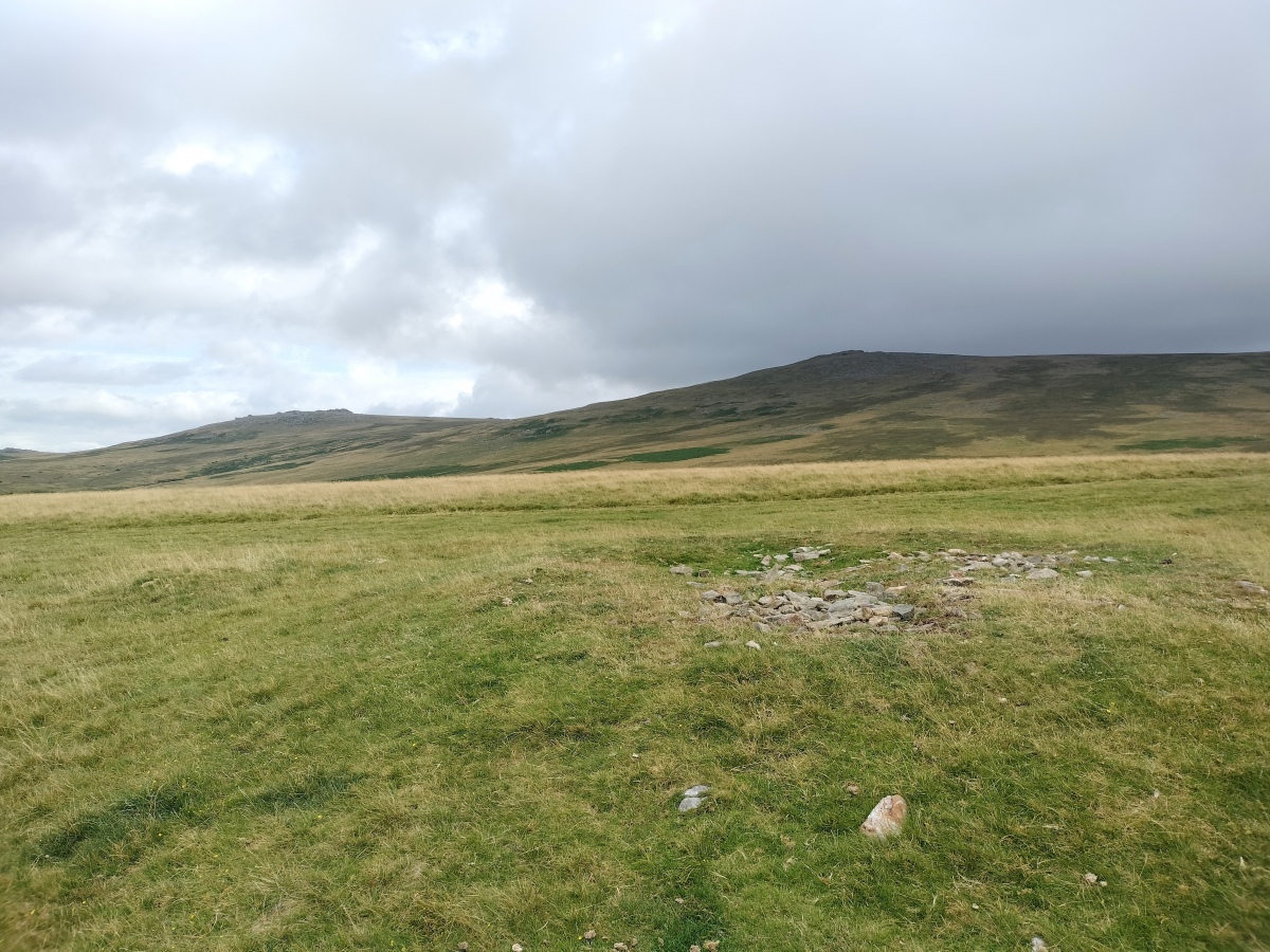
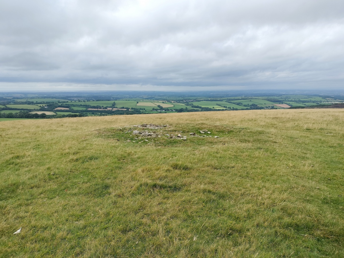
TheCaptain visited on 2nd Aug 2024 - their rating: Cond: 2 Amb: 4 Access: 3 From the Longstone, I head northwards along the summit trackway which takes me past the stony cairn on my way down to the dam and back across to the car. Now very weary, I head for a well deserved pint at Betty Cottles.
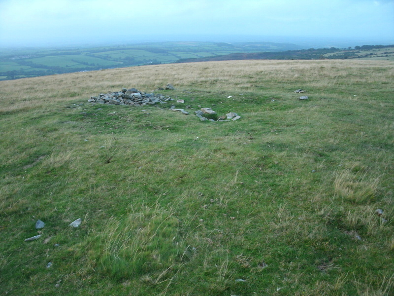
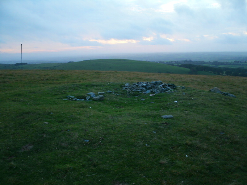
Pastscape Monument No. 969170 says: "(this is) a disturbed cairn on the level summit of Longstone Hill 60m E of the flagstaff. The circular cairn measures 9.4m in diameter and stands 0.4m high. The centre of the mound is occupied by an amorphous hollow, presumably the site of an unrecorded antiquarian excavation. There is no evidence to suggest the presence of a cist or kerb. This feature lies amidst a large number of cairns (at least 64) that litter the summit and ridgeline of Longstone Hill. It differs in being circular and larger than those surrounding it and is probably earlier in origin.
The excavation has exposed some of the boulders and stones that make up the cairn's fabric and these have recently been moved to create a smaller cairn on the S edge of this feature".
You may be viewing yesterday's version of this page. To see the most up to date information please register for a free account.
Do not use the above information on other web sites or publications without permission of the contributor.
Nearby Images from Geograph Britain and Ireland:
©2014(licence)
©2014(licence)
©2014(licence)
©2008(licence)
©2014(licence)
The above images may not be of the site on this page, they are loaded from Geograph.
Please Submit an Image of this site or go out and take one for us!
Click here to see more info for this site
Log in or create a free account to see nearby ancient sites our visitors rate highly
All Nearby sites
 Click here to view sites on an interactive OS map
Download sites to:
KML (Google Earth)
GPX (GPS waypoints)
CSV (Garmin/Navman)
CSV (Excel)
To unlock full downloads you need to sign up as a Society Member. Otherwise downloads are limited to 50 sites.
Turn off the page maps and other distractions
Nearby sites listing. In the following links * = Image available
241m S 174° Longstone Hill stone* Standing Stone (Menhir) (SX56729089)
744m SW 228° Homerton Hill North* Cist (SX56139065)
857m ENE 61° Black Down West Cairn (SX57469153)
1.6km SE 125° Yes Tor cairns* Barrow Cemetery (SX57959020)
2.1km SE 141° High Willhays North* Ring Cairn (SX58028944)
2.3km SE 144° High Willhays kerb cairn* Ring Cairn (SX58038922)
2.4km SSE 157° Fordsland Ledge Chambered cairn* Chambered Cairn (SX57588888)
2.4km SSW 213° Branscombe's Loaf* Ring Cairn (SX55318912)
2.5km SW 215° Corn Ridge Rock* Ring Cairn (SX5521989145)
2.5km SW 217° Corn Ridge Stone Ring Cairn Circle* Ring Cairn (SX5513889153)
2.5km SW 216° Cornridge SE* Stone Circle (SX5517589119)
2.5km SW 231° Sourton Tors Stone Circle* Stone Circle (SX54688958)
2.7km SW 229° Sourton Tors Cairn* Cairn (SX5460389438)
2.8km SW 217° Corndon Ridge Propped Stones Marker Stone (SX5493088942)
3.2km SW 223° Sourton Tors Ring Cairns* Ring Cairn (SX5441888858)
3.4km WSW 254° Sourton Green Saxon Cross* Ancient Cross (SX534903)
3.6km NE 42° Fitz's Well* Holy Well or Sacred Spring (SX5919093783)
4.1km ESE 112° Oke Tor* Stone Row / Alignment (SX605895)
4.1km ENE 77° Belstone Common Cairns* Cairn (SX6077491956)
4.4km SSW 212° Little Links Tor* Stone Row / Alignment (SX5428587463)
4.4km E 86° Winter Tor* Cist (SX6110291335)
4.7km SW 216° Great Nodden* Cist (SX5387487416)
4.7km NE 50° East Hill Promontory Fort* Promontory Fort / Cliff Castle (SX604941)
4.8km ENE 68° Nine Stones (Belstone)* Stone Circle (SX6123192844)
5.0km SSW 199° Great Links Tor Cairn* Cairn (SX5491686496)
View more nearby sites and additional images


 We would like to know more about this location. Please feel free to add a brief description and any relevant information in your own language.
 Wir möchten mehr über diese Stätte erfahren. Bitte zögern Sie nicht, eine kurze Beschreibung und relevante Informationen in Deutsch hinzuzufügen.
 Nous aimerions en savoir encore un peu sur les lieux. S'il vous plaît n'hesitez pas à ajouter une courte description et tous les renseignements pertinents dans votre propre langue.
 Quisieramos informarnos un poco más de las lugares. No dude en añadir una breve descripción y otros datos relevantes en su propio idioma.