



<< Text Pages >> Knatta Barrow - Ring Cairn in England in Devon
Submitted by Anne T on Wednesday, 26 October 2016 Page Views: 1766
Neolithic and Bronze AgeSite Name: Knatta Barrow Alternative Name: KnattabarrowCountry: England
NOTE: This site is 0.599 km away from the location you searched for.
County: Devon Type: Ring Cairn
Nearest Town: Ivybridge Nearest Village: Shipley Bridge
Map Ref: SX6595464218
Latitude: 50.462429N Longitude: 3.889941W
Condition:
| 5 | Perfect |
| 4 | Almost Perfect |
| 3 | Reasonable but with some damage |
| 2 | Ruined but still recognisable as an ancient site |
| 1 | Pretty much destroyed, possibly visible as crop marks |
| 0 | No data. |
| -1 | Completely destroyed |
| 5 | Superb |
| 4 | Good |
| 3 | Ordinary |
| 2 | Not Good |
| 1 | Awful |
| 0 | No data. |
| 5 | Can be driven to, probably with disabled access |
| 4 | Short walk on a footpath |
| 3 | Requiring a bit more of a walk |
| 2 | A long walk |
| 1 | In the middle of nowhere, a nightmare to find |
| 0 | No data. |
| 5 | co-ordinates taken by GPS or official recorded co-ordinates |
| 4 | co-ordinates scaled from a detailed map |
| 3 | co-ordinates scaled from a bad map |
| 2 | co-ordinates of the nearest village |
| 1 | co-ordinates of the nearest town |
| 0 | no data |
Be the first person to rate this site - see the 'Contribute!' box in the right hand menu.
Internal Links:


External Links:


Ring Cairn in Devon
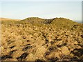
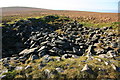
Information about the Knatta Barrow Stone Ring Cairn Circle comes from the Prehistoric Dartmoor Walks (PDW) website. Their notes tell us "this large cairn (24m diameter, 1.7m height) is composed of loose granite boulders. It is unusual among summit cairns in having a well defined outer bank about 1m wide and 0.5m high. This is partly turf covered but where eroded can be seen to be built of loose stone like the central cairn which touches it. It shows best on the north and east sides, while on the south west side it tends to merge into the body of the cairn."
The cairn is also recorded on Pastscape: Monument Number 441767, which adds that "The name "Knatta Barrow" is in current usage and is applied to an embanked cairn of two distinct parts, at approximately 450m OD. There is a central cairn 20.0m in diameter and 1.7m high which may originally have had a flat or platform top, now much disturbed by the creation of small shelters and modern cairns. Contiguous to the base is an encircling bank of stones 2.5m wide and 0.7m high on the outer face; the inner face is but 0.2m high but here it has had to retain spillage and slip from the central mound. Visually it cannot be determined whether this was a ring cairn to which a central cairn was added or if the ring was a subsequent construction."
The barrow is also recorded as MDV5717 (Knatta Barrow, Quickbeam Hill) on the Devon and Dartmoor HER, and scheduled as Historic England List Entry No.1002659 (Knatta Barrow).
Note: Have you visited this site? Do you have any photographs, images or further information you can add?
You may be viewing yesterday's version of this page. To see the most up to date information please register for a free account.
Do not use the above information on other web sites or publications without permission of the contributor.
Nearby Images from Geograph Britain and Ireland:
©2008(licence)
©2009(licence)
©2009(licence)
©2009(licence)
©2009(licence)
The above images may not be of the site on this page, they are loaded from Geograph.
Please Submit an Image of this site or go out and take one for us!
Click here to see more info for this site
Log in or create a free account to see nearby ancient sites our visitors rate highly
All Nearby sites
 Click here to view sites on an interactive OS map
Download sites to:
KML (Google Earth)
GPX (GPS waypoints)
CSV (Garmin/Navman)
CSV (Excel)
To unlock full downloads you need to sign up as a Society Member. Otherwise downloads are limited to 50 sites.
Turn off the page maps and other distractions
Nearby sites listing. In the following links * = Image available
1.1km NNE 30° Eastern White Barrow Cairn* Cairn (SX6653865157)
1.4km NNW 333° Western White Barrow* Cairn (SX6535465480)
1.7km SSW 200° Three Barrows (Ugborough Moor)* Cairn (SX65316259)
1.8km N 352° Buckland Ford* Stone Circle (SX65746604)
1.9km ESE 111° Black Tor SW* Multiple Stone Rows / Avenue (SX6773063494)
1.9km E 86° Riders Rings* Ancient Village or Settlement (SX6788964294)
2.0km N 351° Huntingdon Warren Clapper Bridge* Ancient Trackway (SX65706619)
2.1km E 93° Brent Moor House Cist (SX68026404)
2.1km N 360° Huntingdon Warren Settlement* Ancient Village or Settlement (SX660663)
2.1km ESE 112° Black Tor (Avon)* Ancient Village or Settlement (SX67916338)
2.1km WSW 252° Dry Lake North Settlement* Ancient Village or Settlement (SX639636)
2.1km WNW 299° Hook Lake Row* Multiple Stone Rows / Avenue (SX6411265318)
2.1km WNW 300° Brown Heath Cairn and Cist* Chambered Cairn (SX6411465327)
2.2km SW 225° Three Barrows West prehistoric settlement* Ancient Village or Settlement (SX6436762738)
2.2km NE 54° Dean Moor Enclosed Settlement* Ancient Village or Settlement (SX67766545)
2.2km WNW 301° Hook Lake Settlement* Ancient Village or Settlement (SX6408065390)
2.3km ENE 73° Gripper's Hill Enclosed Settlement* Ancient Village or Settlement (SX68156481)
2.3km SSE 162° Hickley Ridge West Cist (SX66596203)
2.3km NE 48° Brockhill Settlement* Ancient Village or Settlement (SX677657)
2.3km SE 140° Hickley Ridge East* Cist (SX6740262381)
2.3km SE 146° Hickley Ridge Central* Cist (SX6722462250)
2.4km NE 50° Brockhill Ford* Cairn (SX6780965702)
2.4km W 270° River Erme Settlement* Ancient Village or Settlement (SX6355064300)
2.4km W 273° Lower Erme Cairns* Barrow Cemetery (SX6355064400)
2.4km WNW 301° Erme Pound Cist Cist (SX63926551)
View more nearby sites and additional images


 We would like to know more about this location. Please feel free to add a brief description and any relevant information in your own language.
 Wir möchten mehr über diese Stätte erfahren. Bitte zögern Sie nicht, eine kurze Beschreibung und relevante Informationen in Deutsch hinzuzufügen.
 Nous aimerions en savoir encore un peu sur les lieux. S'il vous plaît n'hesitez pas à ajouter une courte description et tous les renseignements pertinents dans votre propre langue.
 Quisieramos informarnos un poco más de las lugares. No dude en añadir una breve descripción y otros datos relevantes en su propio idioma.