<< Our Photo Pages >> Ruapuke Pa - Standing Stone (Menhir) in New Zealand
Submitted by theantiquariansociet on Saturday, 07 January 2006 Page Views: 15629
Neolithic and Bronze AgeSite Name: Ruapuke PaCountry: New Zealand
NOTE: This site is 71.752 km away from the location you searched for.
Type: Standing Stone (Menhir)
Nearest Town: Raglan Nearest Village: Ruapuke
Latitude: 37.9058S Longitude: 174.775000E
Condition:
| 5 | Perfect |
| 4 | Almost Perfect |
| 3 | Reasonable but with some damage |
| 2 | Ruined but still recognisable as an ancient site |
| 1 | Pretty much destroyed, possibly visible as crop marks |
| 0 | No data. |
| -1 | Completely destroyed |
| 5 | Superb |
| 4 | Good |
| 3 | Ordinary |
| 2 | Not Good |
| 1 | Awful |
| 0 | No data. |
| 5 | Can be driven to, probably with disabled access |
| 4 | Short walk on a footpath |
| 3 | Requiring a bit more of a walk |
| 2 | A long walk |
| 1 | In the middle of nowhere, a nightmare to find |
| 0 | No data. |
| 5 | co-ordinates taken by GPS or official recorded co-ordinates |
| 4 | co-ordinates scaled from a detailed map |
| 3 | co-ordinates scaled from a bad map |
| 2 | co-ordinates of the nearest village |
| 1 | co-ordinates of the nearest town |
| 0 | no data |
Internal Links:
External Links:
")
For more info see here
You may be viewing yesterday's version of this page. To see the most up to date information please register for a free account.
Do not use the above information on other web sites or publications without permission of the contributor.
Nearby Images from Flickr
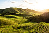


The above images may not be of the site on this page, but were taken nearby. They are loaded from Flickr so please click on them for image credits.
Click here to see more info for this site
Nearby sites
Click here to view sites on an interactive map of the areaKey: Red: member's photo, Blue: 3rd party photo, Yellow: other image, Green: no photo - please go there and take one, Grey: site destroyed
Download sites to:
KML (Google Earth)
GPX (GPS waypoints)
CSV (Garmin/Navman)
CSV (Excel)
To unlock full downloads you need to sign up as a Contributory Member. Otherwise downloads are limited to 50 sites.
Turn off the page maps and other distractions
Nearby sites listing. In the following links * = Image available
106.3km N 0° Mangere Mountain Pa* Hillfort
108.4km N 3° Otahuhu Pa* Hillfort
110.5km N 358° Puketapapa Pa* Hillfort
111.5km NNE 22° Tapapakanga Park* Ancient Village or Settlement
111.9km N 0° Maungakiekie Pa* Hillfort
112.1km N 1° Cornwall Park Rongo Stone* Standing Stone (Menhir)
112.9km N 3° Maungarei Stonefields* Ancient Village or Settlement
112.9km N 3° Maungarei Pa* Hillfort
113.5km N 360° Epsom Modern Megalith* Modern Stone Circle etc
113.7km N 0° Te Kopuke Pa* Hillfort
114.3km N 360° Maungawhau* Hillfort
114.3km N 1° Remuera Pa* Hillfort
115.3km N 5° Tahuna Torea* Ancient Village or Settlement
116.1km N 4° Taurere Pa* Hillfort
116.2km N 0° Auckland Museum* Museum
120.2km N 5° Motukorea Cone Pa* Hillfort
121.2km ESE 117° Pohaturoa* Hillfort
123.4km N 9° Matarahui Bay Pa* Hillfort
126.6km N 9° Mokemoke Pa* Hillfort
126.7km N 354° Te Taou Pa* Hillfort
127.0km NNE 17° Men's Bay North Pa* Hillfort
127.5km N 360° Rahopara Pa* Hillfort
137.8km N 358° Okura 784 Settlement & Midden* Artificial Mound
138.4km N 358° Dacre Point Pa* Hillfort
140.0km N 359° Rarowhara Pa* Hillfort
View more nearby sites and additional images


 We would like to know more about this location. Please feel free to add a brief description and any relevant information in your own language.
 Wir möchten mehr über diese Stätte erfahren. Bitte zögern Sie nicht, eine kurze Beschreibung und relevante Informationen in Deutsch hinzuzufügen.
 Nous aimerions en savoir encore un peu sur les lieux. S'il vous plaît n'hesitez pas à ajouter une courte description et tous les renseignements pertinents dans votre propre langue.
 Quisieramos informarnos un poco más de las lugares. No dude en añadir una breve descripción y otros datos relevantes en su propio idioma.