Featured: Hare and Tabor T Shirts for discerning antiquarians

Hare and Tabor T Shirts for discerning antiquarians

Stone Worlds: Narrative and Reflexivity in Landscape Archaeology

Stone Worlds: Narrative and Reflexivity in Landscape Archaeology

Login

Register here - as a registered user you get more features and fewer ads.

Who's Online

There are currently, 2169 guests and 5 members online.

Sponsors

<< News >> Special Stonehenge Edition of Historic England Research magazine out now

Submitted by Andy B on Tuesday, 25 July 2017  Page Views: 2627

StonehengeCountry: England County: Wiltshire Type: Henge

Internal Links:

Oblique aerial from c.1932
Oblique aerial from c.1932 submitted by Feanor : This recently discovered postcard shows Stonehenge from the south-southeast only a couple of years after Hawley's 7-year investigation. Much of his mess on the old Byway-12, inside the henge, has yet to be tidied up. I date it to 1932 because the window in the ticket office / toolshed has been installed. (Vote or comment on this photo)
Issue 6 of Historic England Research digital magazine is now available and focuses on recent research into the wider connected landscapes of the Stonehenge World Heritage Site. A foreword to the special Stonehenge edition from Historic England's Chief Executive Duncan Wilson:

I’m delighted to introduce this, the sixth, issue of Historic England Research. Given the current, and understandably passionate, debate about how best to manage serious and increasing traffic congestion on the A303 as it crosses the Stonehenge World Heritage Site, the issue’s focus on Stonehenge is timely.

In this case our focus is not on the issue of visitor or traffic management through the site, but instead on how research by Historic England and others is continuing to enhance our understanding and appreciation of the Stonehenge landscape – an important ambition of the World Heritage Site Management Plan.

As recent findings at Durrington Walls and south of the A303 demonstrate, and despite this being one of the most intensively studied archaeological landscapes in the country, continuing investment in research is delivering important new insights and narratives. This, in turn, will create even greater public interest, engagement and enjoyment of a monument and landscape that continue to exercise an unparalleled hold on people’s imagination.

I hope you enjoy this latest addition to the series and, indeed, previous issues of the magazine– which are which are available to download from the back issues page.

In this issue...
New investigations in the Stonehenge World Heritage Site
Aerial Investigation and Mapping
Pigs, curlews and trains: geophysical survey
Neolithic pits near Stonehenge
Middle Neolithic farming and food in the Stonehenge landscape
Bronze Age boundaries in the Stonehenge landscape
Vespasian’s Camp
Visualising our research
The Army Basing Programme: new discoveries at Larkhill and Bulford

You can read the articles as web pages:
historicengland.org.uk/whats-new/research/

or download the magazine in PDF format:
historicengland.org.uk/images-books/publications/historic-england-research-6/

Back Issues are here:
historicengland.org.uk/whats-new/research/back-issues/

<< 2,300-year-old chamber tombs founded in southeastern Turkey

Mapping Mayan: LiDAR Reveals Further Secrets of Classical Guatemalan Cities >>

Please add your thoughts on this site

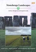
Stonehenge Landscapes Book and CD-ROM

Stonehenge Landscapes Book and CD-ROM

Sponsors

More News

See all News →

Latest Visit Logs

  • Gavurtepe
    “An ancient mound clearly visible and recognizable, but no structures could be clearly identified. I…”
    by longhintim · 13 Jul 2026
  • Teos
    “Nicely managed with clear signposts and footpaths, but a rather large site so a bit of walking is re…”
    by longhintim · 13 Jul 2026
  • Tas Kule
    “Easily accessible just beside the road. The outlook reminds me of the tomb of Cyrus in Pasargadae.”
    by longhintim · 13 Jul 2026
  • Neonteikhos
    “This place actually used to be a major Aeolian city state in the region To get to the site, I par…”
    by longhintim · 13 Jul 2026
  • Assos Temple of Athena
    “The temple of Athena is at the acropolis. Apart from the temple of Athena, Assos is a quite large s…”
    by longhintim · 13 Jul 2026

"Special Stonehenge Edition of Historic England Research magazine out now" | Login/Create an Account | 1 comment
  
Go back to top of page    Comments are owned by the poster. We aren't responsible for their content.
BBC summary of recent Stonehenge research by Andy B on Thursday, 27 July 2017
(User Info | Send a Message)
The site may be instantly recognisable, but there is far more to it than first meets the eye. As archaeologists study this area, mystery after mystery unfolds. But a coherent story may be beginning to emerge.

That has been particularly true over the last decade. Researchers have been studying not just the monument itself, but the area around it, hoping to find clues in this intriguing landscape of prehistoric monuments.

One such project that looked at Stonehenge in this holistic way was the Stonehenge Hidden Landscapes Project, which ran from 2010 to 2014. Underground radar and magnetic imaging techniques revealed that Stonehenge lies at the centre of a complex web of structures covering an estimated 4.5 square miles (12 sq km).

These kinds of surveys are key stressed Vince Gaffney, UK lead for the project, because they allow archaeologists “to investigate all areas of land equally, and not just the monuments we know. This allows us to interpret the evidence in a more sophisticated manner.

“What this has revealed is a completely unknown monumental phase of Durrington Walls. In between the Neolithic village and the massive earthwork was a massive ring of posts somewhere between 4-6m (13-20ft) in height – a minimum of 200 and perhaps as many as 300. This is completely new and would have been missed entirely without the survey.”

Mike Parker Pearson of University College London’s Institute of Archaeology, who led the Stonehenge Riverside Project from 2003 to 2009, thinks that the posts at Durrington Walls were put up with the intention that they would be taken down soon after. “They may only have stood for a matter of months before they were replaced by the henge bank and ditch,” he said. “Their purpose seems to have been to mark the perimeter of the great village, by now abandoned. So perhaps the posts were a monument to the people who lived here while building Stonehenge.”

More at
http://www.bbc.com/travel/story/20170713-why-stonehenge-was-built

With thanks to Roy Batham for the link
[ Reply to This ]

Your Name: Anonymous [ Register Now ]
Subject:


Add your comment or contribution to this page. Spam or offensive posts are deleted immediately, don't even bother

<<< What is five plus one as a number? (Please type the answer to this question in the little box on the left)
You can also embed videos and other things. For Youtube please copy and paste the 'embed code'.
For Google Street View please include Street View in the text.
Create a web link like this: <a href="https://www.megalithic.co.uk">This is a link</a>  

Allowed HTML is:
<p> <b> <i> <a> <img> <em> <br> <strong> <blockquote> <tt> <li> <ol> <ul> <object> <param> <embed> <iframe>

We would like to know more about this location. Please feel free to add a brief description and any relevant information in your own language.
Wir möchten mehr über diese Stätte erfahren. Bitte zögern Sie nicht, eine kurze Beschreibung und relevante Informationen in Deutsch hinzuzufügen.
Nous aimerions en savoir encore un peu sur les lieux. S'il vous plaît n'hesitez pas à ajouter une courte description et tous les renseignements pertinents dans votre propre langue.
Quisieramos informarnos un poco más de las lugares. No dude en añadir una breve descripción y otros datos relevantes en su propio idioma.