


Secret Signs, Sem's Bluestone project
Submitted by Andy B on Sunday, 23 January 2011 Page Views: 4941
Neolithic and Bronze AgeCountry: Wales County: PembrokeshireInternal Links:

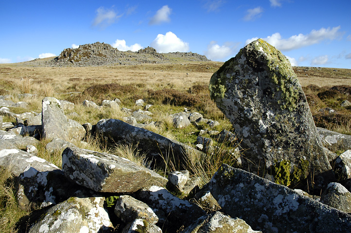
I chose the area around Carn Menyn in Pembrokeshire, the area that the Bluestones at Stonehenge came from. This is a location that has been studied by archaeologists but has lots of open moorland and so is unlikely to have been disturbed much by farming or later development. In general, archaeologists don't have the time to wander around on the off-chance something may be there, so this gave me two good reasons to test the theory and maybe find monuments others had missed.
The main tenet of the Secret Signs theory is, as stated above, that megaliths were placed to be visible to those who knew what to look for.
They may be route markers, show astronomical alignments or a mix of the two. Sometimes stones may be inter-visible, but more often they are not. This acts like good composition in a photograph which leads you into the picture, with one stone leading you on to another. These types are often placed to be visible on the skyline from certain vantage points but if walked towards it becomes apparent that they are on false crests, a remarkable achievement for so-called primitive people! The stones themselves are often unworked and the only give away is their angle of alignment. Typical of these are glacial erratics with the colour of the stone showing it is not native to the area.
Sometimes you have to visit an area many times before the reason for a stone's placing becomes obvious. Poor visibility has led me to visit some megaliths many times before realising why they are there, but when I see the reason my reaction is normally “Of course, how come I missed that.”
Armed with this theory off I went into the Presceli Mountains and yes, there is stuff that has been missed by conventional archaeologists, in plain view if you walk in the right direction. I am hoping that the pictures will persuade other people to walk off the beaten-track and make new discoveries.
There are two definites at present with a number of others waiting for half decent weather to be checked out. Eventually I hope it will be possible to trace a land route for the Bluestones to Milford Haven and maybe beyond using this method. I have included my reasons as to why I think the stones are there.
I apologise in advance for the photographs that do not show everything in the description but the vagaries of Welsh weather plus the fact that stone on a stone background tends to become invisible limits the camera's (and my) abilities. However, grid references are accurate to within 10ft so anyone can check my descriptions.
The first two sites I present in connection with this idea, I have called
Stone River Stone and Carn Menyn Marker.


 We would like to know more about this location. Please feel free to add a brief description and any relevant information in your own language.
 Wir möchten mehr über diese Stätte erfahren. Bitte zögern Sie nicht, eine kurze Beschreibung und relevante Informationen in Deutsch hinzuzufügen.
 Nous aimerions en savoir encore un peu sur les lieux. S'il vous plaît n'hesitez pas à ajouter une courte description et tous les renseignements pertinents dans votre propre langue.
 Quisieramos informarnos un poco más de las lugares. No dude en añadir una breve descripción y otros datos relevantes en su propio idioma.