
Ancient Site Looks Easy to Reach on the Map? Don’t Trust the Map Alone
Submitted by Andy B on Monday, 21 September 2026 Page Views: 22
Resources
In reality, archaeological sites are often surrounded by rough tracks, steep paths, uneven ground, seasonal mud, restricted access points, or roads that are far less reliable than they appear online. A destination that seems ten minutes away on a map can easily turn into a much longer and more demanding trip.
That does not mean remote historical sites should be avoided. It simply means the journey deserves as much planning as the visit itself. Checking terrain, access, weather, and practical logistics beforehand can prevent a fascinating day from becoming unnecessarily difficult.
Check the Road Before You Assume a Car Can Handle It
The biggest mistake is assuming that every line shown on a digital map represents a normal road.Some routes leading toward archaeological areas may be gravel tracks, farm roads, narrow lanes, or surfaces that become difficult after heavy rain. Even when the final destination is accessible, the last few kilometers can be very different from the highway used to reach the region.
Travelers preparing for remote routes should think practically about vehicle readiness, water, basic supplies, and how much help would be available if something went wrong. Equipment suppliers such as https://hotsysouthtexas.com/ are a reminder of how much difference the right tools can make in demanding outdoor and work environments, and the same principle applies to travel preparation: conditions matter more than what a route looks like on a screen.
Read recent visitor notes where available and pay attention to descriptions of the final approach, not just the total driving distance.
Find the Real Entrance, Not Just the Site Marker
Map pins often identify the ruins themselves rather than the place visitors are supposed to enter.That distinction can matter a lot.
The official entrance may be on the opposite side of a hill, behind a visitor center, or connected to a designated parking area that requires a longer walk. Driving directly toward the pin can sometimes lead to private land, closed gates, or roads that were never intended for public access.
Look for information about parking, ticket offices, trailheads, and official visitor routes before setting out.
If the site has a visitor center, treat that as the primary destination rather than navigating straight to the archaeological remains. Staff may also provide current information about trail conditions, closed sections, or the best route for the day.
A few extra minutes of checking can save a long detour.
Study the Terrain, Not Just the Distance
A two-kilometer walk on pavement is very different from two kilometers across loose stone, steep slopes, or exposed terrain.Ancient settlements were not always built where modern visitors would find access convenient. Fortified locations may sit above valleys, temples may be positioned on hillsides, and remote structures may require walking over uneven ground.
Contour lines, elevation information, and trail descriptions can tell a much more useful story than distance alone.
Look for phrases such as steep ascent, rocky path, exposed trail, uneven steps, or limited shade.
Footwear should match those conditions. Comfortable walking shoes may be enough for a maintained archaeological park, while rougher sites may call for footwear with better grip and ankle support.
The shortest route is not always the easiest one, and the easiest one is often worth taking.
Check the Weather for the Site, Not Just the Nearest City
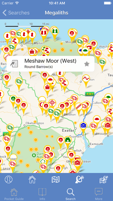 Right: The Megalithic Portal iPhone app
Weather can change the difficulty of an archaeological visit dramatically.
Heat can make exposed ruins exhausting, especially where there is little shade. Rain can turn dirt access roads and stone paths slippery. Strong wind may make elevated sites uncomfortable even when temperatures seem mild.
Look at the forecast for the actual location or the closest available point with similar elevation and terrain.
Timing matters too. Visiting early in the morning can make a hot site far more comfortable, while arriving later may mean dealing with both higher temperatures and larger crowds.
Carry enough water for the entire visit rather than assuming there will be a shop or fountain nearby.
Remote sites may have minimal facilities, and seasonal closures can affect what is available.
Weather planning is not about avoiding imperfect conditions. It is about knowing what those conditions will demand.
Do Not Assume Phone Service Will Follow You
Navigation apps work so well in cities that it is easy to forget how dependent they are on reliable connectivity.Remote archaeological areas may have weak or inconsistent mobile coverage, particularly in valleys, mountainous regions, or sparsely populated countryside.
Download maps before leaving reliable service.
Save the location of the entrance, parking area, accommodation, and any important junctions that might be difficult to identify on the return trip. A screenshot of written directions can also be surprisingly useful.
If the site requires a walk away from the vehicle, note the parking location before setting off.
Battery life matters too. Constant navigation, photography, and searching for a signal can drain a phone quickly. Carrying a charged power bank is a simple precaution for longer days.
Technology is useful, but it should not be the only thing keeping the route understandable.
Know When to Turn Around
One of the most useful travel decisions is recognizing when conditions no longer match the plan.If a road becomes significantly rougher than expected, a trail is flooded, weather deteriorates quickly, or the route seems to require equipment that was not brought, turning around is often the sensible choice.
An archaeological site will still be there another day.
Trying to push forward because the map says the destination is “only another kilometer” can create unnecessary problems, especially when the terrain is unfamiliar.
Build flexibility into the itinerary so abandoning one stop does not feel like ruining the entire day. Nearby towns, museums, viewpoints, or more accessible historical locations can often become worthwhile alternatives.
Good travel planning includes backup options rather than depending completely on one destination.
Plan the Journey as Carefully as the Site
Ancient places are often memorable partly because they are not located beside modern highways and parking lots.That remoteness can be part of the experience, but it also means navigation deserves more attention than simply entering a destination into a phone.
Check the real entrance, understand the final road conditions, study the terrain, review the weather, and prepare for weaker phone coverage. Those steps take very little time compared with dealing with a wrong turn or unexpectedly difficult approach.
A map is useful for understanding where a site is.
It is much less reliable at explaining what the journey will actually feel like.
Treat the route as part of the visit, and the ancient site at the end of it becomes much easier to enjoy.