
Abandoned Landscapes - The Carneddau - Introduction
Submitted by M_M_Robinson on Monday, 10 July 2006 Page Views: 2976
Multi-periodCountry: Wales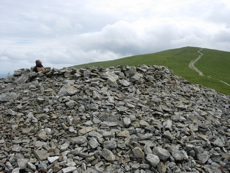
The Carneddau
Introduction
Bounded by the coast to the north, the Conwy valley to the east, and the Ogwen valley to the west and south, the Carneddau cover nearly 200 sq. km, the largest area of high ground in North Wales.
Much of the range consists of 'rolling whaleback hills', and to tramp the main ridge under snow early and alone on a midwinter morning is to taste the world at its most beautiful. Below the high tops is a cascade of wonderful remote cwms and hidden streams which meander down to the river plains and coastal lowlands.
There are two aspects which make the archaeology of this range special. Firstly, several of these valleys represent in archetypal form discrete 'micro-territories' of the kind described in part 1. Here, beside the waters of the Llafar, Caseg, Goch, Anafon and Dulyn we find prehistoric, Medieval and Post-Medieval houses, homesteads and enclosures, and the unique Carneddau cellular sheepfolds. On the tops, ridges and open moorland is a network of Late Neolithic or Bronze Age cairns which still signal, however weakly, their long-lost lineage and territorial claims.
The second aspect, which concerns the Northern Carneddau, is its role from prehistoric times to the 18th century as a passage-way or pinchpoint for those travelling over the key routeway along the North Wales coast between the Conwy Valley and Anglesey avoiding the obstruction of Penmaenmawr Mountain where it bulges impassably out into the sea. The importance of Anglesey as a centre of population, wealth and culture, as well as a portal to Ireland, is apparent from the Neolithic onwards (Lynch 1970). Whilst much communication and trade would have taken place by sea, the well known trackways, one above Penmaenmawr and the other further inland across Bwlch y Ddeufaen were clearly significant. It is no coincidence that the territory through which these routeways pass have such a remarkable concentration of prehistoric monuments, settlements and coastal hillforts.
Another characteristic of the Carneddau is the sparsity of practicable high passes across the main north-south watershed and between the major glens, unlike some of the other ranges such as the Berwyn, Rhinogau, and even the Snowdon massif. To move from valley to valley frequently involves traversing high, sometimes difficult ground across the natural grain of the land [note 1].
[Note 1: Apart from the two key strategic routes across the northern area noted above, there is a convincing prehistoric trail from the Afon Llugwy to Lyn Cowlyd (see chapter X), a high level east- west crossing via yr Aryg, described as a 'minor pack horse trail' (RCHMW 1956, lxxv), and a local route over Bwlch Trimarchog at the head of Cwm Eigiau (710627) (see Chapter X). There are various options further to the south east between Trefriw and Capel Curig via Llyn Crafnant which were followed by Pennant and Fenton.
(1 cont.) A Roman crossing has also been proposed for this area, via Llyn Geirionydd (favoured by Cantrell and Rylance 1992 34-42) and via Llyn Bodgnydd (proposed by Waddilove 1999 103-14). In the north west quarter there are various paths and tracks which cut off the corner between the Ogwen valley at Bethesda, and the coastal plain at Aber, skirting both flanks of Moel Wnion (see From Bethesda, From Aber). These latter appear to have been utilised in prehistory, the hillforts at each end perhaps providing some control over their use in the Iron Age (Pen y Gaer above Bethesda and Maes y Gaer). Finally, I could find no indications of a worn track or cairn associated with the naturally attractive line over Tal y Fan ridge (728724).]
See here for contents page, or here for the bibliography.
Note: This is part of an original series of articles written by archaeologist M M Robinson.


 We would like to know more about this location. Please feel free to add a brief description and any relevant information in your own language.
 Wir möchten mehr über diese Stätte erfahren. Bitte zögern Sie nicht, eine kurze Beschreibung und relevante Informationen in Deutsch hinzuzufügen.
 Nous aimerions en savoir encore un peu sur les lieux. S'il vous plaît n'hesitez pas à ajouter une courte description et tous les renseignements pertinents dans votre propre langue.
 Quisieramos informarnos un poco más de las lugares. No dude en añadir una breve descripción y otros datos relevantes en su propio idioma.