 with our Megalithic Portal iPhone app")


<< Image Pages >> Squerries Park Camp - Hillfort in England in Kent
Submitted by SolarMegalith on Friday, 09 March 2012 Page Views: 8329
Iron Age and Later PrehistorySite Name: Squerries Park CampCountry: England
NOTE: This site is 2.159 km away from the location you searched for.
County: Kent Type: Hillfort
Nearest Village: Crockham Hill
Map Ref: TQ4428052220
Latitude: 51.250904N Longitude: 0.065984E
Condition:
| 5 | Perfect |
| 4 | Almost Perfect |
| 3 | Reasonable but with some damage |
| 2 | Ruined but still recognisable as an ancient site |
| 1 | Pretty much destroyed, possibly visible as crop marks |
| 0 | No data. |
| -1 | Completely destroyed |
| 5 | Superb |
| 4 | Good |
| 3 | Ordinary |
| 2 | Not Good |
| 1 | Awful |
| 0 | No data. |
| 5 | Can be driven to, probably with disabled access |
| 4 | Short walk on a footpath |
| 3 | Requiring a bit more of a walk |
| 2 | A long walk |
| 1 | In the middle of nowhere, a nightmare to find |
| 0 | No data. |
| 5 | co-ordinates taken by GPS or official recorded co-ordinates |
| 4 | co-ordinates scaled from a detailed map |
| 3 | co-ordinates scaled from a bad map |
| 2 | co-ordinates of the nearest village |
| 1 | co-ordinates of the nearest town |
| 0 | no data |
Internal Links:
External Links:
")
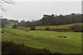
This large Iron Age hillfort was believed to be univallate, but the excavations carried out in 1961 revealed second line of ramparts. The hillfort has two original entrances.
Read More at Pastscape.
You may be viewing yesterday's version of this page. To see the most up to date information please register for a free account.
Do not use the above information on other web sites or publications without permission of the contributor.
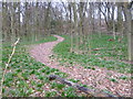
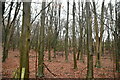
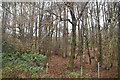
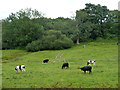
Nearby Images from Geograph Britain and Ireland:
©2015(licence)
©2021(licence)
©2021(licence)
©2020(licence)
©2021(licence)
The above images may not be of the site on this page, they are loaded from Geograph.
Please Submit an Image of this site or go out and take one for us!
Click here to see more info for this site
Nearby sites
Key: Red: member's photo, Blue: 3rd party photo, Yellow: other image, Green: no photo - please go there and take one, Grey: site destroyed
Download sites to:
KML (Google Earth)
GPX (GPS waypoints)
CSV (Garmin/Navman)
CSV (Excel)
To unlock full downloads you need to sign up as a Contributory Member. Otherwise downloads are limited to 50 sites.
Turn off the page maps and other distractions
Nearby sites listing. In the following links * = Image available
3.9km NNE 20° Holy Well (Westerham) Holy Well or Sacred Spring (TQ455559)
6.9km WNW 284° St. Thomas's Well (Godstone) Holy Well or Sacred Spring (TQ375537)
8.1km NW 311° Nore Hill Bronze Age Enclosure* Misc. Earthwork (TQ3800057300)
8.2km W 262° Leigh Place Stone* Natural Stone / Erratic / Other Natural Feature (TQ362509)
8.3km W 262° Diana's Well Holy Well or Sacred Spring (TQ361508)
8.5km W 267° Walker Miles Memorial* Modern Stone Circle etc (TQ358515)
8.6km W 267° St Mary's Well (Godstone)* Holy Well or Sacred Spring (TQ357515)
9.2km SE 143° The Chiding stone* Natural Stone / Erratic / Other Natural Feature (TQ50064509)
9.4km W 268° Godstone Tumulus* Artificial Mound (TQ349517)
9.7km SW 218° St. Margaret's Well (Lingfield)* Holy Well or Sacred Spring (TQ386444)
9.9km ENE 64° Saint John's Spring (Greatness) Holy Well or Sacred Spring (TQ531568)
10.5km ENE 67° Millpond Wood Barrow* Round Barrow(s) (TQ53815661)
10.6km S 187° Dry Hill Fort* Hillfort (TQ432417)
11.1km NE 52° Colet's Well* Holy Well or Sacred Spring (TQ5283459333)
11.3km NE 53° St Thomas a Becket's Well* Holy Well or Sacred Spring (TQ532592)
11.3km W 277° War Coppice Camp* Hillfort (TQ3298053260)
11.3km SSE 152° Stonewall Park Rock Shelters Cave or Rock Shelter (TQ49974241)
11.3km NNW 347° Warbank Ancient Village or Settlement (TQ414632)
11.3km W 271° North Park Farm* Ancient Village or Settlement (TQ329520)
11.9km N 352° Caesar's Camp (Keston)* Hillfort (TQ4220063900)
12.0km N 350° Caesar's Well* Holy Well or Sacred Spring (TQ419640)
12.1km NE 54° Stumblebury Round Barrow(s) (TQ53845966)
12.2km W 276° Spring Bottom* Holy Well or Sacred Spring (TQ321531)
12.9km ENE 62° St Edith's Well (Kemsing)* Holy Well or Sacred Spring (TQ5548458678)
13.4km NNW 347° Hayes Common 2 Ancient Village or Settlement (TQ408652)
View more nearby sites and additional images


 We would like to know more about this location. Please feel free to add a brief description and any relevant information in your own language.
 Wir möchten mehr über diese Stätte erfahren. Bitte zögern Sie nicht, eine kurze Beschreibung und relevante Informationen in Deutsch hinzuzufügen.
 Nous aimerions en savoir encore un peu sur les lieux. S'il vous plaît n'hesitez pas à ajouter une courte description et tous les renseignements pertinents dans votre propre langue.
 Quisieramos informarnos un poco más de las lugares. No dude en añadir una breve descripción y otros datos relevantes en su propio idioma.