<< Our Photo Pages >> St Thomas a Becket's Well - Holy Well or Sacred Spring in England in Kent
Submitted by Thorgrim on Wednesday, 11 August 2004 Page Views: 19791
Springs and Holy WellsSite Name: St Thomas a Becket's WellCountry: England County: Kent Type: Holy Well or Sacred Spring
Nearest Town: Sevenoaks Nearest Village: Otford
Map Ref: TQ532592
Latitude: 51.311296N Longitude: 0.196690E
Condition:
| 5 | Perfect |
| 4 | Almost Perfect |
| 3 | Reasonable but with some damage |
| 2 | Ruined but still recognisable as an ancient site |
| 1 | Pretty much destroyed, possibly visible as crop marks |
| 0 | No data. |
| -1 | Completely destroyed |
| 5 | Superb |
| 4 | Good |
| 3 | Ordinary |
| 2 | Not Good |
| 1 | Awful |
| 0 | No data. |
| 5 | Can be driven to, probably with disabled access |
| 4 | Short walk on a footpath |
| 3 | Requiring a bit more of a walk |
| 2 | A long walk |
| 1 | In the middle of nowhere, a nightmare to find |
| 0 | No data. |
| 5 | co-ordinates taken by GPS or official recorded co-ordinates |
| 4 | co-ordinates scaled from a detailed map |
| 3 | co-ordinates scaled from a bad map |
| 2 | co-ordinates of the nearest village |
| 1 | co-ordinates of the nearest town |
| 0 | no data |
Internal Links:
External Links:

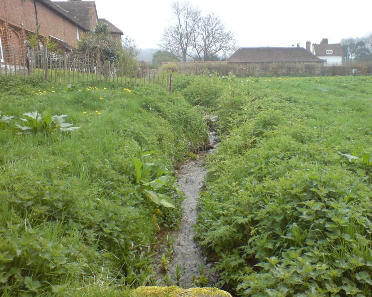
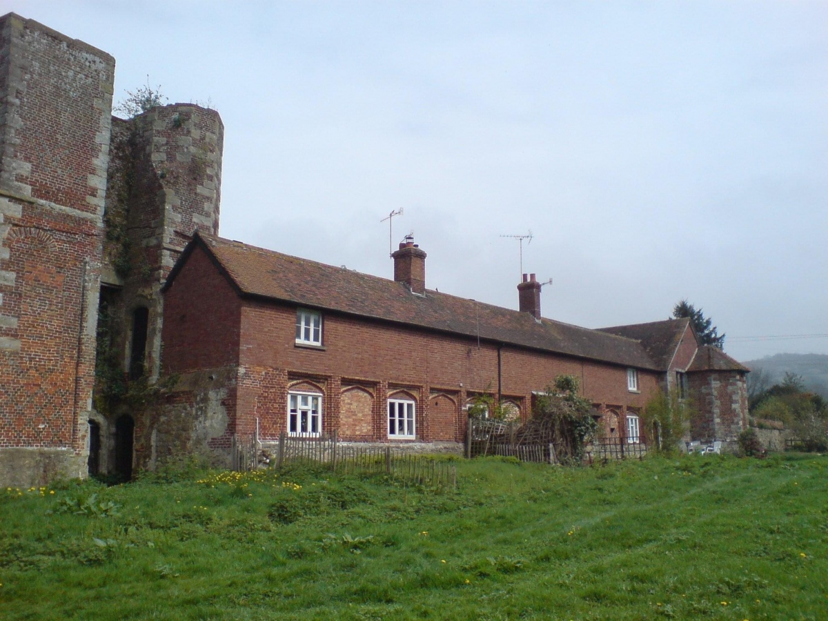
Inaccessable - on private land. I was able to photograph the stream that I was assured flows from the well. It is close to the Archbishop's Palace at Otford. The Source website (above) gives it as 300 yds from the church, founded by Becket who saw that his palace in the village needed a water supply, struck his staff into the ground and water appeared. In 1985, the springhead with late medieval masonry remained.
HOLYWELL writes:
Perhaps the best known holy wells amongst Kent antiquarians is that of Becket’s Well or St. Thomas’s Well. This is no doubt due to the colourful legend associated with it. This tells that whilst living here in the old manor, St. Thomas bemoaned the lack of good water. As a remedy he struck his staff into the ground and clear water gushed forth. This is a familiar folklore motif, and we shall see it again referred to at other Kent sites. Perhaps it recalls the saint ordering well digging to provide fresh water and marked the position with his staff! The legends earliest reference is made by an antiquarian Lambard in 1571: ‘..stake his staffe into the drie ground ( in a place thereof now called Sainte Thomas Well ) and immediately the same water appeared, which running plentifully, serveth the offices of the new house to the present day.’ The site has been well recorded in recent centuries, for example an account of 1876, describes the site as: ‘endorsed within a wall, forming a chamber 15 ft across and 10 ft deep’ Both the chamber's appearance and shape suggests that is would be ideal for immersions, and a number of authors have suggested it was a bath No subsequent or previous work draws notice to this, so it is likely to be antiquarian fancy. Another more plausible possibility, is that it was used by the leper hospital found on this site around 1228. They would have clearly made use of the pure water for medicinal purposes and perhaps indeed used it as a bath. The exact nature of its curative powers are unknown, but although belief in them was waning by 1800s, rumours of its use continued to the last world war. The Gentlemen's Magazine June 1820, gives the only recorded account of a cure and states that: ‘an old man, who, crippled by rheumatism, was completely renovated by this bath to health and action of circumstance witnessed by the late Lord Stanhope and several of the neighbouring gentry.’ Its decline would appear to have started along time ago, as a folly tower, now demolished, was built on Otford Mount a nearby earthwork, from the well's stone work. Consequently, this degraded condition prompted excavation in the 1950s by the Otford and District Historical Society, the following details of their findings are now briefly described. Locally common thought was that the well is the remains of a Roman bath house, a belief echoed by its present owner. This view is further supported by the two surrounding Roman villas, and hence one aim of the excavation was to evaluate this long held claim. Yet, although they showed that the well had gone through considerable renovation and rebuilding over the centuries, no remains could be positively be dated to this period. This renovation, of course, resulted in a rarity of deposits, and hence with a lack of artefacts, the subsequent interpretation was thus difficult. The excavation was further handicapped by the waterlogged conditions. Both may have influenced the results. Consequently, there are still doubts, and the concept of a Roman origin has not been satisfactorily disproved. The earliest written record is from Otford Ministers accounts of 1440-1, indicating that by then a stone structure existed here, but how old that was again is not clear. It states: ‘To a carpenter for two days to make 2 gutters to bring water from the pool of the garden to the moat and for working on and laying another gutter beyond the water course and coming from the fountain of St. Thomas to old garden, 12d; and to a carpenter for one day covering a gutter with timber and cresting it, 6d. And for two masons for 2 days for placing and laying and making a new stone wall of the fountain of St. Thomas, broken for the pipe of the water conduit, 3s, taking between them daily 12d. To five labourers 10 days digging the soil between the said fountain and moat to lay in the leaden pipe of said conduit16s 8d taking each daily 4d.’ The present floor may be ascribed to that period; although it would seem to cover an earlier lower flint floor ( again possibly Roman ). Between 1520-1520, Archbishop Warkham, pulled down the then existing Manor house, and built the Palace, covering four acres. This consequently required a better water supply, and hence the well was improved: the original lower chamber is said to originate from this period. The full purpose of the lower chamber is not clear, but it is believed that it may have housed cisterns giving a greater flow of water. When Henry VIII acquired the Palace from Archbishop Crammer in 1537, he spent money on improvements to the estate, and probably the well. The sluice gate, strengthened by Warham, was now supported by buttresses. These may have supported a conduit house. This was recorded in 1573: ‘The condiyte house or well conteyning in length XXXVI foote and in breadth XIX fote to be taken downe and newe sett upp will coste XXX pounds. The pypes conveyinge the water from hence to the offyces and small sesterns to be amended will coste Xiii.’ By the 1600s, the Palace was in disrepair, and the well was only used for private consumption by Castle farm. Despite this, restoration still continued, and the north, east and south wall saw upper improvements by the 1700s. In the lower chamber a stone west wall was erected on Warham's brick foundations. By this time, the south wall was beginning to collapse, and was rebuilt in the 1800s. By 1954 repairs were again needed, as the north wall was collapsing. Goodsall ( 1968 ) reported that even after its excavation in the late 1950s, the site then enclosed in railings, was forlorn and overgrown with weeds. Forty years on, the present condition is similar to that illustrated in the contemporary photo, taken during the excavation: the intervening decades have seen the inevitable degradation, through time, of its infrastructure. Fortunately, the hideous railings have been removed, obviously to erect the trout farm infrastructure, whose water is supplied by the well. The walls appear now comparably greatly overgrown, which has probably preserved them, and the sluice wall / north, south and west walls appear the most ruinous, with the walling falling away towards the sluice wall. The walling was best preserved at the east end. The clear spring appears to flow rapidly from its source, and has the appearance of being deeper. As stated, it now has now a commercial function, providing good quality water for the raising of trout flowing through a series of fish ponds replacing the cress beds. To find Becket’s Well go along the A225 to the centre of Otford, park in the car park ( in front of the row of terraced shops ) near the Bishop's Palace. Take a small private road to Castle farm, now as said, a fish farm. Enquire here, if you are able to visit the well, which lies on private land within a complex of fish pools to the east of the farm house.
You may be viewing yesterday's version of this page. To see the most up to date information please register for a free account.


Do not use the above information on other web sites or publications without permission of the contributor.
Click here to see more info for this site
Nearby sites
Key: Red: member's photo, Blue: 3rd party photo, Yellow: other image, Green: no photo - please go there and take one, Grey: site destroyed
Download sites to:
KML (Google Earth)
GPX (GPS waypoints)
CSV (Garmin/Navman)
CSV (Excel)
To unlock full downloads you need to sign up as a Contributory Member. Otherwise downloads are limited to 50 sites.
Turn off the page maps and other distractions
Nearby sites listing. In the following links * = Image available
388m WNW 292° Colet's Well* Holy Well or Sacred Spring (TQ5283459333)
786m NE 56° Stumblebury Round Barrow(s) (TQ53845966)
2.3km ESE 105° St Edith's Well (Kemsing)* Holy Well or Sacred Spring (TQ5548458678)
2.4km S 184° Saint John's Spring (Greatness) Holy Well or Sacred Spring (TQ531568)
2.7km SSE 168° Millpond Wood Barrow* Round Barrow(s) (TQ53815661)
5.8km ESE 123° Oldbury Hillfort* Hillfort (TQ582562)
5.9km ESE 119° Oldbury Rock Shelters* Cave or Rock Shelter (TQ5848056439)
6.3km N 9° Eynsford Stone* Natural Stone / Erratic / Other Natural Feature (TQ540655)
6.8km ESE 122° Redwell springs Holy Well or Sacred Spring (TQ591558)
7.9km E 91° Gateway granites* Ancient Trackway (TQ61175924)
8.4km WSW 248° Holy Well (Westerham) Holy Well or Sacred Spring (TQ455559)
9.4km SE 131° Plaxtol Not Known (by us) (TQ605533)
9.9km NW 319° Bromley Museum Museum (TQ465665)
10.4km NNE 14° Sutton At Hone Enclosures Ancient Village or Settlement (TQ555694)
10.6km E 91° Mount Mead* Round Barrow(s) (TQ63835933)
11.3km SW 234° Squerries Park Camp Hillfort (TQ44285222)
11.9km WNW 295° Caesar's Camp (Keston) Hillfort (TQ422639)
12.0km N 349° Stonebill Green Deneholes Ancient Mine, Quarry or other Industry (TQ505709)
12.0km ENE 78° White Horse Wood Barrow Round Barrow(s) (TQ649621)
12.0km E 92° Chestnuts* Long Barrow (TQ65265917)
12.1km E 92° Addington Long Barrow* Long Barrow (TQ65335910)
12.1km NNW 342° Chalk Wood Denehole Ancient Mine, Quarry or other Industry (TQ491706)
12.2km WNW 295° Caesar's Well* Holy Well or Sacred Spring (TQ419640)
12.3km E 85° Coldrum* Chambered Tomb (TQ65446072)
12.3km E 86° Addington Sarsens Natural Stone / Erratic / Other Natural Feature (TQ65516047)
View more nearby sites and additional images


 We would like to know more about this location. Please feel free to add a brief description and any relevant information in your own language.
 Wir möchten mehr über diese Stätte erfahren. Bitte zögern Sie nicht, eine kurze Beschreibung und relevante Informationen in Deutsch hinzuzufügen.
 Nous aimerions en savoir encore un peu sur les lieux. S'il vous plaît n'hesitez pas à ajouter une courte description et tous les renseignements pertinents dans votre propre langue.
 Quisieramos informarnos un poco más de las lugares. No dude en añadir una breve descripción y otros datos relevantes en su propio idioma.