<< Our Photo Pages >> Stanwell Cursus - Cursus in England in Surrey
Submitted by EssexMan on Wednesday, 07 April 2010 Page Views: 6587
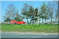
Neolithic and Bronze AgeSite Name: Stanwell Cursus Alternative Name: Heathrow CursusCountry: England
NOTE: This site is 0.3 km away from the location you searched for.
County: Surrey Type: Cursus
Nearest Town: Staines Nearest Village: Stanwell
Map Ref: TQ053746 Landranger Map Number: 176
Latitude: 51.460591N Longitude: 0.48569W
Condition:
| 5 | Perfect |
| 4 | Almost Perfect |
| 3 | Reasonable but with some damage |
| 2 | Ruined but still recognisable as an ancient site |
| 1 | Pretty much destroyed, possibly visible as crop marks |
| 0 | No data. |
| -1 | Completely destroyed |
| 5 | Superb |
| 4 | Good |
| 3 | Ordinary |
| 2 | Not Good |
| 1 | Awful |
| 0 | No data. |
| 5 | Can be driven to, probably with disabled access |
| 4 | Short walk on a footpath |
| 3 | Requiring a bit more of a walk |
| 2 | A long walk |
| 1 | In the middle of nowhere, a nightmare to find |
| 0 | No data. |
| 5 | co-ordinates taken by GPS or official recorded co-ordinates |
| 4 | co-ordinates scaled from a detailed map |
| 3 | co-ordinates scaled from a bad map |
| 2 | co-ordinates of the nearest village |
| 1 | co-ordinates of the nearest town |
| 0 | no data |
Internal Links:
External Links:
I have visited· I would like to visit
JohnLindsay visited on 12th Feb 2016 Tried to visit but not at all clear where the terminus of the cursus actually might be.
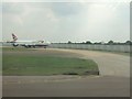
You get a good view though from the top story of Terminal 5 at Heathrow.
The other end, according to Pevnser is Bigley Wash, but I haven't found that spot either.
It is much written up in Landscape Evolution in the Middle Thames Valley, which isn't the sort of title you would expect to be about Stanwell
")
Status: Certain
NMR No. LINEAR 191
Extent: 3600mx20m
Note: This location marks one terminal (end) of a cursus monument. The location of the other terminal can be found in the Nearby Site list below.
The Northern Antiquarian (TNA) features a page for this cursus - see their entry for Stanwell Cursus, Heathrow, Surrey which gives a brief archaeology & history, saying: "Running roughly north-to-south, this cursus was 2¼ miles long (3600 metres) and comprised of two linear sections from a field in Stanwell up through the western side of Heathrow Airport averaging, curiously, just 24 yards (22m) across."
The cursus is also recorded as Pastscape Monument No. 932648, which gives co-ordinates of the cursus as TQ 0545 7431 to TQ 0448 7782 and gives details of the excavation.
You may be viewing yesterday's version of this page. To see the most up to date information please register for a free account.
Do not use the above information on other web sites or publications without permission of the contributor.
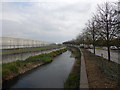
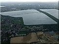
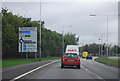
Nearby Images from Geograph Britain and Ireland:
©2017(licence)
©2014(licence)
©2010(licence)
©2007(licence)
©2019(licence)
The above images may not be of the site on this page, they are loaded from Geograph.
Please Submit an Image of this site or go out and take one for us!
Click here to see more info for this site
Nearby sites
Key: Red: member's photo, Blue: 3rd party photo, Yellow: other image, Green: no photo - please go there and take one, Grey: site destroyed
Download sites to:
KML (Google Earth)
GPX (GPS waypoints)
CSV (Garmin/Navman)
CSV (Excel)
To unlock full downloads you need to sign up as a Contributory Member. Otherwise downloads are limited to 50 sites.
Turn off the page maps and other distractions
Nearby sites listing. In the following links * = Image available
499m SE 144° St. Anne's Well (Stanwell)* Holy Well or Sacred Spring (TQ056742)
1.1km NNW 346° Heathrow* Cursus (TQ050757)
2.3km ESE 111° Bedfont Cursus (TQ075738)
3.1km S 179° Ashford Henge* Henge (TQ054715)
3.2km NNW 345° Stanwell Cursus* Cursus (TQ044777)
3.5km WSW 237° Staines Enclosure* Causewayed Enclosure (TQ024726)
3.6km W 281° Kingsmead Quarry* Ancient Village or Settlement (TQ01707520)
3.9km SW 217° Negen Stones Standing Stones (TQ030714)
4.2km WNW 289° Kingsmead Quarry Ancient Village or Settlement (TQ01307588)
6.7km SSE 160° Shepperton Henge* Henge (TQ07686832)
7.4km SSW 204° The Nun's Well (Surrey)* Holy Well or Sacred Spring (TQ0247767756)
7.5km SSW 202° St Ann's Hill* Hillfort (TQ026676)
7.7km S 191° Chertsey Museum Museum (TQ040670)
9.8km SW 229° Leptis Magna (Virginia Waters)* Ancient Temple (SU980680)
10.2km WNW 303° Montem mound Artificial Mound (SU9665880045)
11.0km SW 217° Barrowhills Round Barrow(s) (SU98866567)
11.2km NW 314° Stoke Park Bowl Barrow* Round Barrow(s) (SU97038222)
11.2km SW 214° Flutters Hill Barrow* Round Barrow(s) (SU99206516)
11.7km ENE 66° Elthorne Park Sarsen* Natural Stone / Erratic / Other Natural Feature (TQ15927947)
11.7km SSW 213° Longcross Barrow* Round Barrow(s) (SU99126466)
11.7km ESE 112° Barrow Hill (Teddington)* Round Barrow(s) (TQ16287037)
12.2km SSW 210° Chobham Common (1)* Misc. Earthwork (SU994639)
12.4km E 91° Museum of Richmond* Museum (TQ1774374697)
13.0km SW 219° Albury Bottom Enclosure* Misc. Earthwork (SU97426430)
13.0km SW 232° Sunningdale Barrows Round Barrow(s) (SU952664)
View more nearby sites and additional images


 We would like to know more about this location. Please feel free to add a brief description and any relevant information in your own language.
 Wir möchten mehr über diese Stätte erfahren. Bitte zögern Sie nicht, eine kurze Beschreibung und relevante Informationen in Deutsch hinzuzufügen.
 Nous aimerions en savoir encore un peu sur les lieux. S'il vous plaît n'hesitez pas à ajouter une courte description et tous les renseignements pertinents dans votre propre langue.
 Quisieramos informarnos un poco más de las lugares. No dude en añadir una breve descripción y otros datos relevantes en su propio idioma.