<< Our Photo Pages >> Street House Farm - Barrow Cemetery in England in Cleveland
Submitted by Andy B on Monday, 17 October 2011 Page Views: 11711
Neolithic and Bronze AgeSite Name: Street House FarmCountry: England County: Cleveland Type: Barrow Cemetery
Nearest Town: Loftus
Map Ref: NZ73651960
Latitude: 54.566274N Longitude: 0.86243W
Condition:
| 5 | Perfect |
| 4 | Almost Perfect |
| 3 | Reasonable but with some damage |
| 2 | Ruined but still recognisable as an ancient site |
| 1 | Pretty much destroyed, possibly visible as crop marks |
| 0 | No data. |
| -1 | Completely destroyed |
| 5 | Superb |
| 4 | Good |
| 3 | Ordinary |
| 2 | Not Good |
| 1 | Awful |
| 0 | No data. |
| 5 | Can be driven to, probably with disabled access |
| 4 | Short walk on a footpath |
| 3 | Requiring a bit more of a walk |
| 2 | A long walk |
| 1 | In the middle of nowhere, a nightmare to find |
| 0 | No data. |
| 5 | co-ordinates taken by GPS or official recorded co-ordinates |
| 4 | co-ordinates scaled from a detailed map |
| 3 | co-ordinates scaled from a bad map |
| 2 | co-ordinates of the nearest village |
| 1 | co-ordinates of the nearest town |
| 0 | no data |
Internal Links:
External Links:
I have visited· I would like to visit
drolaf visited on 11th Sep 2021 - their rating: Cond: -1 Amb: 1 Access: 4 as with many such sites it is the excavation drawings that tell the story. It sits in a timescale overlapping with the neolithic saltworks, and 1500 years before the nearby timber 'wossit'
")
During the Bronze Age, a circular cairn was constructed over the top of the site of the Neolithic mound. Cremated bone was found in both the Neolithic and Bronze Age monuments.
Source: TWMuseums
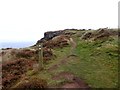
Location is approximate, there is lots more prehistory in the immediate area.
Note: An extraordinary range of site types and time periods at this recently excavated site
You may be viewing yesterday's version of this page. To see the most up to date information please register for a free account.
")
Do not use the above information on other web sites or publications without permission of the contributor.
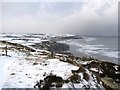
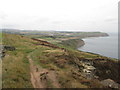
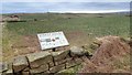
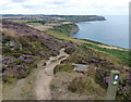
Nearby Images from Geograph Britain and Ireland:
©2009(licence)
©2018(licence)
©2015(licence)
©2019(licence)
©2017(licence)
The above images may not be of the site on this page, they are loaded from Geograph.
Please Submit an Image of this site or go out and take one for us!
Click here to see more info for this site
Nearby sites
Key: Red: member's photo, Blue: 3rd party photo, Yellow: other image, Green: no photo - please go there and take one, Grey: site destroyed
Download sites to:
KML (Google Earth)
GPX (GPS waypoints)
CSV (Garmin/Navman)
CSV (Excel)
To unlock full downloads you need to sign up as a Contributory Member. Otherwise downloads are limited to 50 sites.
Turn off the page maps and other distractions
Nearby sites listing. In the following links * = Image available
743m SSE 161° Street House* Timber Circle (NZ739189)
1.8km SSE 155° Easington Cross* Ancient Cross (NZ7442718004)
2.2km ESE 120° Three Crosses Well (Boulby)* Holy Well or Sacred Spring (NZ7562218523)
4.2km W 261° Brotton Howe Cairn (NZ69501886)
5.9km ESE 108° Hinderwell Beacon* Round Barrow(s) (NZ7933017811)
6.0km ESE 116° St Hilda's Well* Holy Well or Sacred Spring (NZ7911717050)
6.0km ESE 116° Hinderwell Cross Head* Ancient Cross (NZ7912217030)
6.6km SE 144° Newton Mulgrave Moor LB* Long Barrow (NZ7761214328)
7.1km SE 144° Newton Mulgrave Moor RB8* Round Barrow(s) (NZ7793213861)
7.3km SE 142° Newton Mulgrave Moor RB4 - 7* Barrow Cemetery (NZ7829113935)
7.5km SE 142° Newton Mulgrave Moor RB3* Round Barrow(s) (NZ7836513815)
7.6km SE 141° Newton Mulgrave Moor RB2* Round Barrow(s) (NZ7849213733)
7.7km SE 142° Brown Higg Stone* Marker Stone (NZ7852013661)
7.7km SE 143° Newton Mulgrave Moor RB1* Round Barrow(s) (NZ7847913526)
7.8km S 187° Black Howe (Waupley Moor)* Round Barrow(s) (NZ7289011853)
7.8km S 189° Water Dittins Marker Stone* Marker Stone (NZ7258311880)
7.8km S 189° Viscount Downe BS1* Marker Stone (NZ7252911879)
7.9km S 188° Waupley Moor South MS1* Marker Stone (NZ7273011793)
7.9km S 186° Waupley Moor South HC1* Ancient Village or Settlement (NZ7290111755)
7.9km SE 144° Long Stone (Newton Mulgrave Woods)* Standing Stone (Menhir) (NZ7846113319)
7.9km S 173° Sail Howe BSs* Marker Stone (NZ7467811742)
7.9km S 187° Beckwith Stone* Marker Stone (NZ7287611705)
8.0km SSW 195° Harlow Bush* Marker Stone (NZ7171811857)
8.0km S 186° Viscount Downe BS2* Marker Stone (NZ7288411618)
8.1km W 266° Skelton Cross* Ancient Cross (NZ6552818871)
View more nearby sites and additional images


 We would like to know more about this location. Please feel free to add a brief description and any relevant information in your own language.
 Wir möchten mehr über diese Stätte erfahren. Bitte zögern Sie nicht, eine kurze Beschreibung und relevante Informationen in Deutsch hinzuzufügen.
 Nous aimerions en savoir encore un peu sur les lieux. S'il vous plaît n'hesitez pas à ajouter une courte description et tous les renseignements pertinents dans votre propre langue.
 Quisieramos informarnos un poco más de las lugares. No dude en añadir una breve descripción y otros datos relevantes en su propio idioma.