<< Our Photo Pages >> Beckwith Stone - Marker Stone in England in Yorkshire (North)
Submitted by johndhunter on Tuesday, 29 March 2022 Page Views: 495
Modern SitesSite Name: Beckwith StoneCountry: England County: Yorkshire (North) Type: Marker Stone
Nearest Town: Loftus Nearest Village: Danby
Map Ref: NZ7287611705
Latitude: 54.495449N Longitude: 0.876348W
Condition:
| 5 | Perfect |
| 4 | Almost Perfect |
| 3 | Reasonable but with some damage |
| 2 | Ruined but still recognisable as an ancient site |
| 1 | Pretty much destroyed, possibly visible as crop marks |
| 0 | No data. |
| -1 | Completely destroyed |
| 5 | Superb |
| 4 | Good |
| 3 | Ordinary |
| 2 | Not Good |
| 1 | Awful |
| 0 | No data. |
| 5 | Can be driven to, probably with disabled access |
| 4 | Short walk on a footpath |
| 3 | Requiring a bit more of a walk |
| 2 | A long walk |
| 1 | In the middle of nowhere, a nightmare to find |
| 0 | No data. |
| 5 | co-ordinates taken by GPS or official recorded co-ordinates |
| 4 | co-ordinates scaled from a detailed map |
| 3 | co-ordinates scaled from a bad map |
| 2 | co-ordinates of the nearest village |
| 1 | co-ordinates of the nearest town |
| 0 | no data |
Internal Links:
External Links:

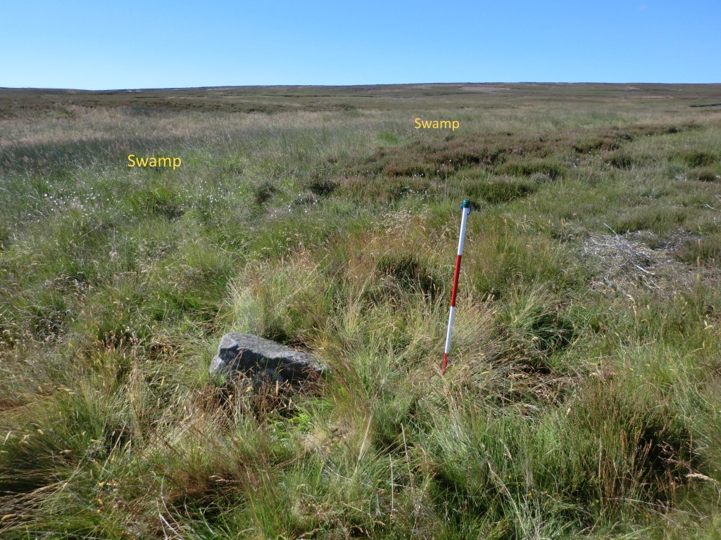
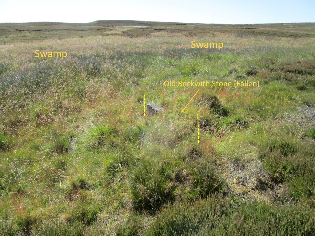
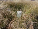
It sits in a swampy area, close to and on the south side of Waupley Beck and with a height of only 2ft it can be well hidden by the tall reed grass that surrounds it, as well as bracken in the summer months. Over the years I have looked for this stone on several occasions and been unable to locate it, consequently I had come to the conclusion that perhaps it had fallen and sunk into the swamp. However a recent (2021) photo by the MILESTONE SOCIETY showed that it was still standing, so I paid another visit and this time found it. Looking at old gpx tracks where I had searched for it previously indicates that I had been virtually next to the stone and still I hadn’t spotted it.
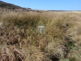
As stated the stone is about 2ft high, rectangular in cross section, about 9 inches (E/W) x 12 inches (N/S). On its west face at the top it has the letter D (Danby) and beneath that its name Beckwith Stone over two lines.
You may be viewing yesterday's version of this page. To see the most up to date information please register for a free account.





Do not use the above information on other web sites or publications without permission of the contributor.
Click here to see more info for this site
Nearby sites
Key: Red: member's photo, Blue: 3rd party photo, Yellow: other image, Green: no photo - please go there and take one, Grey: site destroyed
Download sites to:
KML (Google Earth)
GPX (GPS waypoints)
CSV (Garmin/Navman)
CSV (Excel)
To unlock full downloads you need to sign up as a Contributory Member. Otherwise downloads are limited to 50 sites.
Turn off the page maps and other distractions
Nearby sites listing. In the following links * = Image available
56m NNE 27° Waupley Moor South HC1* Ancient Village or Settlement (NZ7290111755)
87m S 176° Viscount Downe BS2* Marker Stone (NZ7288411618)
149m N 6° Black Howe (Waupley Moor)* Round Barrow(s) (NZ7289011853)
170m WNW 302° Waupley Moor South MS1* Marker Stone (NZ7273011793)
330m SW 226° Old Beckwith Stone* Marker Stone (NZ7264311470)
340m WNW 302° Water Dittins Marker Stone* Marker Stone (NZ7258311880)
387m WNW 298° Viscount Downe BS1* Marker Stone (NZ7252911879)
474m S 176° Great Dinnod* Marker Stone (NZ7291511232)
925m SE 138° Little Dinnod* Marker Stone (NZ7350411024)
1.1km SE 131° Franklan Dyke Stone* Marker Stone (NZ7371511006)
1.2km W 278° Harlow Bush* Marker Stone (NZ7171811857)
1.3km SW 230° Elm Ledge Guide Stone* Marker Stone (NZ7191810876)
1.5km W 259° Robin Hood Butts Howe* Round Barrow(s) (NZ71401140)
1.5km SE 138° Middle Rigg round barrows and pit alignment* Barrow Cemetery (NZ739106)
1.5km S 177° Nean Howe* Round Barrow(s) (NZ7299010184)
1.5km ESE 124° Long Stone (Easington High Moor)* Standing Stone (Menhir) (NZ7417710874)
1.6km WSW 240° Elm Ledge LB1* Long Barrow (NZ7151110900)
1.7km W 261° Robin Hoods Butts 1* Round Barrow(s) (NZ71211140)
1.7km WSW 237° Elm Ledge RB1* Round Barrow(s) (NZ7144710745)
1.8km SE 145° Bella Dale Slack MS1* Marker Stone (NZ7392810262)
1.8km E 90° Sail Howe BSs* Marker Stone (NZ7467811742)
1.8km ESE 124° Black Dike Moor Segmented Pit Alignment* Misc. Earthwork (NZ7443210707)
1.9km W 263° Robin Hoods Butts 3* Round Barrow(s) (NZ7102411434)
1.9km W 268° Gerrick Moor Standing Stone SS1* Standing Stone (Menhir) (NZ7100111625)
2.0km ESE 115° Long Stone (Black Dike Moor)* Marker Stone (NZ7469210909)
View more nearby sites and additional images


 We would like to know more about this location. Please feel free to add a brief description and any relevant information in your own language.
 Wir möchten mehr über diese Stätte erfahren. Bitte zögern Sie nicht, eine kurze Beschreibung und relevante Informationen in Deutsch hinzuzufügen.
 Nous aimerions en savoir encore un peu sur les lieux. S'il vous plaît n'hesitez pas à ajouter une courte description et tous les renseignements pertinents dans votre propre langue.
 Quisieramos informarnos un poco más de las lugares. No dude en añadir una breve descripción y otros datos relevantes en su propio idioma.