


<< Text Pages >> Middlebarn Farm Long Barrow - Long Barrow in England in Hampshire
Submitted by SolarMegalith on Monday, 02 May 2011 Page Views: 4517
Neolithic and Bronze AgeSite Name: Middlebarn Farm Long BarrowCountry: England County: Hampshire Type: Long Barrow
Nearest Village: Chilboton Down
Map Ref: SU4177438299
Latitude: 51.142440N Longitude: 1.404235W
Condition:
| 5 | Perfect |
| 4 | Almost Perfect |
| 3 | Reasonable but with some damage |
| 2 | Ruined but still recognisable as an ancient site |
| 1 | Pretty much destroyed, possibly visible as crop marks |
| 0 | No data. |
| -1 | Completely destroyed |
| 5 | Superb |
| 4 | Good |
| 3 | Ordinary |
| 2 | Not Good |
| 1 | Awful |
| 0 | No data. |
| 5 | Can be driven to, probably with disabled access |
| 4 | Short walk on a footpath |
| 3 | Requiring a bit more of a walk |
| 2 | A long walk |
| 1 | In the middle of nowhere, a nightmare to find |
| 0 | No data. |
| 5 | co-ordinates taken by GPS or official recorded co-ordinates |
| 4 | co-ordinates scaled from a detailed map |
| 3 | co-ordinates scaled from a bad map |
| 2 | co-ordinates of the nearest village |
| 1 | co-ordinates of the nearest town |
| 0 | no data |
Internal Links:
External Links:
Long Barrow in Hampshire
Remains of a Neolithic long barrow of 58 m length.
You may be viewing yesterday's version of this page. To see the most up to date information please register for a free account.
Do not use the above information on other web sites or publications without permission of the contributor.
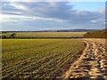
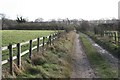
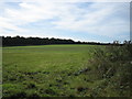
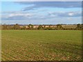
Nearby Images from Geograph Britain and Ireland:
©2012(licence)
©2011(licence)
©2005(licence)
©2012(licence)
©2006(licence)
The above images may not be of the site on this page, they are loaded from Geograph.
Please Submit an Image of this site or go out and take one for us!
Click here to see more info for this site
Nearby sites
Key: Red: member's photo, Blue: 3rd party photo, Yellow: other image, Green: no photo - please go there and take one, Grey: site destroyed
Download sites to:
KML (Google Earth)
GPX (GPS waypoints)
CSV (Garmin/Navman)
CSV (Excel)
To unlock full downloads you need to sign up as a Contributory Member. Otherwise downloads are limited to 50 sites.
Turn off the page maps and other distractions
Nearby sites listing. In the following links * = Image available
3.6km NW 314° St Peter and Holy Cross (Wherwell) Ancient Cross (SU39154082)
4.0km ENE 78° Sutton Scotney Enclosure* Misc. Earthwork (SU457392)
4.7km SW 231° Woolbury* Hillfort (SU381353)
5.0km SW 226° Stockbridge Down field boundary* Misc. Earthwork (SU382348)
5.4km SW 229° Stockbridge Down Bowl Barrows* Round Barrow(s) (SU377347)
5.9km ESE 113° South Wonston* Barrow Cemetery (SU4723736091)
5.9km ENE 73° Kitson's Clump* Round Barrow(s) (SU47454010)
6.4km NE 44° Tidbury Ring* Hillfort (SU462429)
6.7km NNW 342° Old Pound Camp Misc. Earthwork (SU39634465)
7.5km SSE 147° Flowerdown Barrows* Barrow Cemetery (SU459320)
7.5km ENE 77° Norsebury Ring* Hillfort (SU491401)
8.3km ENE 60° Cranbourne Farm Long Barrow* Long Barrow (SU4894442495)
8.8km S 176° West Wood Bowl Barrow* Round Barrow(s) (SU42522949)
8.9km NW 306° Bury Hill (Hampshire)* Hillfort (SU345435)
9.0km S 183° Robin Hood's Barrow (Winchester)* Round Barrow(s) (SU41322927)
9.1km NW 326° Andover Museum of the Iron Age* Museum (SU36614579)
9.4km S 189° Farley Mount* Round Barrow(s) (SU403290)
9.4km W 267° Danebury Ring* Hillfort (SU32353769)
9.4km NE 55° Norton Wood Bowl Barrow* Round Barrow(s) (SU49504375)
9.5km SSW 194° Withering Corner Barrow Cemetery (SU395291)
9.7km W 270° Danebury East Long Barrow (SU320383)
9.8km W 270° Danebury West Long Barrow (SU319383)
10.2km NE 51° Freefolk Wood Bowl Barrow* Round Barrow(s) (SU49694481)
10.2km NE 52° Freefolk Wood Bell Barrow* Round Barrow(s) (SU49764474)
10.3km SSE 147° Oram's Arbour Hillfort (SU475297)
View more nearby sites and additional images


 We would like to know more about this location. Please feel free to add a brief description and any relevant information in your own language.
 Wir möchten mehr über diese Stätte erfahren. Bitte zögern Sie nicht, eine kurze Beschreibung und relevante Informationen in Deutsch hinzuzufügen.
 Nous aimerions en savoir encore un peu sur les lieux. S'il vous plaît n'hesitez pas à ajouter une courte description et tous les renseignements pertinents dans votre propre langue.
 Quisieramos informarnos un poco más de las lugares. No dude en añadir una breve descripción y otros datos relevantes en su propio idioma.