


<< Our Photo Pages >> Stockbridge Down field boundary - Misc. Earthwork in England in Hampshire
Submitted by JimChampion on Wednesday, 26 January 2005 Page Views: 11250
Multi-periodSite Name: Stockbridge Down field boundaryCountry: England County: Hampshire Type: Misc. Earthwork
Nearest Town: Stockbridge
Map Ref: SU382348
Latitude: 51.111227N Longitude: 1.455691W
Condition:
| 5 | Perfect |
| 4 | Almost Perfect |
| 3 | Reasonable but with some damage |
| 2 | Ruined but still recognisable as an ancient site |
| 1 | Pretty much destroyed, possibly visible as crop marks |
| 0 | No data. |
| -1 | Completely destroyed |
| 5 | Superb |
| 4 | Good |
| 3 | Ordinary |
| 2 | Not Good |
| 1 | Awful |
| 0 | No data. |
| 5 | Can be driven to, probably with disabled access |
| 4 | Short walk on a footpath |
| 3 | Requiring a bit more of a walk |
| 2 | A long walk |
| 1 | In the middle of nowhere, a nightmare to find |
| 0 | No data. |
| 5 | co-ordinates taken by GPS or official recorded co-ordinates |
| 4 | co-ordinates scaled from a detailed map |
| 3 | co-ordinates scaled from a bad map |
| 2 | co-ordinates of the nearest village |
| 1 | co-ordinates of the nearest town |
| 0 | no data |
Internal Links:
External Links:
I have visited· I would like to visit
JimChampion has visited here
")
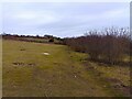
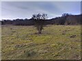
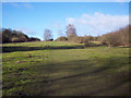
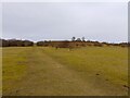
Access The car park is at grid ref SU387345, about two miles east of Stockbridge on the B3049 road to Winchester. Follow the main path north-west from the car park and you will soon find the field boundary. It is also clearly marked as an 'earthwork' on the OS maps of the area. Also on Stockbridge down are many Bronze Age bowl barrows and the Iron Age hillfort of Woolbury.
You may be viewing yesterday's version of this page. To see the most up to date information please register for a free account.
")
Do not use the above information on other web sites or publications without permission of the contributor.
Nearby Images from Geograph Britain and Ireland:
©2024(licence)
©2024(licence)

©2012(licence)
©2007(licence)
©2024(licence)
The above images may not be of the site on this page, they are loaded from Geograph.
Please Submit an Image of this site or go out and take one for us!
Click here to see more info for this site
Nearby sites
Key: Red: member's photo, Blue: 3rd party photo, Yellow: other image, Green: no photo - please go there and take one, Grey: site destroyed
Download sites to:
KML (Google Earth)
GPX (GPS waypoints)
CSV (Garmin/Navman)
CSV (Excel)
To unlock full downloads you need to sign up as a Contributory Member. Otherwise downloads are limited to 50 sites.
Turn off the page maps and other distractions
Nearby sites listing. In the following links * = Image available
509m W 259° Stockbridge Down Bowl Barrows* Round Barrow(s) (SU377347)
510m N 349° Woolbury* Hillfort (SU381353)
5.0km NE 46° Middlebarn Farm Long Barrow Long Barrow (SU4177438299)
5.8km SSE 168° Withering Corner Barrow Cemetery (SU395291)
6.1km N 9° St Peter and Holy Cross (Wherwell) Ancient Cross (SU39154082)
6.2km SSE 161° Farley Mount* Round Barrow(s) (SU403290)
6.3km SSE 151° Robin Hood's Barrow (Winchester)* Round Barrow(s) (SU41322927)
6.5km WNW 297° Danebury Ring* Hillfort (SU32353769)
6.8km SE 141° West Wood Bowl Barrow* Round Barrow(s) (SU42522949)
7.1km WNW 300° Danebury East Long Barrow (SU320383)
7.2km WNW 300° Danebury West Long Barrow (SU319383)
7.8km SSW 194° Stubb's Copse Round Barrow(s) (SU36362722)
8.2km ESE 110° Flowerdown Barrows* Barrow Cemetery (SU459320)
8.7km ENE 60° Sutton Scotney Enclosure* Misc. Earthwork (SU457392)
9.1km E 82° South Wonston* Barrow Cemetery (SU4723736091)
9.3km SSE 156° Merdon Castle* Hillfort (SU421264)
9.4km NNW 337° Bury Hill (Hampshire)* Hillfort (SU345435)
10.0km N 9° Old Pound Camp Misc. Earthwork (SU39634465)
10.6km ESE 119° Oram's Arbour Hillfort (SU475297)
10.6km ENE 61° Kitson's Clump* Round Barrow(s) (SU47454010)
10.6km W 275° Lopcombe Disc Barrow Round Barrow(s) (SU27563561)
10.7km SE 137° Texas Barrows* Round Barrow(s) (SU4558926993)
10.9km ESE 120° Hampshire Jubilee Sculpture* Modern Stone Circle etc (SU477295)
11.1km N 352° Andover Museum of the Iron Age* Museum (SU36614579)
11.2km ESE 119° Winchester City Museum* Museum (SU4809729407)
View more nearby sites and additional images


 We would like to know more about this location. Please feel free to add a brief description and any relevant information in your own language.
 Wir möchten mehr über diese Stätte erfahren. Bitte zögern Sie nicht, eine kurze Beschreibung und relevante Informationen in Deutsch hinzuzufügen.
 Nous aimerions en savoir encore un peu sur les lieux. S'il vous plaît n'hesitez pas à ajouter une courte description et tous les renseignements pertinents dans votre propre langue.
 Quisieramos informarnos un poco más de las lugares. No dude en añadir una breve descripción y otros datos relevantes en su propio idioma.