<< Our Photo Pages >> Kenward stone - Natural Stone / Erratic / Other Natural Feature in England in Wiltshire
Submitted by Bladup on Sunday, 28 July 2013 Page Views: 4330
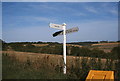
Natural PlacesSite Name: Kenward stoneCountry: England County: Wiltshire Type: Natural Stone / Erratic / Other Natural Feature
Map Ref: SU304552
Latitude: 51.295123N Longitude: 1.565389W
Condition:
| 5 | Perfect |
| 4 | Almost Perfect |
| 3 | Reasonable but with some damage |
| 2 | Ruined but still recognisable as an ancient site |
| 1 | Pretty much destroyed, possibly visible as crop marks |
| 0 | No data. |
| -1 | Completely destroyed |
| 5 | Superb |
| 4 | Good |
| 3 | Ordinary |
| 2 | Not Good |
| 1 | Awful |
| 0 | No data. |
| 5 | Can be driven to, probably with disabled access |
| 4 | Short walk on a footpath |
| 3 | Requiring a bit more of a walk |
| 2 | A long walk |
| 1 | In the middle of nowhere, a nightmare to find |
| 0 | No data. |
| 5 | co-ordinates taken by GPS or official recorded co-ordinates |
| 4 | co-ordinates scaled from a detailed map |
| 3 | co-ordinates scaled from a bad map |
| 2 | co-ordinates of the nearest village |
| 1 | co-ordinates of the nearest town |
| 0 | no data |
Internal Links:
External Links:
I have visited· I would like to visit
Twiff13 visited on 22nd Jan 2022 - their rating: Cond: 3 Amb: 3 Access: 4 Went up today, on a very cold and frosted ground, temp was around -2 deg C. The stone is visible, down into the workings pit on the farside as you come in through the field gate (from the road). Other than some moss and lichen covering, it is in a good state and the markings are still visible. In my humble opinion, these look man made and not natural markings.The stone is easy to get to, so long as the grass isn't frozen! The grass was in long tussocks, making underfoot a little tricky because of the frost and ice. ADDENDUM: August 2023 - with the long grasses and new fence going up on a new crop (you can still access the stone), you can't see the stone without a scramble through nettles and long tussocky grass.
51.294990,-1.565808 grid ref from Google maps.
")
A stone who's markings have been said to be man-made. Geologists in the 20's thought they were natural, I'm with the latter. It's on the side of a Roman quarry which was used to build the nearby Roman road.
You may be viewing yesterday's version of this page. To see the most up to date information please register for a free account.
")
")
Do not use the above information on other web sites or publications without permission of the contributor.
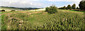
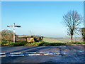
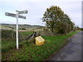
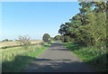
Nearby Images from Geograph Britain and Ireland:
©2015(licence)
©2014(licence)
©2013(licence)
©2011(licence)
©2005(licence)
The above images may not be of the site on this page, they are loaded from Geograph.
Please Submit an Image of this site or go out and take one for us!
Click here to see more info for this site
Nearby sites
Key: Red: member's photo, Blue: 3rd party photo, Yellow: other image, Green: no photo - please go there and take one, Grey: site destroyed
Download sites to:
KML (Google Earth)
GPX (GPS waypoints)
CSV (Garmin/Navman)
CSV (Excel)
To unlock full downloads you need to sign up as a Contributory Member. Otherwise downloads are limited to 50 sites.
Turn off the page maps and other distractions
Nearby sites listing. In the following links * = Image available
1.8km WNW 293° Grim's Ditch 1 (Wiltshire) Misc. Earthwork (SU287559)
2.0km NE 49° Fosbury Camp* Hillfort (SU319565)
2.1km WNW 295° Chute 1 Long Barrow Long Barrow (SU28455609)
2.3km ENE 61° Haydown Hill Field System* Misc. Earthwork (SU324563)
2.5km ESE 117° Bevisbury* Hillfort (SU326541)
2.7km NNW 335° Tidcombe Long Barrow* Long Barrow (SU2924957610)
3.3km WNW 291° Grafton 8 Bowl Barrow* Round Barrow(s) (SU27285636)
3.5km WNW 289° Grafton 9-11 Disc Barrows* Barrow Cemetery (SU271563)
3.6km NW 320° Tidcombe and Fosbury Mound Round Barrow(s) (SU2804957991)
3.9km NW 311° Tow Barrow* Long Barrow (SU27425775)
4.5km WSW 243° Collingbourne Ducis 22 Bowl Barrow* Round Barrow(s) (SU26405317)
5.0km WNW 288° Collingbourne Kingston 21 Long Barrow* Long Barrow (SU25645671)
5.7km SW 225° Ludgershall Castle Southern Enclosure* Misc. Earthwork (SU2639051130)
6.3km SSE 155° Nutbane* Long Barrow (SU33104952)
6.6km ESE 117° Blagden Copse Bowl Barrow Round Barrow(s) (SU36305228)
7.8km NNW 333° Dodsdown Bowl Barrow Round Barrow(s) (SU2677862069)
8.2km NE 34° Inkpen Hill Barrows* Barrow Cemetery (SU34966203)
8.3km WSW 245° Cow Down Barrow Cemetery Barrow Cemetery (SU229516)
8.5km SSE 161° Penton Park Bowl Barrow Round Barrow(s) (SU3326247217)
8.5km W 270° Collingbourne Kingston 3 Bowl Barrow Round Barrow(s) (SU21845520)
8.7km ESE 110° Severals Copse Bowl Barrow* Round Barrow(s) (SU38615227)
9.1km WSW 251° Snail Down Barrow Cemetery* Barrow Cemetery (SU218522)
9.2km W 269° Collingbourne Kingston 2 Bowl Barrow Round Barrow(s) (SU2122454921)
9.2km SW 222° Tidworth Bowl Barrow Round Barrow(s) (SU24274837)
9.3km NE 41° Inkpen Long Barrow* Long Barrow (SU365623)
View more nearby sites and additional images


 We would like to know more about this location. Please feel free to add a brief description and any relevant information in your own language.
 Wir möchten mehr über diese Stätte erfahren. Bitte zögern Sie nicht, eine kurze Beschreibung und relevante Informationen in Deutsch hinzuzufügen.
 Nous aimerions en savoir encore un peu sur les lieux. S'il vous plaît n'hesitez pas à ajouter une courte description et tous les renseignements pertinents dans votre propre langue.
 Quisieramos informarnos un poco más de las lugares. No dude en añadir una breve descripción y otros datos relevantes en su propio idioma.