<< Our Photo Pages >> Pewsey Standing Stones - Modern Stone Circle etc in England in Wiltshire
Submitted by hamish on Monday, 13 June 2005 Page Views: 10221
Modern SitesSite Name: Pewsey Standing StonesCountry: England
NOTE: This site is 0.95 km away from the location you searched for.
County: Wiltshire Type: Modern Stone Circle etc
Nearest Town: Pewsey
Map Ref: SU167601
Latitude: 51.339746N Longitude: 1.761643W
Condition:
| 5 | Perfect |
| 4 | Almost Perfect |
| 3 | Reasonable but with some damage |
| 2 | Ruined but still recognisable as an ancient site |
| 1 | Pretty much destroyed, possibly visible as crop marks |
| 0 | No data. |
| -1 | Completely destroyed |
| 5 | Superb |
| 4 | Good |
| 3 | Ordinary |
| 2 | Not Good |
| 1 | Awful |
| 0 | No data. |
| 5 | Can be driven to, probably with disabled access |
| 4 | Short walk on a footpath |
| 3 | Requiring a bit more of a walk |
| 2 | A long walk |
| 1 | In the middle of nowhere, a nightmare to find |
| 0 | No data. |
| 5 | co-ordinates taken by GPS or official recorded co-ordinates |
| 4 | co-ordinates scaled from a detailed map |
| 3 | co-ordinates scaled from a bad map |
| 2 | co-ordinates of the nearest village |
| 1 | co-ordinates of the nearest town |
| 0 | no data |
Internal Links:
External Links:
I have visited· I would like to visit
hamish has visited here
")
Some say these Stones are said to be the remains of a Stone Circle which may have been in the grounds of the old rectory (but see comments below!). There are more stones incorporated into the foundations around the church and in the park behind.
You may be viewing yesterday's version of this page. To see the most up to date information please register for a free account.
")
")
")
Do not use the above information on other web sites or publications without permission of the contributor.
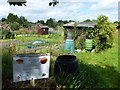
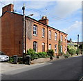
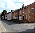
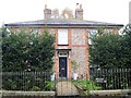
Nearby Images from Geograph Britain and Ireland:
©2016(licence)
©2018(licence)
©2018(licence)

©2012(licence)
©2016(licence)
The above images may not be of the site on this page, they are loaded from Geograph.
Please Submit an Image of this site or go out and take one for us!
Click here to see more info for this site
Nearby sites
Key: Red: member's photo, Blue: 3rd party photo, Yellow: other image, Green: no photo - please go there and take one, Grey: site destroyed
Download sites to:
KML (Google Earth)
GPX (GPS waypoints)
CSV (Garmin/Navman)
CSV (Excel)
To unlock full downloads you need to sign up as a Contributory Member. Otherwise downloads are limited to 50 sites.
Turn off the page maps and other distractions
Nearby sites listing. In the following links * = Image available
2.9km SE 131° Giant's Grave (Wiltshire)* Long Barrow (SU18925820)
3.1km N 359° Giant's Grave (Oare)* Promontory Fort / Cliff Castle (SU16636324)
4.0km NNE 14° Martinshill Fort* Hillfort (SU1767563970)
4.3km SSE 157° Everleigh Barrows Barrow Cemetery (SU184561)
4.4km E 101° Easton Clump Disc Barrow Round Barrow(s) (SU21085927)
4.7km NW 324° Gopher Wood Barrows* Barrow Cemetery (SU139639)
5.1km NW 317° Golden Ball Hill Barrow* Round Barrow(s) (SU1318163862)
5.2km N 355° West Woods Standing Stone* Standing Stone (Menhir) (SU16246528)
5.3km WSW 246° Cat's Brain* Long Barrow (SU1185057889)
5.6km N 350° West Woods Long Barrow* Long Barrow (SU15676563)
5.8km NW 308° Knap Hill* Causewayed Enclosure (SU121636)
5.8km NW 307° Knap Hill Bowl Barrow 1* Round Barrow(s) (SU12056362)
5.9km NW 307° Knap Hill Bowl Barrow 2 Round Barrow(s) (SU11976358)
6.2km NW 305° Adam's Grave's Round Barrows 1* Round Barrow(s) (SU116636)
6.2km WNW 289° All Saints (Alton Priors)* Holed Stone (SU108621)
6.2km WNW 290° Broad Well (Alton Priors)* Holy Well or Sacred Spring (SU108622)
6.3km WNW 288° Alton Barnes Modern Stone* Modern Stone Circle etc (SU10736202)
6.3km NE 54° Square Copse Barrow Cemetery* Barrow Cemetery (SU2179463760)
6.3km NNW 340° West Woods Sarsen Stones* Natural Stone / Erratic / Other Natural Feature (SU145660)
6.3km NNW 347° West Woods (Hursley Bottom) Standing Stone* Standing Stone (Menhir) (SU15226625)
6.3km WNW 304° Adam's Graves Round Barrows 2* Round Barrow(s) (SU114636)
6.4km WNW 301° Adam's Grave (Alton Barnes)* Long Barrow (SU1123363386)
6.4km SSW 194° Chisenbury Camp Hillfort (SU15195387)
6.4km NW 308° New Town Tumuli* Round Barrow(s) (SU11596403)
6.5km NW 322° Wansdyke* Misc. Earthwork (SU127652)
View more nearby sites and additional images


 We would like to know more about this location. Please feel free to add a brief description and any relevant information in your own language.
 Wir möchten mehr über diese Stätte erfahren. Bitte zögern Sie nicht, eine kurze Beschreibung und relevante Informationen in Deutsch hinzuzufügen.
 Nous aimerions en savoir encore un peu sur les lieux. S'il vous plaît n'hesitez pas à ajouter une courte description et tous les renseignements pertinents dans votre propre langue.
 Quisieramos informarnos un poco más de las lugares. No dude en añadir una breve descripción y otros datos relevantes en su propio idioma.