 with our Megalithic Portal iPhone app")


<< Our Photo Pages >> Wyaston Road 1 - Round Barrow(s) in England in Derbyshire
Submitted by PaulM on Friday, 15 August 2003 Page Views: 6554
Neolithic and Bronze AgeSite Name: Wyaston Road 1Country: England County: Derbyshire Type: Round Barrow(s)
Nearest Town: Ashbourne
Map Ref: SK181443 Landranger Map Number: 125
Latitude: 52.995724N Longitude: 1.731778W
Condition:
| 5 | Perfect |
| 4 | Almost Perfect |
| 3 | Reasonable but with some damage |
| 2 | Ruined but still recognisable as an ancient site |
| 1 | Pretty much destroyed, possibly visible as crop marks |
| 0 | No data. |
| -1 | Completely destroyed |
| 5 | Superb |
| 4 | Good |
| 3 | Ordinary |
| 2 | Not Good |
| 1 | Awful |
| 0 | No data. |
| 5 | Can be driven to, probably with disabled access |
| 4 | Short walk on a footpath |
| 3 | Requiring a bit more of a walk |
| 2 | A long walk |
| 1 | In the middle of nowhere, a nightmare to find |
| 0 | No data. |
| 5 | co-ordinates taken by GPS or official recorded co-ordinates |
| 4 | co-ordinates scaled from a detailed map |
| 3 | co-ordinates scaled from a bad map |
| 2 | co-ordinates of the nearest village |
| 1 | co-ordinates of the nearest town |
| 0 | no data |
Internal Links:
External Links:
")
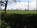
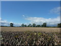
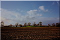
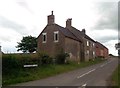
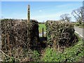
One of five barrows located around the Osmaston Field farm south of Ashbourne. Located at SJ181443 this barrow can be accessed via a public footpath.
You may be viewing yesterday's version of this page. To see the most up to date information please register for a free account.
")
Do not use the above information on other web sites or publications without permission of the contributor.
Nearby Images from Geograph Britain and Ireland:
©2006(licence)
©2011(licence)
©2010(licence)
©2013(licence)
©2018(licence)
The above images may not be of the site on this page, they are loaded from Geograph.
Please Submit an Image of this site or go out and take one for us!
Click here to see more info for this site
Nearby sites
Key: Red: member's photo, Blue: 3rd party photo, Yellow: other image, Green: no photo - please go there and take one, Grey: site destroyed
Download sites to:
KML (Google Earth)
GPX (GPS waypoints)
CSV (Garmin/Navman)
CSV (Excel)
To unlock full downloads you need to sign up as a Contributory Member. Otherwise downloads are limited to 50 sites.
Turn off the page maps and other distractions
Nearby sites listing. In the following links * = Image available
447m NNE 27° Wyaston Road 2* Round Barrow(s) (SK183447)
2.2km NNW 349° St Oswald (Ashbourne)* Ancient Cross (SK1765546480)
5.5km S 180° Bently Fields Farm* Modern Stone Circle etc (SK18093878)
5.8km WSW 251° The Norbury Cross* Ancient Cross (SK126424)
6.7km NNW 344° Lids Lowe Round Barrow(s) (SK16235078)
6.8km NW 315° Top Low 2 Round Barrow(s) (SK133491)
6.9km NW 322° Barrow near Lady Low Round Barrow(s) (SK138497)
6.9km NW 322° Lady Low Round Barrow(s) (SK138497)
6.9km ESE 115° All Saints (Brailsford)* Ancient Cross (SK244414)
7.1km NW 313° Top Low 1 Round Barrow(s) (SK129491)
7.3km NNE 26° Stand Low Kniveton* Round Barrow(s) (SK21335085)
7.5km WNW 293° Thorswood* Barrow Cemetery (SK112472)
7.5km NNE 19° Wigber Low* Round Barrow(s) (SK205514)
7.7km ESE 112° The Brailsford Cross* Ancient Cross (SK253415)
7.8km NW 315° Hazleton Clump Cairn (SK125498)
7.9km N 358° Town Well* Holy Well or Sacred Spring (SK1774852209)
7.9km N 356° Yew Tree Well* Holy Well or Sacred Spring (SK1756252201)
7.9km NW 323° St Bertram's Well (Ilam)* Holy Well or Sacred Spring (SK13275059)
8.0km N 358° Coffin Well* Holy Well or Sacred Spring (SK1782252270)
8.0km NW 323° Church of the Holy Cross (Ilam)* Ancient Cross (SK1326950697)
8.0km NW 310° Dun Low* Round Barrow(s) (SK119494)
8.0km N 356° Hall Well (Tissington)* Holy Well or Sacred Spring (SK1756052321)
8.1km NNW 347° Hollington Barn* Round Barrow(s) (SK1627552175)
8.1km WNW 284° Weaver Hills* Barrow Cemetery (SK102462)
8.1km N 356° Children's Well* Holy Well or Sacred Spring (SK1746052426)
View more nearby sites and additional images


 We would like to know more about this location. Please feel free to add a brief description and any relevant information in your own language.
 Wir möchten mehr über diese Stätte erfahren. Bitte zögern Sie nicht, eine kurze Beschreibung und relevante Informationen in Deutsch hinzuzufügen.
 Nous aimerions en savoir encore un peu sur les lieux. S'il vous plaît n'hesitez pas à ajouter une courte description et tous les renseignements pertinents dans votre propre langue.
 Quisieramos informarnos un poco más de las lugares. No dude en añadir una breve descripción y otros datos relevantes en su propio idioma.