


<< Our Photo Pages >> Stand Low Kniveton - Round Barrow(s) in England in Derbyshire
Submitted by Melanie on Monday, 09 May 2005 Page Views: 9731
Neolithic and Bronze AgeSite Name: Stand Low KnivetonCountry: England County: Derbyshire Type: Round Barrow(s)
Nearest Village: Kniveton
Map Ref: SK21335085
Latitude: 53.054484N Longitude: 1.683225W
Condition:
| 5 | Perfect |
| 4 | Almost Perfect |
| 3 | Reasonable but with some damage |
| 2 | Ruined but still recognisable as an ancient site |
| 1 | Pretty much destroyed, possibly visible as crop marks |
| 0 | No data. |
| -1 | Completely destroyed |
| 5 | Superb |
| 4 | Good |
| 3 | Ordinary |
| 2 | Not Good |
| 1 | Awful |
| 0 | No data. |
| 5 | Can be driven to, probably with disabled access |
| 4 | Short walk on a footpath |
| 3 | Requiring a bit more of a walk |
| 2 | A long walk |
| 1 | In the middle of nowhere, a nightmare to find |
| 0 | No data. |
| 5 | co-ordinates taken by GPS or official recorded co-ordinates |
| 4 | co-ordinates scaled from a detailed map |
| 3 | co-ordinates scaled from a bad map |
| 2 | co-ordinates of the nearest village |
| 1 | co-ordinates of the nearest town |
| 0 | no data |
Internal Links:
External Links:
 (PID:13696)")
The two barrows are found on a limestone ridge outcrop 270 metres at SK21335085 and 21325086 and are scheduled Ancient Monuments Number 13338. They are in Stanlow Nobbs field on Newhouse Farm, Kniveton, Derbyshire.
Dimensions
The largest mound to the North West is 16m by 13.5 m by 1-1.2m high. There is a smaller mound 20m to the South East which is 10.5m x 9.5m x 1m, this is generally believed to be natural.
Archaeological History
There is some confusion in the literature surrounding the sites known as Stan(d)low barrows. In total there appear to be three sites in Derbyshire. The other two being Standlow East of Dovedale SK15915358, and Stanlow SK16917923 near Little Hucklow
In 1845 T Bateman partially excavated a Stand low barrow, which is identified at SK15915358. (Vestiges p75). Artefacts were recovered during the excavation.
On 10th September 1869 J F Lucas excavated a Stand Low barrow. This excavation recovered several artefacts including a three rivetted bronze dagger with ivory pommel, an urn or food vessel, a perforated stone axe and an amber ring. These dated the Lucas barrow quite firmly. Unfortunately no exact position was recorded. However, a letter between S Carrington and T N Brushfield dated 3rd January 1870 and uncovered by Barry Marsden in 1977 is said to evidence these finds to the Stand Low at Kniveton. In addition it is recorded that J F Lucas excavated Wigber Low some 1000m away from Stand Low in 1869. Lucas lived at Fenny Bentley a village less than three miles from Kniveton.
The British Museum also confirmed that the remaining artefacts were listed as Standlow (Kniveton) in their records. But we unable to locate a reference to an amber ring or ceramic vessel in their index locurum for Kniveton. But do mention an amber bead with three outside openings (1873 6-2 29) As all these finds were bequeathed from the J F Lucas collection in 1873 after the death of Lucas in 1870, it seems likely that some confusion has arisen following the damage to the British Museum and the artefacts lost in the 1940s.
John Barnett visited the site in 1988 and is confident that only the larger barrow is the most likely source and considered the smaller mound to be natural. Martin Wildgoose is also in agreement that the larger is formed and the smaller natural. Wildgoose had previously noted dark crop marks on the large mound in dry weather, which he considered may represent the nineteenth century excavations or later c8th century Anglian burial reuse.
In 1996 Boldrini conducted a detailed measurement survey of the site. He noted greater topographical disturbance in the South Eastern mound. But Robinson (2001) believes that there was an error in orientation of 180 degrees and believes with the error corrected the survey correlates the beliefs of Barnett and Wildgoose.
The Landscape
The foundation material of both mounds are naturally occurring knolls.
The views from the hills are generally good, particularly to the South, West, North and Northeast. With the views to the East being somewhat restricted.
There are many prominent archaeological sites visible on neighbouring hill tops and sides. Including Minninglow, Hawkslow, Mootlow and Liffs Low.
Wigber Low approximately 1100 northwest , falls slightly below the horizon.
The Artefacts
The Artefacts were acquired in 1873 by the British Museum from the J F Lucas Collection following the death of Lucas in 1872 at the age of 35. Presumably his findings were not published due to his death.
These included a bronze dagger, a perforated Axe, a pottery vessel described as a food vessel or urn and an amber ring.
It was believed that all the finds were lost during the war due to damage at the museum, but the dagger and axe were re-discovered during re-organisation.
The original British Museum record marks the dagger find as:
Bronze dagger with one rivet remaining, and a bone end of handle (73, 6-2,25) found in a barrow at Standlow, Co Derby, with axe hammer.
The Axe is registered as OA144 and has an original label signed by Lucas, dating the find to September 10th 1869.
More on
http://web.onetel.net.uk/~alexredon/newhouse/standlow.htm
You may be viewing yesterday's version of this page. To see the most up to date information please register for a free account.
Do not use the above information on other web sites or publications without permission of the contributor.
coldrum has found this location on Google Street View:
Nearby Images from Geograph Britain and Ireland:
©2023(licence)
©2016(licence)
©2010(licence)
©2010(licence)
©2016(licence)
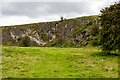
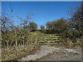
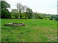
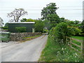
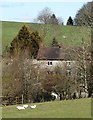
The above images may not be of the site on this page, they are loaded from Geograph.
Please Submit an Image of this site or go out and take one for us!
Click here to see more info for this site
Nearby sites
Key: Red: member's photo, Blue: 3rd party photo, Yellow: other image, Green: no photo - please go there and take one, Grey: site destroyed
Download sites to:
KML (Google Earth)
GPX (GPS waypoints)
CSV (Garmin/Navman)
CSV (Excel)
To unlock full downloads you need to sign up as a Contributory Member. Otherwise downloads are limited to 50 sites.
Turn off the page maps and other distractions
Nearby sites listing. In the following links * = Image available
994m NW 304° Wigber Low* Round Barrow(s) (SK205514)
1.9km NNW 345° All Saints (Bradbourne)* Ancient Cross (SK2082052660)
2.2km N 349° Bradbourne Stone* Standing Stone (Menhir) (SK209530)
2.5km NE 55° The Stoup* Standing Stone (Menhir) (SK2335852257)
3.0km E 80° Stones Island* Modern Stone Circle etc (SK243514)
3.6km NNE 28° Brassington Moor Stone Circle (SK230540)
3.8km WNW 292° Coffin Well* Holy Well or Sacred Spring (SK1782252270)
3.8km WNW 291° Town Well* Holy Well or Sacred Spring (SK1774852209)
4.0km NE 45° Carsington Pasture* Cave or Rock Shelter (SK24155368)
4.0km WNW 290° Yew Tree Well* Holy Well or Sacred Spring (SK1756252201)
4.0km WNW 292° Hall Well (Tissington)* Holy Well or Sacred Spring (SK1756052321)
4.0km NNE 13° Rainster Rocks* Ancient Village or Settlement (SK222548)
4.2km WNW 292° Children's Well* Holy Well or Sacred Spring (SK1746052426)
4.2km WNW 293° Hands Well* Holy Well or Sacred Spring (SK1742752487)
4.6km NNE 16° Rains Cave Cave or Rock Shelter (SK226553)
4.7km WNW 291° Boars Low* Round Barrow(s) (SK169525)
4.8km WNW 289° Sharplow Farm* Standing Stone (Menhir) (SK168524)
4.8km NNE 32° Round Low (Brassington)* Round Barrow(s) (SK2388854905)
4.8km WNW 302° Crake Low Round Barrow(s) (SK17235343)
5.1km W 269° Lids Lowe Round Barrow(s) (SK16235078)
5.2km NNE 34° Harborough Cave* Cave or Rock Shelter (SK242552)
5.2km WNW 285° Hollington Barn* Round Barrow(s) (SK1627552175)
5.2km NE 34° Harborough Rocks* Ancient Village or Settlement (SK2427455185)
5.6km WNW 291° Sharp Low* Round Barrow(s) (SK16135286)
5.6km NNW 326° Foufinside stones* Standing Stones (SK1818655507)
View more nearby sites and additional images


 We would like to know more about this location. Please feel free to add a brief description and any relevant information in your own language.
 Wir möchten mehr über diese Stätte erfahren. Bitte zögern Sie nicht, eine kurze Beschreibung und relevante Informationen in Deutsch hinzuzufügen.
 Nous aimerions en savoir encore un peu sur les lieux. S'il vous plaît n'hesitez pas à ajouter une courte description et tous les renseignements pertinents dans votre propre langue.
 Quisieramos informarnos un poco más de las lugares. No dude en añadir una breve descripción y otros datos relevantes en su propio idioma.