<< Our Photo Pages >> Casterley Camp - Hillfort in England in Wiltshire
Submitted by vicky on Wednesday, 22 June 2011 Page Views: 13849
Iron Age and Later PrehistorySite Name: Casterley CampCountry: England County: Wiltshire Type: Hillfort
Nearest Village: Upavon
Map Ref: SU115535 Landranger Map Number: 184
Latitude: 51.280528N Longitude: 1.836504W
Condition:
| 5 | Perfect |
| 4 | Almost Perfect |
| 3 | Reasonable but with some damage |
| 2 | Ruined but still recognisable as an ancient site |
| 1 | Pretty much destroyed, possibly visible as crop marks |
| 0 | No data. |
| -1 | Completely destroyed |
| 5 | Superb |
| 4 | Good |
| 3 | Ordinary |
| 2 | Not Good |
| 1 | Awful |
| 0 | No data. |
| 5 | Can be driven to, probably with disabled access |
| 4 | Short walk on a footpath |
| 3 | Requiring a bit more of a walk |
| 2 | A long walk |
| 1 | In the middle of nowhere, a nightmare to find |
| 0 | No data. |
| 5 | co-ordinates taken by GPS or official recorded co-ordinates |
| 4 | co-ordinates scaled from a detailed map |
| 3 | co-ordinates scaled from a bad map |
| 2 | co-ordinates of the nearest village |
| 1 | co-ordinates of the nearest town |
| 0 | no data |
Internal Links:
External Links:
I have visited· I would like to visit
Andy B has visited here
")
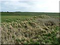
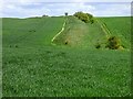
There are many indications of prehistoric settlement. There was substantial activity on the downs in Neolithic and Bronze Age times and finds include an axe and arrowheads at Casterley Camp.
Casterley Camp itself is probably the earliest settlement and must have been communal with several families living here in the Iron Age. The village, founded in the early Iron Age, was enclosed by a bank and ditch that wsa pierced by three entrances. It is a large site and there were separate enclosures within this bank. The site was occupied throughout the period and much pottery and many implements were found by the Cunningtons in excavation here. These included a spearhead and hammer head, brooches, a button and saddle querns for grinding corn. The pottery included locally made utensils and items imported from present day French and Belgium. The central complex, probably the settlement itself, covers nine acres and this is surrounded by ditched enclosures, opening out of one another, in the 62 acres enclosed by the outer bank.
Occupation of Casterley Camp continued throughout the Roman period and finds include Samian ware pottery, coins from Claudius to Constantine, and items such as pins, bronze earpicks, tweezers, iron knives, nails and brooches. More at Wilts CC
Note: Walk from Avebury to Stonehenge on the new Great Stones Way (well the Casterley Camp to Stonehenge section is now officially open)
You may be viewing yesterday's version of this page. To see the most up to date information please register for a free account.
")
Do not use the above information on other web sites or publications without permission of the contributor.
Nearby Images from Geograph Britain and Ireland:

©2006(licence)
©2008(licence)

©2008(licence)
©2019(licence)

©2006(licence)
The above images may not be of the site on this page, they are loaded from Geograph.
Please Submit an Image of this site or go out and take one for us!
Click here to see more info for this site
Nearby sites
Key: Red: member's photo, Blue: 3rd party photo, Yellow: other image, Green: no photo - please go there and take one, Grey: site destroyed
Download sites to:
KML (Google Earth)
GPX (GPS waypoints)
CSV (Garmin/Navman)
CSV (Excel)
To unlock full downloads you need to sign up as a Contributory Member. Otherwise downloads are limited to 50 sites.
Turn off the page maps and other distractions
Nearby sites listing. In the following links * = Image available
2.4km SE 144° Enfold Bowl Barrow* Round Barrow(s) (SU129516)
3.1km E 95° East Chisenbury Midden Ancient Village or Settlement (SU14605323)
3.7km E 84° Chisenbury Camp Hillfort (SU15195387)
4.1km SSE 157° Netheravon Cursus Cursus (SU131497)
4.4km N 5° Cat's Brain* Long Barrow (SU1185057889)
5.1km E 92° Lidbury Camp Hillfort (SU16645335)
5.3km NNW 333° Marden Henge* Henge (SU09085820)
5.4km NNW 333° Marden Timber Circle Timber Circle (SU090583)
6.8km SE 144° Gallows Barrow Round Barrow(s) (SU15564800)
7.1km SE 129° Idmiston Cursus Cursus (SU1749)
7.2km NNW 347° The Hanging Stone (Wiltshire)* Standing Stone (Menhir) (SU099605)
7.2km S 187° Robin Hood Ball Clump Barrow Round Barrow(s) (SU10674630)
7.4km ENE 69° Everleigh Barrows Barrow Cemetery (SU184561)
7.6km S 189° Robin Hood's Ball Causewayed Enclosure (SU103460)
7.8km SSW 191° Shrewton 4 Round Barrow(s) (SU09994588)
8.2km S 171° Knighton Down Long Barrow (SU12784535)
8.3km SE 143° Ablington Barrow Clump* Round Barrow(s) (SU1654546924)
8.4km NE 38° Pewsey Standing Stones* Modern Stone Circle etc (SU167601)
8.4km WNW 298° Jerusalem Well Holy Well or Sacred Spring (SU040574)
8.6km N 355° Alton Barnes Modern Stone* Modern Stone Circle etc (SU10736202)
8.6km ESE 103° Fittleton 5 Long Barrow Long Barrow (SU19885166)
8.6km N 355° All Saints (Alton Priors)* Holed Stone (SU108621)
8.7km N 356° Broad Well (Alton Priors)* Holy Well or Sacred Spring (SU108622)
8.8km ENE 58° Giant's Grave (Wiltshire)* Long Barrow (SU18925820)
8.8km SE 128° Figheldean Earthwork* Misc. Earthwork (SU1846348131)
View more nearby sites and additional images


 We would like to know more about this location. Please feel free to add a brief description and any relevant information in your own language.
 Wir möchten mehr über diese Stätte erfahren. Bitte zögern Sie nicht, eine kurze Beschreibung und relevante Informationen in Deutsch hinzuzufügen.
 Nous aimerions en savoir encore un peu sur les lieux. S'il vous plaît n'hesitez pas à ajouter une courte description et tous les renseignements pertinents dans votre propre langue.
 Quisieramos informarnos un poco más de las lugares. No dude en añadir una breve descripción y otros datos relevantes en su propio idioma.