<< Our Photo Pages >> Reed Hill - Round Barrow(s) in England in Cheshire
Submitted by vicky on Friday, 03 January 2003 Page Views: 8040
Neolithic and Bronze AgeSite Name: Reed HillCountry: England County: Cheshire Type: Round Barrow(s)
Nearest Town: Macclesfield Nearest Village: Pott Shrigley
Map Ref: SJ978799 Landranger Map Number: 118
Latitude: 53.316027N Longitude: 2.034484W
Condition:
| 5 | Perfect |
| 4 | Almost Perfect |
| 3 | Reasonable but with some damage |
| 2 | Ruined but still recognisable as an ancient site |
| 1 | Pretty much destroyed, possibly visible as crop marks |
| 0 | No data. |
| -1 | Completely destroyed |
| 5 | Superb |
| 4 | Good |
| 3 | Ordinary |
| 2 | Not Good |
| 1 | Awful |
| 0 | No data. |
| 5 | Can be driven to, probably with disabled access |
| 4 | Short walk on a footpath |
| 3 | Requiring a bit more of a walk |
| 2 | A long walk |
| 1 | In the middle of nowhere, a nightmare to find |
| 0 | No data. |
| 5 | co-ordinates taken by GPS or official recorded co-ordinates |
| 4 | co-ordinates scaled from a detailed map |
| 3 | co-ordinates scaled from a bad map |
| 2 | co-ordinates of the nearest village |
| 1 | co-ordinates of the nearest town |
| 0 | no data |
Internal Links:
External Links:
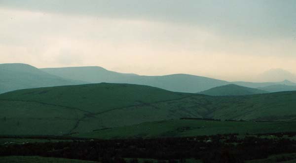
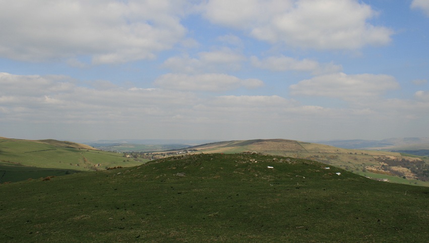
Sponds Hill lies on the border between Cheshire and Derbyshire within the estate of Lyme Hall and is reputedly one of the most notable objects to be seen from the Cheshire plain. The hill which runs north and south at 1348ft above sea level with fantastic views across to North Wales, Snowdon and the Great Orme, is home to three Bronze Age tumuli. The most notable lies on the spur of the hill on a natural mound, known as Reed Hill or Reed’s Piece, midway along the ridge.
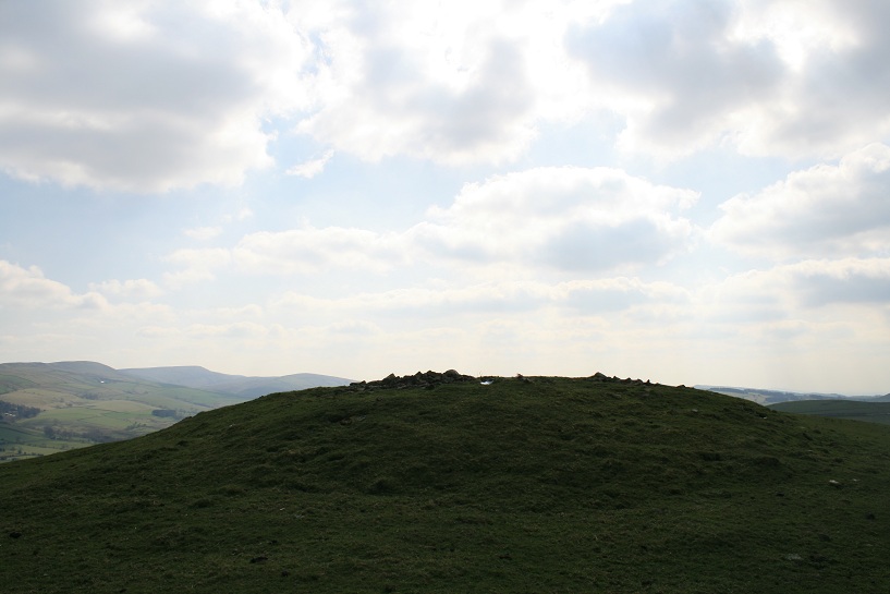
Breaking the skyline the Reed Hill tumulus is a prominent landmark for miles around, almost resembling a cherry on a cake. This barrow was excavated during the early 20th century but was not marked on the Ordnance Survey map of that time, despite the fact that it had an Ordnance Mark on it proclaiming its height to be 1263ft above sea level!
According to an account in the Transactions of the Lancashire and Cheshire Antiquarian Society, operations were carried out from Wednesday 11th to Monday 16th January 1911 (excluding the Sunday) with the permission of Lord Newton, owner of the estate.
The tumulus was found to be almost circular in shape, measuring 45ft by 52ft in diameter and standing between 5ft and 6ft high from the original ground surface. Around the base there were traces of what may have been a ditch ‘but which may possibly have been merely the result of sheep treading for centuries around the mound’. A slight depression running exactly north and south was noticed, indicating that it may have been examined previously.
The excavation team comprised Lord Newton, his son-in-law Mr John Egerton-Warburton, Mr Andrew (the author of the report) and one workmen only ‘because in such cases questions of time and speed are quite secondary to care and observation’. A trench was first cut east to west revealing a mass of tightly packed stones beneath a thin coating of turf. ‘The stones were mainly brook or gravel pebbles, varying from the size of a man’s fist to that of his head, but there was broken millstone grit also present’. As the author comments, this barrow was constructed in an area where turf abounded so why instead did they chose to bring up stones from the brooks and valleys below? Perhaps they did it for practical reasons, believing stone would last longer than soil or maybe it was for spiritual reasons with water holding special significance.
Immediately inside the ditch, a retaining wall of large water-worn stones ‘inclining inwards’ was discovered. The explorers concluded that this must have been the original face of the tumulus. A little further in, a second retaining wall of natural sandy marl was found which ‘represented the edge of a kind of saucer’ and followed the contour of the hill.
Within this bank on the eastern side, they discovered a few fragments of calcinated human bone with a tiny amount of charcoal. At eighteen feet from the eastern end of the trench a circular cist composed of ‘a circle of stones set upright’ was discovered. To the annoyance of the excavators it looked as if this had been explored previously as the capstone was missing, the cist itself was filled with stones and three or four of the side stones had been thrown down. Not a single trace of human remains was to be found so they concluded that any burial must have been in an urn which had been completely removed during previous investigations. The capstone of the cist was later found to be the large flat stone upon which Ordnance Surveyors had cut their benchmark!
The cist was built on the natural ground surface and its stones were standing on the level so the excavators concluded that this must have been a secondary interment dug at a later date than the mound. The ground must have been solidified before the cist was built, otherwise the weight of the mound would have pressed the stones into the soil. Heartened by this discovery, the men pressed on in the hope that the main burial lay undisturbed.
The third day, Friday 13th, lived up to its reputation and proved to be ‘a blank day’. However, on the Saturday continuing work in the northern section the explorers soon discovered a curious drain-like formation at floor-level. It was ‘composed of a small trench about six inches wide, bounded by side stones of four or five inches high, covered over with cap-stones, like a stone drain. It slanted back towards the centre and a walking stick could not determine its length’. They immediately began to try and remove the stones, when a collapse revealed a second cist within inches of both trenches.
This cist proved to be very unusual - ‘It was set in foundations about eight inches below the level of the floor, circular in plan, and dry-built of gritstone into the form of a perfect beehive, being two feet six inches in diameter and two feet high, inside measurements’. Within was a mass of cremated bones ‘But it was now dark, and further examination was reserved for Monday.’
Access
There is no formal access to Reed Hill but it is best viewed from the minor road leading to the Bowstones at GR: SJ974813.
References
D.M.Longley “Prehistory” in C.R.Elrington (ed) “The Victoria History of the County of Chester, volume 1, Oxford University Press (1987)
J. Barnatt & J. Collis “Barrows in the Peak District – Recent Research”, J.R.Collis Publications (1996)
W.J. Andrew “Excavation of the Tumulus on Sponds Hill, East Cheshire” TLCAS Volume 30 (1912)
Note: Please note this barrow is located on private land but can be easily viewed from the nearby road and public footpath.
You may be viewing yesterday's version of this page. To see the most up to date information please register for a free account.

Do not use the above information on other web sites or publications without permission of the contributor.
Click here to see more info for this site
Nearby sites
Key: Red: member's photo, Blue: 3rd party photo, Yellow: other image, Green: no photo - please go there and take one, Grey: site destroyed
Download sites to:
KML (Google Earth)
GPX (GPS waypoints)
CSV (Garmin/Navman)
CSV (Excel)
To unlock full downloads you need to sign up as a Contributory Member. Otherwise downloads are limited to 50 sites.
Turn off the page maps and other distractions
Nearby sites listing. In the following links * = Image available
852m WNW 291° Sponds Hill S Round Barrow(s) (SJ970802)
892m WNW 297° Sponds Hill N* Round Barrow(s) (SJ970803)
999m SW 217° Further Harrop* Round Barrow(s) (SJ972791)
1.1km S 185° Charles Head* Round Barrow(s) (SJ977788)
1.4km NNE 29° Stone near Higher Cornfield Farm* Standing Stone (Menhir) (SJ9845581083)
1.5km NNW 344° Bowstones* Ancient Cross (SJ9739181309)
2.0km WSW 252° Andrew's Knob Round Barrow(s) (SJ959793)
2.1km NW 323° Knights Low W Round Barrow(s) (SJ965816)
2.2km NW 321° Knights Low E* Round Barrow(s) (SJ964816)
2.2km NW 324° Knightslow Wood E Round Barrow(s) (SJ965817)
2.2km NW 324° Knightslow Wood W* Round Barrow(s) (SJ965817)
2.3km NW 322° Knightslow Wood* Round Barrow(s) (SJ964817)
2.3km SE 133° Windgather Rocks Cup-Mark Stone Rock Art (SJ995783)
2.5km NW 320° Knights Low NW Round Barrow(s) (SJ962818)
2.5km NE 44° The Dipping Stone* Ancient Cross (SJ99558171)
2.6km NE 52° Hawkhurst Head* Standing Stone (Menhir) (SJ99838149)
2.8km NNW 331° Lyme Park* Ancient Cross (SJ96458235)
3.0km NE 46° Ringstone (Whaley Bridge) Stone Circle (SK000820)
3.2km SSW 200° Highway Man Stone* Standing Stone (Menhir) (SJ9670476849)
3.2km SW 227° Little Low Round Barrow(s) (SJ954777)
3.5km SSW 192° Blue Boar Farm* Round Barrow(s) (SJ971765)
3.6km SW 216° Great Low Hillfort (SJ957770)
3.9km E 94° The Shall Cross* Ancient Cross (SK0165579615)
3.9km SSW 212° Black Rock Farm* Round Barrow(s) (SJ957766)
3.9km WSW 254° Nab Head (Cheshire)* Round Barrow(s) (SJ940788)
View more nearby sites and additional images


 We would like to know more about this location. Please feel free to add a brief description and any relevant information in your own language.
 Wir möchten mehr über diese Stätte erfahren. Bitte zögern Sie nicht, eine kurze Beschreibung und relevante Informationen in Deutsch hinzuzufügen.
 Nous aimerions en savoir encore un peu sur les lieux. S'il vous plaît n'hesitez pas à ajouter une courte description et tous les renseignements pertinents dans votre propre langue.
 Quisieramos informarnos un poco más de las lugares. No dude en añadir una breve descripción y otros datos relevantes en su propio idioma.