<< Text Pages >> Knightslow Wood E - Round Barrow(s) in England in Cheshire
Submitted by vicky on Thursday, 19 September 2002 Page Views: 3534
Neolithic and Bronze AgeSite Name: Knightslow Wood ECountry: England County: Cheshire Type: Round Barrow(s)
Nearest Town: Disley Nearest Village: Lyme
Map Ref: SJ965817 Landranger Map Number: 109
Latitude: 53.332199N Longitude: 2.054018W
Condition:
| 5 | Perfect |
| 4 | Almost Perfect |
| 3 | Reasonable but with some damage |
| 2 | Ruined but still recognisable as an ancient site |
| 1 | Pretty much destroyed, possibly visible as crop marks |
| 0 | No data. |
| -1 | Completely destroyed |
| 5 | Superb |
| 4 | Good |
| 3 | Ordinary |
| 2 | Not Good |
| 1 | Awful |
| 0 | No data. |
| 5 | Can be driven to, probably with disabled access |
| 4 | Short walk on a footpath |
| 3 | Requiring a bit more of a walk |
| 2 | A long walk |
| 1 | In the middle of nowhere, a nightmare to find |
| 0 | No data. |
| 5 | co-ordinates taken by GPS or official recorded co-ordinates |
| 4 | co-ordinates scaled from a detailed map |
| 3 | co-ordinates scaled from a bad map |
| 2 | co-ordinates of the nearest village |
| 1 | co-ordinates of the nearest town |
| 0 | no data |
Internal Links:
External Links:
I have visited· I would like to visit
louisearchaeology would like to visit
According to the County Sites and Monuments Record, Knights Low Wood in the care of the National Trust on the Lyme Estate, is a barrow hot spot, home to a number of Bronze Age mounds.
This flat topped oval mound 0.9m high and 9m by 7.5m in diameter may be one of three possible barrows discussed by Marriott in his Antiquities of Lyme in 1810:‘3 small tumuli, just beyond the wall which forms the partition of the calf-croft from the Knight’s Low. These are not particularly striking, yet have character enough in them to warrant the supposition that they may be composed for small barrows or sepulchres.’
Access
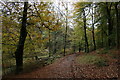
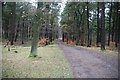
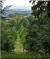
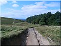
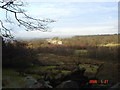
The barrows in Knights Low Wood are very hard to distinguish and not really worth visiting specifically to try and find them. However, the walk through the woodland is very pleasant. It is best reached by parking on the roadside near the Bowstones at GR: SJ974813 and following the footpath (Gritstone Trail) down the hill and into the woods. This barrow is located east of the north-south aligned path through the wood
References
D.M.Longley “Prehistory” in C.R.Elrington (ed) “The Victoria History of the County of Chester, volume 1, Oxford University Press (1987)
J. Barnatt & J. Collis “Barrows in the Peak District – Recent Research”, J.R.Collis Publications (1996)
Rev. W. Marriott “Antiquities of Lyme” (1810)
You may be viewing yesterday's version of this page. To see the most up to date information please register for a free account.
")
Do not use the above information on other web sites or publications without permission of the contributor.
Nearby Images from Geograph Britain and Ireland:
©2012(licence)
©2010(licence)
©2022(licence)
©2015(licence)
©2006(licence)
The above images may not be of the site on this page, they are loaded from Geograph.
Please Submit an Image of this site or go out and take one for us!
Click here to see more info for this site
Nearby sites
Key: Red: member's photo, Blue: 3rd party photo, Yellow: other image, Green: no photo - please go there and take one, Grey: site destroyed
Download sites to:
KML (Google Earth)
GPX (GPS waypoints)
CSV (Garmin/Navman)
CSV (Excel)
To unlock full downloads you need to sign up as a Contributory Member. Otherwise downloads are limited to 50 sites.
Turn off the page maps and other distractions
Nearby sites listing. In the following links * = Image available
nankm 0° Knightslow Wood W* Round Barrow(s) (SJ965817)
100m W 270° Knightslow Wood* Round Barrow(s) (SJ964817)
100m S 180° Knights Low W Round Barrow(s) (SJ965816)
141m SW 225° Knights Low E* Round Barrow(s) (SJ964816)
315m WNW 288° Knights Low NW Round Barrow(s) (SJ962818)
652m N 356° Lyme Park* Ancient Cross (SJ96458235)
971m ESE 114° Bowstones* Ancient Cross (SJ9739181309)
1.5km SSE 160° Sponds Hill N* Round Barrow(s) (SJ970803)
1.6km SSE 162° Sponds Hill S Round Barrow(s) (SJ970802)
2.1km ESE 107° Stone near Higher Cornfield Farm* Standing Stone (Menhir) (SJ985811)
2.2km SE 144° Reed Hill* Round Barrow(s) (SJ978799)
2.5km SSW 194° Andrew's Knob Round Barrow(s) (SJ959793)
2.7km SSE 165° Further Harrop* Round Barrow(s) (SJ972791)
2.9km NNE 18° St Mary (Disley)* Ancient Cross (SJ97388444)
3.0km E 90° The Dipping Stone* Ancient Cross (SJ99558171)
3.1km SSE 158° Charles Head* Round Barrow(s) (SJ977788)
3.3km E 94° Hawkhurst Head* Standing Stone (Menhir) (SJ99838149)
3.5km E 85° Ringstone (Whaley Bridge) Stone Circle (SK000820)
3.7km SW 225° Nab Wood Round Barrow(s) (SJ939791)
3.8km SW 221° Nab Head (Cheshire)* Round Barrow(s) (SJ940788)
4.1km SSW 195° Little Low Round Barrow(s) (SJ954777)
4.5km SE 139° Windgather Rocks Cup-Mark Stone Rock Art (SJ995783)
4.8km S 190° Great Low Hillfort (SJ957770)
4.9km S 178° Highway Man Stone* Standing Stone (Menhir) (SJ9670476849)
5.2km S 189° Black Rock Farm* Round Barrow(s) (SJ957766)
View more nearby sites and additional images


 We would like to know more about this location. Please feel free to add a brief description and any relevant information in your own language.
 Wir möchten mehr über diese Stätte erfahren. Bitte zögern Sie nicht, eine kurze Beschreibung und relevante Informationen in Deutsch hinzuzufügen.
 Nous aimerions en savoir encore un peu sur les lieux. S'il vous plaît n'hesitez pas à ajouter une courte description et tous les renseignements pertinents dans votre propre langue.
 Quisieramos informarnos un poco más de las lugares. No dude en añadir una breve descripción y otros datos relevantes en su propio idioma.