<< Our Photo Pages >> The Bridestones (Cheshire) - Chambered Tomb in England in Cheshire
Submitted by vicky on Friday, 15 April 2011 Page Views: 66212
Neolithic and Bronze AgeSite Name: The Bridestones (Cheshire)Country: England County: Cheshire Type: Chambered Tomb
Nearest Town: Congleton Nearest Village: Timbersbrook
Map Ref: SJ9058962190 Landranger Map Number: 118
Latitude: 53.156755N Longitude: 2.142193W
Condition:
| 5 | Perfect |
| 4 | Almost Perfect |
| 3 | Reasonable but with some damage |
| 2 | Ruined but still recognisable as an ancient site |
| 1 | Pretty much destroyed, possibly visible as crop marks |
| 0 | No data. |
| -1 | Completely destroyed |
| 5 | Superb |
| 4 | Good |
| 3 | Ordinary |
| 2 | Not Good |
| 1 | Awful |
| 0 | No data. |
| 5 | Can be driven to, probably with disabled access |
| 4 | Short walk on a footpath |
| 3 | Requiring a bit more of a walk |
| 2 | A long walk |
| 1 | In the middle of nowhere, a nightmare to find |
| 0 | No data. |
| 5 | co-ordinates taken by GPS or official recorded co-ordinates |
| 4 | co-ordinates scaled from a detailed map |
| 3 | co-ordinates scaled from a bad map |
| 2 | co-ordinates of the nearest village |
| 1 | co-ordinates of the nearest town |
| 0 | no data |
Internal Links:
External Links:
I have visited· I would like to visit
Froakie SumDoood GeorgieCollins MarbleArch Mountainharry would like to visit
elad13 visited on 21st Feb 2024 - their rating: Cond: 3 Amb: 4 Access: 4
TykeinExile visited on 12th Nov 2021 - their rating: Cond: 3 Amb: 4 Access: 4 lovely little site on the edge of a small copse of trees. I parked by the Stoneyard, walked back a few metres and into the copse and there it was in all its glory. Peaceful, tranquil and well worth a visit.
I would have given access a 5 but not sure how easy the few feet of wood would be to get access through.
Marko visited on 5th Sep 2021 - their rating: Cond: 2 Amb: 3 Access: 4 Been meaning to visit here for many years.
Sad to say that the visit left me underwhelmed.
The invasive rhododendrons comletely covered the right hand side of the chamber. The inside of the chamber was cluttered with briars,weeds and undergrowth,making access to it nigh on impossible.
Only the portal stones and the stones on the left hand side of the chamber were visible (externally) and weed free.
This site desperately needs a bit of t.l.c.
Maybe the next visitor could take a pair of secateurs and garden gloves - they're sorely needed!
gritstone visited on 1st Jun 2020 - their rating: Cond: 3 Amb: 4 Access: 5 Worth the trip to visit this impressive site.
Ballhc visited on 8th Mar 2015 - their rating: Cond: 3 Amb: 4 Access: 4
Judy6 visited on 18th Aug 2013 - their rating: Cond: 3 Amb: 4 Access: 4 Visited here on a Sunday and had no problems with access. Parked in the driveway leading up to "Bridestone Stone", where there is a wooden access gate on the left without entering the company's premises. This gate should not be confused with the shiny new gate leading to a footpath across the adjacent field.
jeniferj visited on 26th Jun 2011 - their rating: Cond: 3 Amb: 4 Access: 5
BrownEdger visited - their rating: Access: 5
crissy visited - their rating: Cond: 3 Access: 5
Bladup rldixon TimPrevett have visited here
Average ratings for this site from all visit loggers: Condition: 2.88 Ambience: 3.86 Access: 4.44

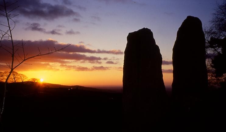
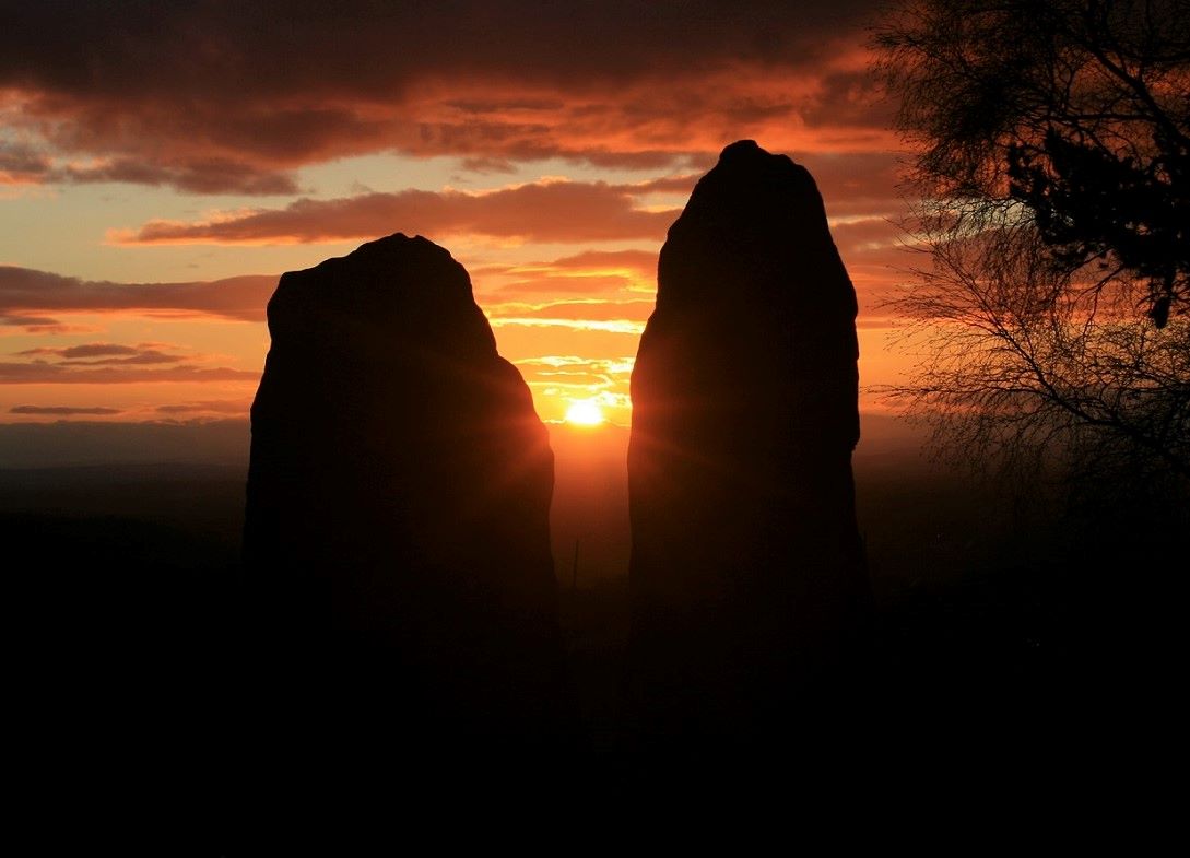
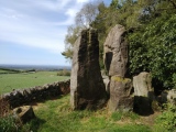
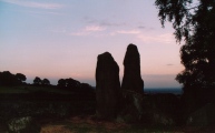
Located at 820ft above sea level, the burial chamber lies on the western crest of a pass running in a north-south line at the foot of the Pennines and has spectacular views across the Cheshire Plain.
It is now a shadow of its former self with thousands of tons of stone having been taken from the cairn by the builders of the nearby turnpike road in 1764. Other stones were used to build the adjacent house and farm, while yet more were recycled into an ornamental garden in Tunstall Park.
However, before this large scale ransacking occurred, it appears that the Bridestones was an incredible monument, perhaps unique in England.
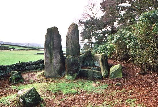
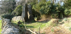
Evidence from a variety of sources indicates that it was a chambered tomb of massive proportions with a paved crescentic forecourt and a port-holed stone dividing the main chamber. The complex was supposedly 110 metres in length with the horned cairn being 11 metres wide. A report from the 18th Century notes that in addition to the main chamber which still stands today, a further two subsidiary ones were located at a distance of 55 yards. No traces of these have ever been found, but there is much debate as to whether they are located east of the surviving chamber, or west. The latter seems more likely as they were probably covered by the same cairn as the main chamber.
Chambered tombs with crescentic forecourts are normally found in the Clyde region of Scotland (Clyde Cairns) such as at Cairnholy and Carn Ban as well as in Ireland (Court Cairns). No other examples are known from the English mainland, the closest being Casthal yn Ard on the Isle of Man. In addition to the paved forecourt, the Bridestones also has another interesting feature in the port-holed stone, a characteristic usually associated with chambered tombs from the Cotswold Severn Region. In the case of the Bridestones it divided the two compartments of the main chamber – at 191/2 inches, the hole would have been large enough for a person to crawl through. A stone of identical proportions known as The Devil's Ring & Finger lies in Staffordshire.
So the question is why was such an unusual monument (one of such large proportions with such unusual features) built here? Cheshire is not a county known for its Neolithic architecture. In fact apart from a couple of suspect long barrows and a now destroyed mortuary enclosure, the Bridestones is the only authentic Neolithic monument. Sadly this has not aided its protection.
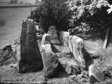
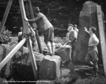
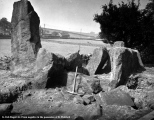
The site has suffered much in the last two centuries. As well as the thousands of tons of stone that have been taken from the cairn, a number of the standing stones from the ‘circle’ forming the forecourt have also been removed. During the 19th Century a picnicker’s bonfire led to the side slabs of the main chamber and the port-holed stone being seriously cracked. In fact the top half of the port-holed stone has long since disappeared. To add insult to injury a local newspaper article records that ‘many years ago, an engineer engaged in the cutting of the Manchester Ship Canal, visiting the spot actually used one of the biggest monoliths for the purpose of carrying out a demonstration with a detonator, as a result of which the great stone was broken off close to the ground’. Luckily the damage was not beyond repair as this portal stone was cemented back together during excavations in the 1930s.
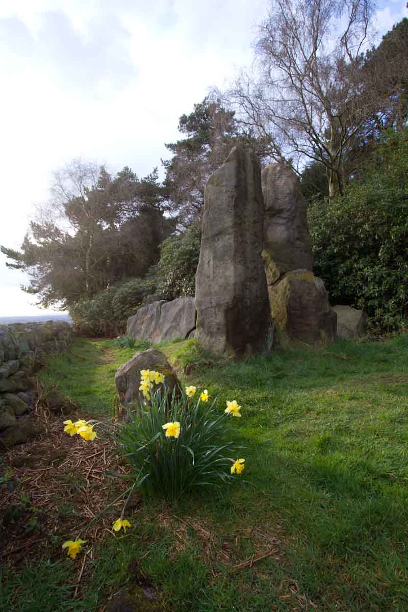
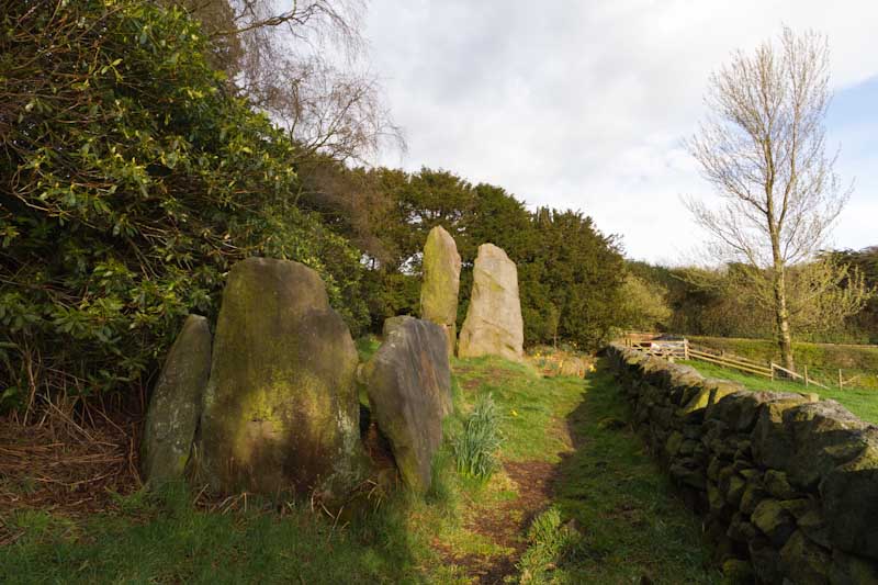
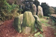
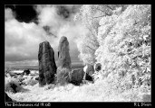
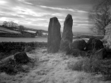
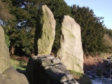
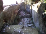
The stones that have survived are now fenced off in the corner of a field, surrounded by yews, rhododendrons and conifers and overgrown with bracken in the summer. The site is in desperate need of attention and recognition.
For more information see Historic England List ID 1011115 and Pastscape Monument No. 78118. The Journal of Antiquities also features a page for this chambered tomb - see their entry for The Bridestones, Timbersbrook, Cheshire.
Note: Many thanks to Doug Pickford and Kevin Kilburn for these exclusive archive photos of the 1936 excavation
You may be viewing yesterday's version of this page. To see the most up to date information please register for a free account.






These are just the first 25 photos of The Bridestones (Cheshire). If you log in with a free user account you will be able to see our entire collection.
Do not use the above information on other web sites or publications without permission of the contributor.
Click here to see more info for this site
Nearby sites
Key: Red: member's photo, Blue: 3rd party photo, Yellow: other image, Green: no photo - please go there and take one, Grey: site destroyed
Download sites to:
KML (Google Earth)
GPX (GPS waypoints)
CSV (Garmin/Navman)
CSV (Excel)
To unlock full downloads you need to sign up as a Contributory Member. Otherwise downloads are limited to 50 sites.
Turn off the page maps and other distractions
Nearby sites listing. In the following links * = Image available
1.2km N 0° Bosley Cloud (2)* Standing Stone (Menhir) (SJ906634)
1.4km N 356° Bosley Cloud (1)* Standing Stone (Menhir) (SJ905636)
2.0km SSW 209° Shepherd's Cross* Standing Stone (Menhir) (SJ89626042)
2.8km E 93° Satan's Stone* Natural Stone / Erratic / Other Natural Feature (SJ93406206)
3.5km E 89° St Helen's Well (Rushton Spencer)* Holy Well or Sacred Spring (SJ94076222)
4.7km W 279° Congleton Museum* Museum (SJ859629)
4.9km NE 42° Bosley Minn 1* Standing Stone (Menhir) (SJ93886585)
4.9km E 82° Heaton Low* Round Barrow(s) (SJ955629)
5.1km NE 42° Bosley Minn 2 & 3* Standing Stones (SJ940660)
5.3km NE 40° Bosley Minn 4 & 5* Standing Stones (SJ940662)
5.9km W 263° St Marys (Astbury)* Ancient Cross (SJ847615)
5.9km SSW 205° Red Cross* Ancient Cross (SJ881568)
6.1km W 264° Astbury Churchyard* Round Barrow(s) (SJ845616)
6.4km E 99° Gun Hill Standing Stone* Standing Stone (Menhir) (SJ969612)
6.7km S 186° Gawton's Well* Holy Well or Sacred Spring (SJ89825555)
6.7km ENE 59° Bartomley Farm* Long Barrow (SJ964656)
6.8km S 186° Gawton's Stone* Modern Stone Circle etc (SJ898554)
6.9km NE 41° Clulow Cross* Round Barrow(s) (SJ952674)
7.1km NE 43° Longgutter* Round Barrow(s) (SJ955674)
7.4km NE 42° Bullstones* Stone Circle (SJ9556867627)
7.5km N 7° Woodhouse End* Round Barrow(s) (SJ915696)
7.5km N 11° Gawsworth henge* Henge (SJ920696)
7.6km NE 55° Allgreave* Standing Stone (Menhir) (SJ969665)
7.7km W 279° Loachbrook Farm* Long Barrow (SJ830634)
7.9km N 11° Broad Oak Farm* Round Barrow(s) (SJ921699)
View more nearby sites and additional images


 We would like to know more about this location. Please feel free to add a brief description and any relevant information in your own language.
 Wir möchten mehr über diese Stätte erfahren. Bitte zögern Sie nicht, eine kurze Beschreibung und relevante Informationen in Deutsch hinzuzufügen.
 Nous aimerions en savoir encore un peu sur les lieux. S'il vous plaît n'hesitez pas à ajouter une courte description et tous les renseignements pertinents dans votre propre langue.
 Quisieramos informarnos un poco más de las lugares. No dude en añadir una breve descripción y otros datos relevantes en su propio idioma.