


<< Our Photo Pages >> Gawton's Stone - Modern Stone Circle etc in England in Staffordshire
Submitted by Sunny100 on Wednesday, 12 May 2010 Page Views: 17075
Modern SitesSite Name: Gawton's Stone Alternative Name: Gawton's Dolmen, The Healing StoneCountry: England County: Staffordshire Type: Modern Stone Circle etc
Nearest Town: Biddulph Nearest Village: Knypersley
Map Ref: SJ898554
Latitude: 53.095705N Longitude: 2.153774W
Condition:
| 5 | Perfect |
| 4 | Almost Perfect |
| 3 | Reasonable but with some damage |
| 2 | Ruined but still recognisable as an ancient site |
| 1 | Pretty much destroyed, possibly visible as crop marks |
| 0 | No data. |
| -1 | Completely destroyed |
| 5 | Superb |
| 4 | Good |
| 3 | Ordinary |
| 2 | Not Good |
| 1 | Awful |
| 0 | No data. |
| 5 | Can be driven to, probably with disabled access |
| 4 | Short walk on a footpath |
| 3 | Requiring a bit more of a walk |
| 2 | A long walk |
| 1 | In the middle of nowhere, a nightmare to find |
| 0 | No data. |
| 5 | co-ordinates taken by GPS or official recorded co-ordinates |
| 4 | co-ordinates scaled from a detailed map |
| 3 | co-ordinates scaled from a bad map |
| 2 | co-ordinates of the nearest village |
| 1 | co-ordinates of the nearest town |
| 0 | no data |
Internal Links:
External Links:
I have visited· I would like to visit
elad13 visited on 21st Oct 2023 - their rating: Cond: 4 Amb: 5 Access: 3
Mountainharry visited on 18th Dec 2021 - their rating: Cond: 5 Amb: 4 Access: 4
Ballhc visited on 16th Mar 2015 - their rating: Cond: 4 Amb: 3 Access: 3
BrownEdger visited on 9th Jun 2011 - their rating: Cond: 3 Amb: 3
Average ratings for this site from all visit loggers: Condition: 4 Ambience: 3.75 Access: 3.33
")
It has been regarded as a sacred healing stone. Long ago it may have been used by a hermit because at one end of the massive dolmen there is a cave like recess. There is evidence that a hermit was cured at the nearby Gawton's Well, so he may well have used the stone for prayer and shelter. The name Gawton may allude to a member of the Biddulph family who lived at nearby Biddulph Grange. Local people claim the stone has magical powers and when touched it exudes energy - a kind of magnetic field.
Close by is Gawton's Well and also a Druids' Grove, a collection of recumbant stones that are also known to be sacred. They probably date back to the Dark Ages, if not before that. Other curious stones can be found here, one may be part of an ancient cross. All in all, a very interesting site to explore at leisure if you are not to bothered about a long walk in the country!
You may be viewing yesterday's version of this page. To see the most up to date information please register for a free account.
")
")
Do not use the above information on other web sites or publications without permission of the contributor.
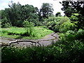
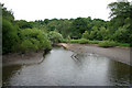
Nearby Images from Geograph Britain and Ireland:
©2011(licence)

©2011(licence)
©2011(licence)
©2008(licence)

©2011(licence)
The above images may not be of the site on this page, they are loaded from Geograph.
Please Submit an Image of this site or go out and take one for us!
Click here to see more info for this site
Nearby sites
Key: Red: member's photo, Blue: 3rd party photo, Yellow: other image, Green: no photo - please go there and take one, Grey: site destroyed
Download sites to:
KML (Google Earth)
GPX (GPS waypoints)
CSV (Garmin/Navman)
CSV (Excel)
To unlock full downloads you need to sign up as a Contributory Member. Otherwise downloads are limited to 50 sites.
Turn off the page maps and other distractions
Nearby sites listing. In the following links * = Image available
151m N 7° Gawton's Well* Holy Well or Sacred Spring (SJ89825555)
2.2km NW 309° Red Cross* Ancient Cross (SJ881568)
5.0km SW 222° Tunstall Park* Natural Stone / Erratic / Other Natural Feature (SJ865517)
5.0km N 358° Shepherd's Cross* Standing Stone (Menhir) (SJ89626042)
6.8km N 6° The Bridestones (Cheshire)* Chambered Tomb (SJ9058962190)
7.5km WNW 298° Little Moreton Hall* Round Barrow(s) (SJ832589)
7.5km S 191° Hanley Stone Circle* Modern Stone Circle etc (SJ884480)
7.6km NNE 28° Satan's Stone* Natural Stone / Erratic / Other Natural Feature (SJ93406206)
7.6km W 272° All Saints (Church Lawton)* Artificial Mound (SJ82165573)
7.9km NW 320° St Marys (Astbury)* Ancient Cross (SJ847615)
8.0km N 6° Bosley Cloud (2)* Standing Stone (Menhir) (SJ906634)
8.0km NNE 32° St Helen's Well (Rushton Spencer)* Holy Well or Sacred Spring (SJ94076222)
8.1km E 83° Cock Low (Leek)* Round Barrow(s) (SJ9783656426)
8.1km NW 319° Astbury Churchyard* Round Barrow(s) (SJ845616)
8.2km N 5° Bosley Cloud (1)* Standing Stone (Menhir) (SJ905636)
8.3km SSW 191° Potteries Museum & Art Gallery* Museum (SJ8815147308)
8.4km NNW 332° Congleton Museum* Museum (SJ859629)
8.6km E 82° St Edward the Confessor* Ancient Cross (SJ9831956617)
8.8km E 82° Nicholson Museum and Art Gallery* Museum (SJ985566)
8.9km W 273° Church Lawton Barrows* Barrow Cemetery (SJ809559)
8.9km E 86° Lady Well (Leek)* Holy Well or Sacred Spring (SJ9871455940)
9.0km W 272° Church Lawton South* Stone Circle (SJ808557)
9.2km NE 51° Gun Hill Standing Stone* Standing Stone (Menhir) (SJ969612)
9.2km ENE 69° Nine Pins* Stone Circle (SJ984587)
9.4km NE 37° Heaton Low* Round Barrow(s) (SJ955629)
View more nearby sites and additional images


 We would like to know more about this location. Please feel free to add a brief description and any relevant information in your own language.
 Wir möchten mehr über diese Stätte erfahren. Bitte zögern Sie nicht, eine kurze Beschreibung und relevante Informationen in Deutsch hinzuzufügen.
 Nous aimerions en savoir encore un peu sur les lieux. S'il vous plaît n'hesitez pas à ajouter une courte description et tous les renseignements pertinents dans votre propre langue.
 Quisieramos informarnos un poco más de las lugares. No dude en añadir una breve descripción y otros datos relevantes en su propio idioma.