<< Our Photo Pages >> Ferneybrae - Standing Stone (Menhir) in Scotland in Aberdeenshire
Submitted by cosmic on Sunday, 17 July 2005 Page Views: 4644
Neolithic and Bronze AgeSite Name: FerneybraeCountry: Scotland
NOTE: This site is 0.6 km away from the location you searched for.
County: Aberdeenshire Type: Standing Stone (Menhir)
Nearest Village: Kintore
Map Ref: NJ80211459
Latitude: 57.221623N Longitude: 2.329354W
Condition:
| 5 | Perfect |
| 4 | Almost Perfect |
| 3 | Reasonable but with some damage |
| 2 | Ruined but still recognisable as an ancient site |
| 1 | Pretty much destroyed, possibly visible as crop marks |
| 0 | No data. |
| -1 | Completely destroyed |
| 5 | Superb |
| 4 | Good |
| 3 | Ordinary |
| 2 | Not Good |
| 1 | Awful |
| 0 | No data. |
| 5 | Can be driven to, probably with disabled access |
| 4 | Short walk on a footpath |
| 3 | Requiring a bit more of a walk |
| 2 | A long walk |
| 1 | In the middle of nowhere, a nightmare to find |
| 0 | No data. |
| 5 | co-ordinates taken by GPS or official recorded co-ordinates |
| 4 | co-ordinates scaled from a detailed map |
| 3 | co-ordinates scaled from a bad map |
| 2 | co-ordinates of the nearest village |
| 1 | co-ordinates of the nearest town |
| 0 | no data |
Internal Links:
External Links:
")
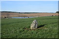
In a field just to the North of the new bungalow of the same name is this small standing stone just over a metre high. There were Highland Cows in the field so I didn't venture in!
You may be viewing yesterday's version of this page. To see the most up to date information please register for a free account.
")
")
Do not use the above information on other web sites or publications without permission of the contributor.
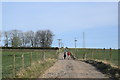
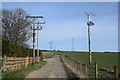
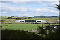
Nearby Images from Geograph Britain and Ireland:
©2020(licence)

©2020(licence)
©2020(licence)
©2020(licence)
©2020(licence)
The above images may not be of the site on this page, they are loaded from Geograph.
Please Submit an Image of this site or go out and take one for us!
Click here to see more info for this site
Nearby sites
Key: Red: member's photo, Blue: 3rd party photo, Yellow: other image, Green: no photo - please go there and take one, Grey: site destroyed
Download sites to:
KML (Google Earth)
GPX (GPS waypoints)
CSV (Garmin/Navman)
CSV (Excel)
To unlock full downloads you need to sign up as a Contributory Member. Otherwise downloads are limited to 50 sites.
Turn off the page maps and other distractions
Nearby sites listing. In the following links * = Image available
872m NW 305° Midmill Chambered Cairn (NJ795151)
1.1km NW 319° Tuack* Stone Circle (NJ795154)
1.6km ESE 116° Cairntradlin* Standing Stone (Menhir) (NJ81681385)
1.9km E 95° Kinellar Pictish Symbol Stone* Class I Pictish Symbol Stone (NJ821144)
1.9km NNW 331° Kintore 1* Class I Pictish Symbol Stone (NJ79301628)
2.0km E 95° Kinellar Churchyard* Stone Circle (NJ82161440)
2.0km NW 323° Kintore 4 Class I Pictish Symbol Stone (NJ790162)
2.1km SE 142° Newton of Lewesk* Class I Pictish Symbol Stone (NJ815129)
3.3km E 80° Gouk Stone* Standing Stone (Menhir) (NJ8344815171)
3.3km NNE 17° Greenlands* Ancient Village or Settlement (NJ81231778)
3.4km NNW 330° Cairnhall Stone Circle (NJ78501759)
3.7km NW 305° Ratch-hill Ancient Village or Settlement (NJ772167)
3.7km ENE 62° Mill of Fintray Cursus Multiple Stone Rows / Avenue (NJ835163)
3.8km WSW 249° South Ley Lodge* Stone Circle (NJ76681326)
3.8km ENE 62° Fintray Cursus Cursus (NJ83571633)
3.8km NNW 332° Fullerton* Stone Circle (NJ7839517969)
3.9km E 93° The Slacks* Cairn (NJ841144)
4.1km ENE 68° Donald's Hillock* Cairn (NJ84001609)
4.2km SSW 208° South Fornet* Stone Circle (NJ782109)
4.3km WSW 253° The Knock (Leylodge)* Standing Stone (Menhir) (NJ7611813345)
4.4km SSE 152° Tertowie* Standing Stone (Menhir) (NJ823107)
4.6km S 180° Drum Stone* Natural Stone / Erratic / Other Natural Feature (NJ802100)
4.9km NNE 23° Peathill* Standing Stone (Menhir) (NJ8210419068)
4.9km SW 224° Breemie Stones* Modern Stone Circle etc (NJ768111)
5.0km S 182° Drumstone Ring Ditch Ancient Village or Settlement (NJ800096)
View more nearby sites and additional images


 We would like to know more about this location. Please feel free to add a brief description and any relevant information in your own language.
 Wir möchten mehr über diese Stätte erfahren. Bitte zögern Sie nicht, eine kurze Beschreibung und relevante Informationen in Deutsch hinzuzufügen.
 Nous aimerions en savoir encore un peu sur les lieux. S'il vous plaît n'hesitez pas à ajouter une courte description et tous les renseignements pertinents dans votre propre langue.
 Quisieramos informarnos un poco más de las lugares. No dude en añadir una breve descripción y otros datos relevantes en su propio idioma.