<< Our Photo Pages >> Law of Melrose - Cairn in Scotland in Aberdeenshire
Submitted by cosmic on Friday, 08 August 2008 Page Views: 4797
Neolithic and Bronze AgeSite Name: Law of Melrose Alternative Name: MelroseCountry: Scotland
NOTE: This site is 2.8 km away from the location you searched for.
County: Aberdeenshire Type: Cairn
Nearest Town: Macduff
Map Ref: NJ75666426
Latitude: 57.667556N Longitude: 2.409658W
Condition:
| 5 | Perfect |
| 4 | Almost Perfect |
| 3 | Reasonable but with some damage |
| 2 | Ruined but still recognisable as an ancient site |
| 1 | Pretty much destroyed, possibly visible as crop marks |
| 0 | No data. |
| -1 | Completely destroyed |
| 5 | Superb |
| 4 | Good |
| 3 | Ordinary |
| 2 | Not Good |
| 1 | Awful |
| 0 | No data. |
| 5 | Can be driven to, probably with disabled access |
| 4 | Short walk on a footpath |
| 3 | Requiring a bit more of a walk |
| 2 | A long walk |
| 1 | In the middle of nowhere, a nightmare to find |
| 0 | No data. |
| 5 | co-ordinates taken by GPS or official recorded co-ordinates |
| 4 | co-ordinates scaled from a detailed map |
| 3 | co-ordinates scaled from a bad map |
| 2 | co-ordinates of the nearest village |
| 1 | co-ordinates of the nearest town |
| 0 | no data |
Internal Links:
External Links:
")
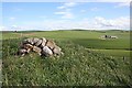
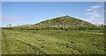
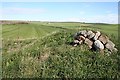
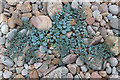
Again crops prevented access, this being obvious from Cairn Lee from where I should have tried a long distance photograph.
You may be viewing yesterday's version of this page. To see the most up to date information please register for a free account.
Do not use the above information on other web sites or publications without permission of the contributor.
coldrum has found this location on Google Street View:
Nearby Images from Geograph Britain and Ireland:
©2007(licence)
©2007(licence)
©2007(licence)
©2012(licence)
©2022(licence)
The above images may not be of the site on this page, they are loaded from Geograph.
Please Submit an Image of this site or go out and take one for us!
Click here to see more info for this site
Nearby sites
Key: Red: member's photo, Blue: 3rd party photo, Yellow: other image, Green: no photo - please go there and take one, Grey: site destroyed
Download sites to:
KML (Google Earth)
GPX (GPS waypoints)
CSV (Garmin/Navman)
CSV (Excel)
To unlock full downloads you need to sign up as a Contributory Member. Otherwise downloads are limited to 50 sites.
Turn off the page maps and other distractions
Nearby sites listing. In the following links * = Image available
1.5km SSW 200° Cairn Lee* Cairn (NJ75136284)
3.0km SW 220° Longmanhill Cairn Long Barrow (NJ73726200)
3.7km E 91° Castle of Findon Hillfort (NJ794642)
5.4km S 189° Law of Balgreen* Cairn (NJ74815887)
6.4km WSW 258° Gavenie Braes* Stone Circle (NJ69386293)
6.9km SE 144° Gray Stone (Clochforbie)* Stone Circle (NJ79685863)
7.8km W 264° Lusy Law* Cairn (NJ67866346)
8.0km SW 216° King Edward Class I Pictish Symbol Stone (NJ70925776)
8.3km ENE 76° Cullykhan * Promontory Fort / Cliff Castle (NJ83756618)
8.3km E 93° Litterty Hill* Cairn (NJ840638)
8.7km E 93° Cummerton Cairn (NJ844638)
9.0km ESE 108° Strath Howe Hillfort (NJ842614)
9.0km ESE 112° Glenhouses Hut Circles Ancient Village or Settlement (NJ840608)
9.3km WSW 243° Stirling Cairn* Cairn (NJ67296015)
9.5km WSW 248° St Colme's Well* Holy Well or Sacred Spring (NJ668607)
11.4km SSW 209° Boghead Souterrain Souterrain (Fogou, Earth House) (NJ701543)
11.5km SE 134° Upper Auchnagorth* Stone Circle (NJ8391156272)
12.0km SW 219° Newton Of Montblairy Stone Circle (NJ680550)
12.3km SW 220° North Burreldales* Stone Circle (NJ6759054916)
12.5km E 87° Mess John's Well Holy Well or Sacred Spring (NJ882648)
13.0km E 88° St Drostan's Well* Holy Well or Sacred Spring (NJ887646)
13.3km SSW 203° Haughs of Ashogle Ancient Village or Settlement (NJ703521)
13.5km ESE 112° Law Cairn* Cairn (NJ88205911)
13.8km E 87° Dundarg Castle* Hillfort (NJ895648)
14.7km SSW 193° Turriff* Class I Pictish Symbol Stone (NJ72304991)
View more nearby sites and additional images


 We would like to know more about this location. Please feel free to add a brief description and any relevant information in your own language.
 Wir möchten mehr über diese Stätte erfahren. Bitte zögern Sie nicht, eine kurze Beschreibung und relevante Informationen in Deutsch hinzuzufügen.
 Nous aimerions en savoir encore un peu sur les lieux. S'il vous plaît n'hesitez pas à ajouter une courte description et tous les renseignements pertinents dans votre propre langue.
 Quisieramos informarnos un poco más de las lugares. No dude en añadir una breve descripción y otros datos relevantes en su propio idioma.