


<< Our Photo Pages >> Cairn Lee - Cairn in Scotland in Aberdeenshire
Submitted by cosmic on Friday, 08 August 2008 Page Views: 8298
Neolithic and Bronze AgeSite Name: Cairn LeeCountry: Scotland County: Aberdeenshire Type: Cairn
Nearest Town: Macduff
Map Ref: NJ75136284
Latitude: 57.654772N Longitude: 2.418395W
Condition:
| 5 | Perfect |
| 4 | Almost Perfect |
| 3 | Reasonable but with some damage |
| 2 | Ruined but still recognisable as an ancient site |
| 1 | Pretty much destroyed, possibly visible as crop marks |
| 0 | No data. |
| -1 | Completely destroyed |
| 5 | Superb |
| 4 | Good |
| 3 | Ordinary |
| 2 | Not Good |
| 1 | Awful |
| 0 | No data. |
| 5 | Can be driven to, probably with disabled access |
| 4 | Short walk on a footpath |
| 3 | Requiring a bit more of a walk |
| 2 | A long walk |
| 1 | In the middle of nowhere, a nightmare to find |
| 0 | No data. |
| 5 | co-ordinates taken by GPS or official recorded co-ordinates |
| 4 | co-ordinates scaled from a detailed map |
| 3 | co-ordinates scaled from a bad map |
| 2 | co-ordinates of the nearest village |
| 1 | co-ordinates of the nearest town |
| 0 | no data |
Internal Links:
External Links:
")
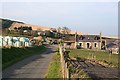
In 1869 the Ordnance Survey described there having been a large pile of stone which according to Canmore in 1965 had shrunk to the vestiges of a cairn on the highest point of the hill.
Anything that remains is now either buried in the gorse or is being used as a foundation for the radio mast and associated hut.
You may be viewing yesterday's version of this page. To see the most up to date information please register for a free account.
")
Do not use the above information on other web sites or publications without permission of the contributor.
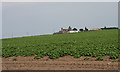
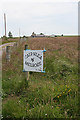
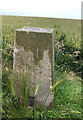
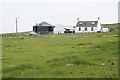
Nearby Images from Geograph Britain and Ireland:
©2012(licence)
©2012(licence)
©2021(licence)
©2012(licence)
©2007(licence)
The above images may not be of the site on this page, they are loaded from Geograph.
Please Submit an Image of this site or go out and take one for us!
Click here to see more info for this site
Nearby sites
Key: Red: member's photo, Blue: 3rd party photo, Yellow: other image, Green: no photo - please go there and take one, Grey: site destroyed
Download sites to:
KML (Google Earth)
GPX (GPS waypoints)
CSV (Garmin/Navman)
CSV (Excel)
To unlock full downloads you need to sign up as a Contributory Member. Otherwise downloads are limited to 50 sites.
Turn off the page maps and other distractions
Nearby sites listing. In the following links * = Image available
1.5km NNE 20° Law of Melrose* Cairn (NJ75666426)
1.6km WSW 239° Longmanhill Cairn Long Barrow (NJ73726200)
4.0km S 184° Law of Balgreen* Cairn (NJ74815887)
4.5km ENE 72° Castle of Findon Hillfort (NJ794642)
5.7km W 271° Gavenie Braes* Stone Circle (NJ69386293)
6.2km SE 132° Gray Stone (Clochforbie)* Stone Circle (NJ79685863)
6.6km SW 219° King Edward Class I Pictish Symbol Stone (NJ70925776)
7.3km W 275° Lusy Law* Cairn (NJ67866346)
8.3km WSW 251° Stirling Cairn* Cairn (NJ67296015)
8.6km WSW 255° St Colme's Well* Holy Well or Sacred Spring (NJ668607)
8.9km E 83° Litterty Hill* Cairn (NJ840638)
9.1km ESE 103° Glenhouses Hut Circles Ancient Village or Settlement (NJ840608)
9.2km E 99° Strath Howe Hillfort (NJ842614)
9.2km ENE 68° Cullykhan * Promontory Fort / Cliff Castle (NJ83756618)
9.3km E 84° Cummerton Cairn (NJ844638)
9.9km SSW 210° Boghead Souterrain Souterrain (Fogou, Earth House) (NJ701543)
10.6km SW 222° Newton Of Montblairy Stone Circle (NJ680550)
10.9km SW 223° North Burreldales* Stone Circle (NJ6759054916)
10.9km SE 126° Upper Auchnagorth* Stone Circle (NJ8391156272)
11.8km SSW 204° Haughs of Ashogle Ancient Village or Settlement (NJ703521)
13.2km E 81° Mess John's Well Holy Well or Sacred Spring (NJ882648)
13.2km SSW 192° Turriff* Class I Pictish Symbol Stone (NJ72304991)
13.4km SSW 199° Boat of Muiresk Ancient Village or Settlement (NJ707502)
13.6km ESE 106° Law Cairn* Cairn (NJ88205911)
13.6km E 82° St Drostan's Well* Holy Well or Sacred Spring (NJ887646)
View more nearby sites and additional images


 We would like to know more about this location. Please feel free to add a brief description and any relevant information in your own language.
 Wir möchten mehr über diese Stätte erfahren. Bitte zögern Sie nicht, eine kurze Beschreibung und relevante Informationen in Deutsch hinzuzufügen.
 Nous aimerions en savoir encore un peu sur les lieux. S'il vous plaît n'hesitez pas à ajouter une courte description et tous les renseignements pertinents dans votre propre langue.
 Quisieramos informarnos un poco más de las lugares. No dude en añadir una breve descripción y otros datos relevantes en su propio idioma.