<< Our Photo Pages >> Leacet Hill - Cairn in England in Cumbria
Submitted by stu on Saturday, 17 July 2004 Page Views: 6451
Neolithic and Bronze AgeSite Name: Leacet HillCountry: England County: Cumbria Type: Cairn
Map Ref: NY563263 Landranger Map Number: 90
Latitude: 54.629928N Longitude: 2.678434W
Condition:
| 5 | Perfect |
| 4 | Almost Perfect |
| 3 | Reasonable but with some damage |
| 2 | Ruined but still recognisable as an ancient site |
| 1 | Pretty much destroyed, possibly visible as crop marks |
| 0 | No data. |
| -1 | Completely destroyed |
| 5 | Superb |
| 4 | Good |
| 3 | Ordinary |
| 2 | Not Good |
| 1 | Awful |
| 0 | No data. |
| 5 | Can be driven to, probably with disabled access |
| 4 | Short walk on a footpath |
| 3 | Requiring a bit more of a walk |
| 2 | A long walk |
| 1 | In the middle of nowhere, a nightmare to find |
| 0 | No data. |
| 5 | co-ordinates taken by GPS or official recorded co-ordinates |
| 4 | co-ordinates scaled from a detailed map |
| 3 | co-ordinates scaled from a bad map |
| 2 | co-ordinates of the nearest village |
| 1 | co-ordinates of the nearest town |
| 0 | no data |
Internal Links:
External Links:
")
Penrith 135 m a.s.l. (This is a cairn circle, or was before it was chopped in half by forestation. 5-7 stones remain in this stone/kerb circle.
You may be viewing yesterday's version of this page. To see the most up to date information please register for a free account.
")
")
")
")
Do not use the above information on other web sites or publications without permission of the contributor.
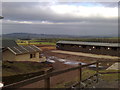
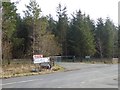
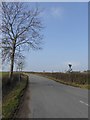
Nearby Images from Geograph Britain and Ireland:

©2018(licence)

©2009(licence)
©2008(licence)
©2015(licence)
©2015(licence)
The above images may not be of the site on this page, they are loaded from Geograph.
Please Submit an Image of this site or go out and take one for us!
Click here to see more info for this site
Nearby sites
Key: Red: member's photo, Blue: 3rd party photo, Yellow: other image, Green: no photo - please go there and take one, Grey: site destroyed
Download sites to:
KML (Google Earth)
GPX (GPS waypoints)
CSV (Garmin/Navman)
CSV (Excel)
To unlock full downloads you need to sign up as a Contributory Member. Otherwise downloads are limited to 50 sites.
Turn off the page maps and other distractions
Nearby sites listing. In the following links * = Image available
2.7km W 270° St Cuthbert's Well (Clifton)* Holy Well or Sacred Spring (NY5359326336)
3.2km W 263° Clifton Stones* Standing Stones (NY53132593)
3.2km WNW 283° Clifton Cross* Ancient Cross (NY5319427036)
3.3km SW 232° Trainford Brow Long Barrow* Long Barrow (NY5369724313)
3.3km S 180° Low Well (Great Strickland)* Holy Well or Sacred Spring (NY56242302)
3.3km SW 233° Low Moor (Cumbria)* Long Barrow (NY53642431)
3.7km N 354° St Ninian's Church (Ninekirks)* Ancient Cross (NY5593629962)
3.7km N 356° St Ninian's Preconquest Monastery (Ninekirks)* Ancient Village or Settlement (NY5607129981)
3.8km W 272° Lowther Woodhouse Stone Row / Alignment (NY525265)
3.9km N 357° Giants Cave Holy Well (Edenhall)* Holy Well or Sacred Spring (NY5610030200)
4.0km N 356° Giant's Cave (Cumbria)* Cave or Rock Shelter (NY56093027)
4.3km NE 49° Winderwath Stone Circle* Stone Circle (NY5960729085)
4.3km WNW 295° Little Round Table* Henge (NY52382817)
4.5km WNW 297° King Arthur's Round Table* Henge (NY5232528374)
4.6km WSW 255° Castlesteads (Yanwath Wood)* Ancient Village or Settlement (NY5185725187)
4.6km WNW 291° Brougham Hall Stone Circle (NY520280)
4.6km WSW 256° Castlesteads (Tirril) Ancient Village or Settlement (NY518252)
4.8km WSW 247° St Michael (Lowther)* Ancient Cross (NY51902445)
4.9km WNW 295° Mayburgh* Henge (NY5191728428)
4.9km SE 135° Powdonnet Well (Morland)* Holy Well or Sacred Spring (NY5970722786)
4.9km WSW 243° Castlesteads (Lowther)* Misc. Earthwork (NY51892412)
5.4km NW 323° Dickey Bank Holy Well (Carleton Hill) Holy Well or Sacred Spring (NY5309030660)
5.4km NW 306° Plague Stone (Penrith)* Ancient Cross (NY5196329563)
5.7km E 88° Roman Milestone (Temple Sowerby)* Marker Stone (NY6199026444)
5.8km N 5° St. Cuthbert's Church (Edenhall)* Ancient Cross (NY5689832046)
View more nearby sites and additional images


 We would like to know more about this location. Please feel free to add a brief description and any relevant information in your own language.
 Wir möchten mehr über diese Stätte erfahren. Bitte zögern Sie nicht, eine kurze Beschreibung und relevante Informationen in Deutsch hinzuzufügen.
 Nous aimerions en savoir encore un peu sur les lieux. S'il vous plaît n'hesitez pas à ajouter une courte description et tous les renseignements pertinents dans votre propre langue.
 Quisieramos informarnos un poco más de las lugares. No dude en añadir una breve descripción y otros datos relevantes en su propio idioma.