


<< Our Photo Pages >> Trainford Brow Long Barrow - Long Barrow in England in Cumbria
Submitted by Anne T on Monday, 04 July 2016 Page Views: 2972
Neolithic and Bronze AgeSite Name: Trainford Brow Long Barrow Alternative Name: Lowther Long BarrowCountry: England County: Cumbria Type: Long Barrow
Nearest Town: Penrith Nearest Village: Lowther
Map Ref: NY5369724313
Latitude: 54.611840N Longitude: 2.718437W
Condition:
| 5 | Perfect |
| 4 | Almost Perfect |
| 3 | Reasonable but with some damage |
| 2 | Ruined but still recognisable as an ancient site |
| 1 | Pretty much destroyed, possibly visible as crop marks |
| 0 | No data. |
| -1 | Completely destroyed |
| 5 | Superb |
| 4 | Good |
| 3 | Ordinary |
| 2 | Not Good |
| 1 | Awful |
| 0 | No data. |
| 5 | Can be driven to, probably with disabled access |
| 4 | Short walk on a footpath |
| 3 | Requiring a bit more of a walk |
| 2 | A long walk |
| 1 | In the middle of nowhere, a nightmare to find |
| 0 | No data. |
| 5 | co-ordinates taken by GPS or official recorded co-ordinates |
| 4 | co-ordinates scaled from a detailed map |
| 3 | co-ordinates scaled from a bad map |
| 2 | co-ordinates of the nearest village |
| 1 | co-ordinates of the nearest town |
| 0 | no data |
Internal Links:
External Links:
")
Listed on the Historic England web site as Monument List Entry 1012825, this is apparently the only long barrow in this part of Cumbria.
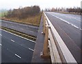
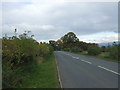
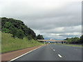
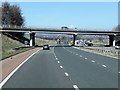
Situated immediately to the west of the A6, just south of Clifton and north of Hackthorpe, the barrow runs east-west along the northern side of the side-road leading to Newtown and Lowther Park. It is difficult to see that this is actually an ancient monument; hidden within a narrow strip of what appears to be unmanaged woodland, the ground rises sharply from the flat landscape around it.
Historic England give the measurements as 104 m long by 24 metres wide, varying between 3.5 metres and 1.5 metres in height.
The Ancient Monuments site (which gives the wrong grid reference for this monument) says it was first noted in 1933, when it was first identified as a long cairn. However, a 1984 report dismisses this as a spoil mound, which, having visited the site seems unlikely and is contradicted by the Historic England entry (see above).
You may be viewing yesterday's version of this page. To see the most up to date information please register for a free account.
")
")
")
Do not use the above information on other web sites or publications without permission of the contributor.
Nearby Images from Geograph Britain and Ireland:
©2005(licence)
©2016(licence)

©2019(licence)
©2012(licence)
©2014(licence)
The above images may not be of the site on this page, they are loaded from Geograph.
Please Submit an Image of this site or go out and take one for us!
Click here to see more info for this site
Nearby sites
Key: Red: member's photo, Blue: 3rd party photo, Yellow: other image, Green: no photo - please go there and take one, Grey: site destroyed
Download sites to:
KML (Google Earth)
GPX (GPS waypoints)
CSV (Garmin/Navman)
CSV (Excel)
To unlock full downloads you need to sign up as a Contributory Member. Otherwise downloads are limited to 50 sites.
Turn off the page maps and other distractions
Nearby sites listing. In the following links * = Image available
57m W 266° Low Moor (Cumbria)* Long Barrow (NY53642431)
1.7km NNW 340° Clifton Stones* Standing Stones (NY53132593)
1.8km W 274° St Michael (Lowther)* Ancient Cross (NY51902445)
1.8km W 263° Castlesteads (Lowther)* Misc. Earthwork (NY51892412)
2.0km N 356° St Cuthbert's Well (Clifton)* Holy Well or Sacred Spring (NY5359326336)
2.0km WNW 295° Castlesteads (Yanwath Wood)* Ancient Village or Settlement (NY5185725187)
2.1km WNW 295° Castlesteads (Tirril) Ancient Village or Settlement (NY518252)
2.5km NNW 331° Lowther Woodhouse Stone Row / Alignment (NY525265)
2.8km ESE 116° Low Well (Great Strickland)* Holy Well or Sacred Spring (NY56242302)
3.3km NE 52° Leacet Hill* Cairn (NY563263)
3.4km SW 228° Mark's Well (Helton)* Holy Well or Sacred Spring (NY5114222090)
3.9km WSW 254° Skirsgill Hill* Ancient Village or Settlement (NY4990923267)
4.1km NNW 335° Brougham Hall Stone Circle (NY520280)
4.1km NNW 341° Little Round Table* Henge (NY52382817)
4.3km NNW 341° King Arthur's Round Table* Henge (NY5232528374)
4.5km NNW 336° Mayburgh* Henge (NY5191728428)
4.6km WSW 251° Riddingleys Top* Cairn (NY49332289)
4.6km WSW 250° Hag Stones (Moor Divock) Misc. Earthwork (NY493228)
4.8km WSW 239° Askham Fell Round Cairn B Round Cairn (NY4956621935)
4.8km WSW 239° Askham Fell Round Cairn A Round Cairn (NY4958021879)
4.9km WSW 243° Moor Divock Round Cairn C Cairn (NY4933022158)
4.9km WSW 244° Moor Divock Round Cairn D* Cairn (NY4929822204)
4.9km WSW 244° Moor Divock 5* Cairn (NY4930322183)
4.9km WSW 242° Moor Divock 4 to 5 Stone Avenue Stone Row / Alignment (NY4937322033)
4.9km WSW 241° Moor Divock 4* Stone Circle (NY49402196)
View more nearby sites and additional images


 We would like to know more about this location. Please feel free to add a brief description and any relevant information in your own language.
 Wir möchten mehr über diese Stätte erfahren. Bitte zögern Sie nicht, eine kurze Beschreibung und relevante Informationen in Deutsch hinzuzufügen.
 Nous aimerions en savoir encore un peu sur les lieux. S'il vous plaît n'hesitez pas à ajouter une courte description et tous les renseignements pertinents dans votre propre langue.
 Quisieramos informarnos un poco más de las lugares. No dude en añadir una breve descripción y otros datos relevantes en su propio idioma.