<< Our Photo Pages >> King Arthur's Round Table - Henge in England in Cumbria
Submitted by vicky on Monday, 14 October 2002 Page Views: 24300
Neolithic and Bronze AgeSite Name: King Arthur's Round TableCountry: England County: Cumbria Type: Henge
Nearest Town: Penrith Nearest Village: Eamont Bridge
Map Ref: NY5232528374 Landranger Map Number: 90
Latitude: 54.648204N Longitude: 2.74034W
Condition:
| 5 | Perfect |
| 4 | Almost Perfect |
| 3 | Reasonable but with some damage |
| 2 | Ruined but still recognisable as an ancient site |
| 1 | Pretty much destroyed, possibly visible as crop marks |
| 0 | No data. |
| -1 | Completely destroyed |
| 5 | Superb |
| 4 | Good |
| 3 | Ordinary |
| 2 | Not Good |
| 1 | Awful |
| 0 | No data. |
| 5 | Can be driven to, probably with disabled access |
| 4 | Short walk on a footpath |
| 3 | Requiring a bit more of a walk |
| 2 | A long walk |
| 1 | In the middle of nowhere, a nightmare to find |
| 0 | No data. |
| 5 | co-ordinates taken by GPS or official recorded co-ordinates |
| 4 | co-ordinates scaled from a detailed map |
| 3 | co-ordinates scaled from a bad map |
| 2 | co-ordinates of the nearest village |
| 1 | co-ordinates of the nearest town |
| 0 | no data |
Internal Links:
External Links:
I have visited· I would like to visit
Modern-Neolithic MikeyB eirrac5 radrad would like to visit
rvbaker2003 visited on 30th Dec 2024 - their rating: Cond: 3 Amb: 3 Access: 4
Chappers60 visited on 9th Aug 2024 - their rating: Cond: 2 Amb: 3 Access: 4
stolinskie visited on 1st Jan 2023 - their rating: Cond: 2 Amb: 2 Access: 4
TheCaptain visited on 20th Sep 2022 - their rating: Cond: 3 Amb: 2 Access: 5 From Mayburgh I walk to King Arthur's Round Table, and then pop into its field for a walk around the outside. Much smaller, and more henge like than the nearby Mayburgh, this has the ditch well inside the outer bank. Unfortunately, being so close to the busy roads, it suffers a fair bit in the ambience stakes.
drolaf visited on 18th Sep 2021 - their rating: Cond: 3 Amb: 3 Access: 4 similar in form to the ure henges
Hodur visited on 30th Sep 2018 - their rating: Cond: 2 Amb: 2 Access: 5
Anne T visited on 5th Apr 2018 - their rating: Cond: 3 Amb: 4 Access: 5 King Arthur's Round Table Henge, Eamont Bridge: We tried to stop here on the way down to Langwathby, but the traffic was so dense and moving in so many different directions at the traffic lights, we decided to try when it was quieter. Thankfully, we managed to park in the layby opposite on the way back and let ourselves in through the kissing gate by the western side of the A66.
The scale of this monument is huge, and we walked all around its outer bank, trying to photograph the whole. Well worth stopping off and taking a look.
I didn't realise until I got home and was looking up information that there is a Little Round Table henge at NY 52387 28180.
kthdsn visited on 18th Feb 2014 - their rating: Cond: 2 Amb: 3 Access: 5
Richard13 visited on 1st Mar 2005 - their rating: Cond: 3 Amb: 3 Access: 5
FrothNinja visited - their rating: Cond: 2 Amb: 3 Access: 5
Andy B: would like to visit No 7. in Kenny Brophy's Top Ten Urban Prehistory site selections, compiled for our Old Stones book.
Humbucker DrewParsons h_fenton rldixon kelpie have visited here
Average ratings for this site from all visit loggers: Condition: 2.5 Ambience: 2.8 Access: 4.6

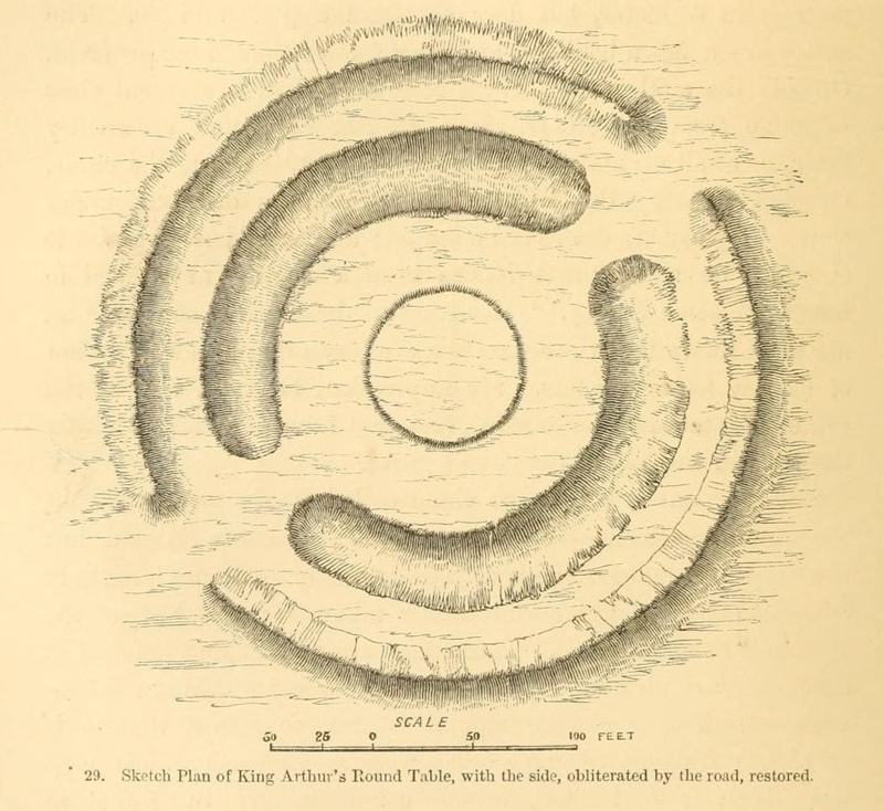
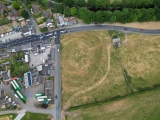
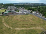
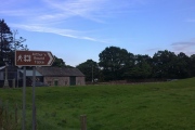
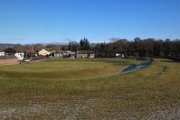
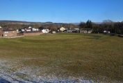
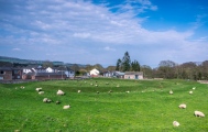
This henge which was damaged in the 19th century when someone tried to turn it into a garden and cut in half by the road, is approximately 90m in diameter and located close to Mayburgh and the M6. A report from the 17th century records that two stones once stood outside the northern entrance (now under the road).
For more information see Pastscape Monument No 11978 and Historic England List ID 1007903. The Journal of Antiquities also includes information for this site in their page for Mayburgh Henge, Eamont Bridge, Cumbria.
You may be viewing yesterday's version of this page. To see the most up to date information please register for a free account.












These are just the first 25 photos of King Arthur's Round Table. If you log in with a free user account you will be able to see our entire collection.
Do not use the above information on other web sites or publications without permission of the contributor.
Click here to see more info for this site
Nearby sites
Key: Red: member's photo, Blue: 3rd party photo, Yellow: other image, Green: no photo - please go there and take one, Grey: site destroyed
Download sites to:
KML (Google Earth)
GPX (GPS waypoints)
CSV (Garmin/Navman)
CSV (Excel)
To unlock full downloads you need to sign up as a Contributory Member. Otherwise downloads are limited to 50 sites.
Turn off the page maps and other distractions
Nearby sites listing. In the following links * = Image available
211m SSE 164° Little Round Table* Henge (NY52382817)
410m W 277° Mayburgh* Henge (NY5191728428)
495m SW 220° Brougham Hall Stone Circle (NY520280)
1.2km NNW 342° Plague Stone (Penrith)* Ancient Cross (NY5196329563)
1.4km W 277° Skirsgill Holy Well (Skirsgill) Holy Well or Sacred Spring (NY5095028560)
1.4km WNW 285° Skirsgill Standing Stone* Standing Stone (Menhir) (NY50972875)
1.6km SSE 146° Clifton Cross* Ancient Cross (NY5319427036)
1.9km S 174° Lowther Woodhouse Stone Row / Alignment (NY525265)
1.9km NNW 339° Giants Grave, Penrith* Ancient Cross (NY51653017)
2.1km NNW 335° Penrith Museum* Museum (NY5144830339)
2.2km WSW 253° Redhills Rock Art* Rock Art (NY50192776)
2.4km SSE 148° St Cuthbert's Well (Clifton)* Holy Well or Sacred Spring (NY5359326336)
2.4km NNE 18° Dickey Bank Holy Well (Carleton Hill) Holy Well or Sacred Spring (NY5309030660)
2.5km WNW 287° Bell Mount* Natural Stone / Erratic / Other Natural Feature (NY49932914)
2.6km SSE 161° Clifton Stones* Standing Stones (NY53132593)
3.0km WSW 257° Dacre Parish* Stone Circle (NY49342771)
3.2km S 189° Castlesteads (Tirril) Ancient Village or Settlement (NY518252)
3.2km S 188° Castlesteads (Yanwath Wood)* Ancient Village or Settlement (NY5185725187)
3.5km WSW 254° Snuff Mill (Stainton)* Standing Stone (Menhir) (NY4890927405)
3.8km WNW 294° Sewborrans Stone* Standing Stone (Menhir) (NY48842999)
3.9km ENE 66° St Ninian's Church (Ninekirks)* Ancient Cross (NY5593629962)
3.9km S 186° St Michael (Lowther)* Ancient Cross (NY51902445)
4.1km ENE 66° St Ninian's Preconquest Monastery (Ninekirks)* Ancient Village or Settlement (NY5607129981)
4.2km ENE 64° Giants Cave Holy Well (Edenhall)* Holy Well or Sacred Spring (NY5610030200)
4.2km ENE 63° Giant's Cave (Cumbria)* Cave or Rock Shelter (NY56093027)
View more nearby sites and additional images


 We would like to know more about this location. Please feel free to add a brief description and any relevant information in your own language.
 Wir möchten mehr über diese Stätte erfahren. Bitte zögern Sie nicht, eine kurze Beschreibung und relevante Informationen in Deutsch hinzuzufügen.
 Nous aimerions en savoir encore un peu sur les lieux. S'il vous plaît n'hesitez pas à ajouter une courte description et tous les renseignements pertinents dans votre propre langue.
 Quisieramos informarnos un poco más de las lugares. No dude en añadir una breve descripción y otros datos relevantes en su propio idioma.