<< Our Photo Pages >> Howe Hill (Howe Farm) - Ancient Village or Settlement in Scotland in Orkney
Submitted by howar on Thursday, 11 January 2024 Page Views: 144
Multi-periodSite Name: Howe Hill (Howe Farm) Alternative Name: hillock of HoweCountry: Scotland County: Orkney Type: Ancient Village or Settlement
Nearest Town: Kirkwall Nearest Village: Balfour Village
Map Ref: HY51171599
Latitude: 59.028148N Longitude: 2.852344W
Condition:
| 5 | Perfect |
| 4 | Almost Perfect |
| 3 | Reasonable but with some damage |
| 2 | Ruined but still recognisable as an ancient site |
| 1 | Pretty much destroyed, possibly visible as crop marks |
| 0 | No data. |
| -1 | Completely destroyed |
| 5 | Superb |
| 4 | Good |
| 3 | Ordinary |
| 2 | Not Good |
| 1 | Awful |
| 0 | No data. |
| 5 | Can be driven to, probably with disabled access |
| 4 | Short walk on a footpath |
| 3 | Requiring a bit more of a walk |
| 2 | A long walk |
| 1 | In the middle of nowhere, a nightmare to find |
| 0 | No data. |
| 5 | co-ordinates taken by GPS or official recorded co-ordinates |
| 4 | co-ordinates scaled from a detailed map |
| 3 | co-ordinates scaled from a bad map |
| 2 | co-ordinates of the nearest village |
| 1 | co-ordinates of the nearest town |
| 0 | no data |
Internal Links:
External Links:
 (PID:267868)")
Excavation at the top revealed curving drystane walls, After excavation the structure was filled in, but there were still ruins visible in 1923. The Pict’s House structure is thought to be a broch, though a more recent opinion has it as more like an unenclosed settlement, A solstitial alignment to the Mor Stein to my mind indicates an earlier origin or purpose to the whole.
I could get to within a field of it all around and only saw a grassy mound. Being on a large circular walk I left it in peace
You may be viewing yesterday's version of this page. To see the most up to date information please register for a free account.
 (PID:267867)")
 (PID:267866)")
 (PID:267865)")
Do not use the above information on other web sites or publications without permission of the contributor.
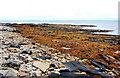
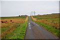
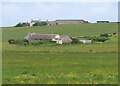
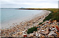
Nearby Images from Geograph Britain and Ireland:
©2009(licence)
©2009(licence)
©2023(licence)
©2009(licence)
©2013(licence)
The above images may not be of the site on this page, they are loaded from Geograph.
Please Submit an Image of this site or go out and take one for us!
Click here to see more info for this site
Nearby sites
Key: Red: member's photo, Blue: 3rd party photo, Yellow: other image, Green: no photo - please go there and take one, Grey: site destroyed
Download sites to:
KML (Google Earth)
GPX (GPS waypoints)
CSV (Garmin/Navman)
CSV (Excel)
To unlock full downloads you need to sign up as a Contributory Member. Otherwise downloads are limited to 50 sites.
Turn off the page maps and other distractions
Nearby sites listing. In the following links * = Image available
1.0km WNW 289° Broch of Steiro* Broch or Nuraghe (HY50191635)
1.5km SE 136° Hacksness (Shapinsay) Cairn (HY52181491)
1.5km NE 54° Mor Stein* Standing Stone (Menhir) (HY52401685)
2.4km ENE 79° Castle Bloody* Souterrain (Fogou, Earth House) (HY53581644)
2.6km W 265° Helliar Holm Broch or Nuraghe (HY48591579)
3.2km N 349° Odin Stone* Standing Stone (Menhir) (HY506191)
3.6km SW 232° Head of Work* Chambered Cairn (HY48341382)
3.9km W 273° Setter Noost* Ancient Village or Settlement (HY47301621)
4.0km NNE 18° Unyatuak* Artificial Mound (HY52451983)
4.4km W 273° Twi Ness* Cairn (HY46761625)
5.7km S 183° Yinstay* Ancient Village or Settlement (HY50841031)
5.7km NNE 29° Burroughston Broch* Broch or Nuraghe (HY540210)
6.6km SSE 150° Castle of Hangie Bay* Stone Fort or Dun (HY54461022)
6.8km SSE 150° The Brough* Ancient Village or Settlement (HY545101)
6.8km S 171° Loch of Tankerness* Ancient Village or Settlement (HY522093)
6.8km NNE 20° Ness of Ork Broch or Nuraghe (HY53562238)
7.0km S 177° The Howie of The Manse* Broch or Nuraghe (HY514090)
7.0km SSW 211° Berstane Broch* Broch or Nuraghe (HY475100)
7.1km S 171° Grieves Cottage* Standing Stone (Menhir) (HY522090)
7.1km SSE 163° Taing of Beeman* Ancient Village or Settlement (HY53210914)
7.5km S 180° Whitecleat* Holy Well or Sacred Spring (HY511085)
7.8km SSW 213° Tower Hill (Orkney)* Round Barrow(s) (HY469095)
7.9km SW 231° Kirkwall Sculptured Stone (HY450111)
8.0km S 178° Mill Sand* Standing Stones (HY513080)
8.0km SW 230° Kirkwall Sculptured Stone (HY44941087)
View more nearby sites and additional images


 We would like to know more about this location. Please feel free to add a brief description and any relevant information in your own language.
 Wir möchten mehr über diese Stätte erfahren. Bitte zögern Sie nicht, eine kurze Beschreibung und relevante Informationen in Deutsch hinzuzufügen.
 Nous aimerions en savoir encore un peu sur les lieux. S'il vous plaît n'hesitez pas à ajouter une courte description et tous les renseignements pertinents dans votre propre langue.
 Quisieramos informarnos un poco más de las lugares. No dude en añadir una breve descripción y otros datos relevantes en su propio idioma.