


<< Our Photo Pages >> Castle Bloody - Souterrain (Fogou, Earth House) in Scotland in Orkney
Submitted by C_Michael_Hogan on Tuesday, 06 November 2007 Page Views: 13653
Iron Age and Later PrehistorySite Name: Castle BloodyCountry: Scotland County: Orkney Type: Souterrain (Fogou, Earth House)
Nearest Town: Kirkwall Nearest Village: Balfour
Map Ref: HY53581644
Latitude: 59.032458N Longitude: 2.810463W
Condition:
| 5 | Perfect |
| 4 | Almost Perfect |
| 3 | Reasonable but with some damage |
| 2 | Ruined but still recognisable as an ancient site |
| 1 | Pretty much destroyed, possibly visible as crop marks |
| 0 | No data. |
| -1 | Completely destroyed |
| 5 | Superb |
| 4 | Good |
| 3 | Ordinary |
| 2 | Not Good |
| 1 | Awful |
| 0 | No data. |
| 5 | Can be driven to, probably with disabled access |
| 4 | Short walk on a footpath |
| 3 | Requiring a bit more of a walk |
| 2 | A long walk |
| 1 | In the middle of nowhere, a nightmare to find |
| 0 | No data. |
| 5 | co-ordinates taken by GPS or official recorded co-ordinates |
| 4 | co-ordinates scaled from a detailed map |
| 3 | co-ordinates scaled from a bad map |
| 2 | co-ordinates of the nearest village |
| 1 | co-ordinates of the nearest town |
| 0 | no data |
Internal Links:
External Links:
I have visited· I would like to visit
C_Michael_Hogan has visited here
")
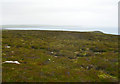
Castle Bloody is a large souterrain mound prominently situated on the highest topographic point of southeastern Shapinsay on the island's sole remaining heather moorland. (Fraser, 1983) The structure has been described as a Pictish fort or earthen house, and likely predates the Burroughston Broch located somewhat further to the north along Shapinsay's east coast. Earlier records of the Royal Commission on the Ancient and Historical Monuments of Scotland (RCAHMS) classify this site as a chambered cairn, although more detailed analysis places the structure in the category of a souterrain.(RCAHMS, 1981) The interior geometry is comprised by a principal subterranean cell with multiple ancillary cells or recesses branching from that central structure. There are two passages leading to the principal cell. Other nearby prehistoric monuments are the Mor Stein standing stone (about 1.3 kilometres northwest) and several cairns (about 0.8 kilometres north-northwest). The findings herein are based upon review of extant literature and my field visit in July, 2007.
EXPLORATION HISTORY. Since the site has only been examined in an elementary manner, the overall structure remains mysterious and has yielded an incomplete understanding of its architecture and function. Earliest noting of the site was in the 1880 Name Book and on the 1900 six inch Ordinance Survey map at HY 5358 1644 (OS, 1900). Sometime prior to 1928, M. Work of Newfield Cottage removed some of the massive upper capstone slabs, which subsequently were determined to be roofing for the principal chamber. (RCAHMS, 1946)
ARCHITECTURE. The overall geometry is that of a turf covered stony mound approximately 13 metres in diameter. The mound height has been variously reported in the literature at 1.2 to 1.8 metres, which outcome is not surprising given the unexcavated nature of the monument and its position on undulating terrain. The mound classification can be likened to Ham, Caithness (ND27SW 1) and Midgarth (HY32SE 6). The principal chamber is offset somewhat east of the mound midpoint, with a north/south axis. The chamber's a roof is capped with of large flattish stones; thie approximate chamber dimensions are 1.5 by 0.9 metres. This main chamber has drystone sides with corbelling in evidence. There are apparently other cells or recesses on each side of the principal chamber.
The main entrance to the principal chamber is a slightly curved lintelled passage approaching from the southeast direction. A second and much lower passage, now blocked by debris, leads from the north end of the chamber, and thence turning northeast after the entrant reaches a short distance. (RCAHMS, 1987). The smaller north end passage is traceable for about one metre and appears to lead to a depression or cavity, filled with loose-packed rubble with voids, which may be another chamber.
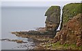
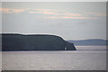
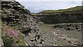
ENVIRONMENTAL FACTORS.. As in the case of Burroughston to the north, the siting of Castle bloody served as a defensive lookout for sea marauders coming from other islands or nations. The structure is set back approximately 150 feet from the shoreline, sufficient to provide the Pictish inhabitants a buffer zone from the sea which pound the surrounding lands with salt spray driven by fierce Orcadian storm winds. Besides this buffer from surf and ocean noise, the situation of Castle Bloody is much more sheltered from high wave action than the cliff areas at the island's north; for example, a site selected near the Geo of Ork would have similar cliff defences of the Castle bloody site, but would be subjected to much higher wave action, making fishing and seal hunting unpromising.
Significantly, Castle Bloody is near fertile lands that are even today producing grain crops, as they no doubt did for the Picts inclined to farming at the ancient settlement, even though the immediate locale is moorland. This habitat may qualify as a rare ecosystem known as the North Atlantic wet heath; I observed one of its indicator species, Eriophorum vaginatum, a rare cotton grass immediately close by to Castle Bloody. An important food resource at hand for the ancient Picts was the abundant birdlife at the immediate coastline situated near Langavi Geo a scant 150 feet from the doorstep of Castle Bloody. A further factor favouring the selection of Castle Bloody by the Picts is the rich seafood resource on the western shores of Shapinsay. (Hogan, 2007). There are two brackish lochs, Lairo Water and Vasa Loch, respectively 40 minutes and 1.3 hours walk respectively from Castle Bloody; furthermore there is a biologically productive estuary, the Ouse, adjacent to Lairo Water.
REFERENCES.
* David Fraser (1983) ‘'Land and Society in Neolithic Orkney'‘, B.A.R.
* RCAHMS (1981 ) Ordinance Survey visit (JLD) 18 May, 1981 (Confirmed by A S Henshall).
* Ordinance Survey of the United Kingdom {1900} 6"map, Orkney, 2nd ed.
* RCAHMS (1946) Original Name Books of the Ordnance Survey: Book No.18, 145, visited 1928
* RCAHMS (1987) ‘'The Royal Commission on the Ancient and Historical Monuments of Scotland. Twelfth report with an inventory of the ancient monuments of Orkney and Shetland'‘,
3v, Edinburgh, 277, No.786,
* C.Michael Hogan (2007) ‘'Burroughston Broch'‘, The Megalithic Portal, ed. Andy Burnham
(The foregoing content is an original article prepared by C. Michael Hogan for the Megalithic Portal.)
You may be viewing yesterday's version of this page. To see the most up to date information please register for a free account.
")
Do not use the above information on other web sites or publications without permission of the contributor.
Nearby Images from Geograph Britain and Ireland:

©2007(licence)
©2009(licence)
©2007(licence)
©2013(licence)
©2022(licence)
The above images may not be of the site on this page, they are loaded from Geograph.
Please Submit an Image of this site or go out and take one for us!
Click here to see more info for this site
Nearby sites
Key: Red: member's photo, Blue: 3rd party photo, Yellow: other image, Green: no photo - please go there and take one, Grey: site destroyed
Download sites to:
KML (Google Earth)
GPX (GPS waypoints)
CSV (Garmin/Navman)
CSV (Excel)
To unlock full downloads you need to sign up as a Contributory Member. Otherwise downloads are limited to 50 sites.
Turn off the page maps and other distractions
Nearby sites listing. In the following links * = Image available
1.2km WNW 288° Mor Stein* Standing Stone (Menhir) (HY52401685)
2.1km SW 222° Hacksness (Shapinsay) Cairn (HY52181491)
2.4km WSW 259° Howe Hill (Howe Farm)* Ancient Village or Settlement (HY51171599)
3.4km W 268° Broch of Steiro* Broch or Nuraghe (HY50191635)
3.6km NNW 341° Unyatuak* Artificial Mound (HY52451983)
4.0km NW 311° Odin Stone* Standing Stone (Menhir) (HY506191)
4.6km N 5° Burroughston Broch* Broch or Nuraghe (HY540210)
5.0km W 262° Helliar Holm Broch or Nuraghe (HY48591579)
5.8km WSW 243° Head of Work* Chambered Cairn (HY48341382)
5.9km N 359° Ness of Ork Broch or Nuraghe (HY53562238)
6.3km W 267° Setter Noost* Ancient Village or Settlement (HY47301621)
6.3km S 171° Castle of Hangie Bay* Stone Fort or Dun (HY54461022)
6.4km S 171° The Brough* Ancient Village or Settlement (HY545101)
6.7km SSW 203° Yinstay* Ancient Village or Settlement (HY50841031)
6.8km W 268° Twi Ness* Cairn (HY46761625)
7.3km S 190° Loch of Tankerness* Ancient Village or Settlement (HY522093)
7.3km S 182° Taing of Beeman* Ancient Village or Settlement (HY53210914)
7.6km S 190° Grieves Cottage* Standing Stone (Menhir) (HY522090)
7.7km SSW 196° The Howie of The Manse* Broch or Nuraghe (HY514090)
8.3km SSW 197° Whitecleat* Holy Well or Sacred Spring (HY511085)
8.7km SSW 194° Mill Sand* Standing Stones (HY513080)
8.8km SW 223° Berstane Broch* Broch or Nuraghe (HY475100)
9.3km S 190° Loch of Messigate* Standing Stones (HY519073)
9.6km SW 223° Tower Hill (Orkney)* Round Barrow(s) (HY469095)
9.7km SE 142° Brough of Deerness* Promontory Fort / Cliff Castle (HY59550873)
View more nearby sites and additional images


 We would like to know more about this location. Please feel free to add a brief description and any relevant information in your own language.
 Wir möchten mehr über diese Stätte erfahren. Bitte zögern Sie nicht, eine kurze Beschreibung und relevante Informationen in Deutsch hinzuzufügen.
 Nous aimerions en savoir encore un peu sur les lieux. S'il vous plaît n'hesitez pas à ajouter une courte description et tous les renseignements pertinents dans votre propre langue.
 Quisieramos informarnos un poco más de las lugares. No dude en añadir una breve descripción y otros datos relevantes en su propio idioma.