<< Our Photo Pages >> Cubbie Roo's Burden - Chambered Cairn in Scotland in Orkney
Submitted by TimPrevett on Friday, 04 August 2006 Page Views: 6626
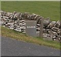
Neolithic and Bronze AgeSite Name: Cubbie Roo's Burden Alternative Name: Cobbie Row's BurdenCountry: Scotland County: Orkney Type: Chambered Cairn
Nearest Town: Rousay (Island)
Map Ref: HY43932800
Latitude: 59.135094N Longitude: 2.981518W
Condition:
| 5 | Perfect |
| 4 | Almost Perfect |
| 3 | Reasonable but with some damage |
| 2 | Ruined but still recognisable as an ancient site |
| 1 | Pretty much destroyed, possibly visible as crop marks |
| 0 | No data. |
| -1 | Completely destroyed |
| 5 | Superb |
| 4 | Good |
| 3 | Ordinary |
| 2 | Not Good |
| 1 | Awful |
| 0 | No data. |
| 5 | Can be driven to, probably with disabled access |
| 4 | Short walk on a footpath |
| 3 | Requiring a bit more of a walk |
| 2 | A long walk |
| 1 | In the middle of nowhere, a nightmare to find |
| 0 | No data. |
| 5 | co-ordinates taken by GPS or official recorded co-ordinates |
| 4 | co-ordinates scaled from a detailed map |
| 3 | co-ordinates scaled from a bad map |
| 2 | co-ordinates of the nearest village |
| 1 | co-ordinates of the nearest town |
| 0 | no data |
Internal Links:
External Links:
I have visited· I would like to visit
drolaf visited on 9th Jun 2022 - their rating: Cond: 2 Amb: 3 Access: 4
SandyG visited on 3rd Jun 2015 - their rating: Cond: 3 Amb: 4 Access: 4
TimPrevett have visited here
Average ratings for this site from all visit loggers: Condition: 2.5 Ambience: 3.5 Access: 4
")
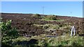
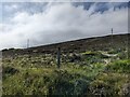
Remains of a chambered cairn just over 50 feet in diameter and just over 4 feet high, on north side of the road. Five upright stones have been noted within the the robbed out centre.
You may be viewing yesterday's version of this page. To see the most up to date information please register for a free account.
")
Do not use the above information on other web sites or publications without permission of the contributor.
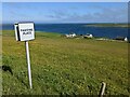
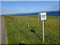
Nearby Images from Geograph Britain and Ireland:
©2021(licence)
©2023(licence)
©2023(licence)
©2023(licence)
©2019(licence)
The above images may not be of the site on this page, they are loaded from Geograph.
Please Submit an Image of this site or go out and take one for us!
Click here to see more info for this site
Nearby sites
Key: Red: member's photo, Blue: 3rd party photo, Yellow: other image, Green: no photo - please go there and take one, Grey: site destroyed
Download sites to:
KML (Google Earth)
GPX (GPS waypoints)
CSV (Garmin/Navman)
CSV (Excel)
To unlock full downloads you need to sign up as a Contributory Member. Otherwise downloads are limited to 50 sites.
Turn off the page maps and other distractions
Nearby sites listing. In the following links * = Image available
1.4km WSW 253° Taversoe Tuick* Chambered Cairn (HY42572761)
1.8km NW 306° Tammaskirk* Ancient Village or Settlement (HY42502907)
1.9km SSE 162° Braes of Ha’Breck, Wyre. Ancient Village or Settlement (HY445262)
2.5km W 260° Blackhammer* Chambered Tomb (HY41422761)
2.6km WSW 252° Knowe of Hunclett* Broch or Nuraghe (HY41442722)
3.4km W 268° Knowe of Yarso* Chambered Cairn (HY40482795)
3.5km E 92° Onziebist* Chambered Cairn (HY4741827807)
3.6km W 261° Langstane (Orkney)* Standing Stone (Menhir) (HY404275)
3.9km W 269° Knowe of Ramsay* Chambered Cairn (HY40042800)
3.9km W 261° Knowe of Burrian (Frotoft)* Broch or Nuraghe (HY40062745)
4.0km W 269° Knowe of Lairo* Chambered Cairn (HY39922796)
4.0km NNW 330° Knowe of Craie* Chambered Cairn (HY41963153)
4.2km N 354° Bigland Long (Rousay) Cairn (HY43533214)
4.2km NNW 338° Kierfea Hill (Rousay) Cairn (HY42423196)
4.3km NNE 17° Scockness* Ancient Village or Settlement (HY45263214)
4.5km N 358° Bigland Round* Chambered Cairn (HY438325)
4.7km N 0° Faraclett Head West Cairn (HY44003270)
4.7km N 360° Faraclett Head East Cairn (HY43993271)
4.7km W 270° Viera Lodge Broch or Nuraghe (HY392281)
4.8km N 8° Yetnasteen* Standing Stone (Menhir) (HY447327)
5.0km SW 230° Ness of Woodwick* Broch or Nuraghe (HY40072487)
5.6km W 279° Westness Chambererd Tomb* Chambered Tomb (HY38402898)
5.7km S 169° Gairsay Cairn (HY44942237)
5.8km WSW 258° Gurness* Broch or Nuraghe (HY3818926842)
5.8km WSW 258° Aikerness Class I Pictish Symbol Stone (HY38182685)
View more nearby sites and additional images


 We would like to know more about this location. Please feel free to add a brief description and any relevant information in your own language.
 Wir möchten mehr über diese Stätte erfahren. Bitte zögern Sie nicht, eine kurze Beschreibung und relevante Informationen in Deutsch hinzuzufügen.
 Nous aimerions en savoir encore un peu sur les lieux. S'il vous plaît n'hesitez pas à ajouter une courte description et tous les renseignements pertinents dans votre propre langue.
 Quisieramos informarnos un poco más de las lugares. No dude en añadir una breve descripción y otros datos relevantes en su propio idioma.