 with our Megalithic Portal iPhone app")

<< Our Photo Pages >> The Larches Camp - Hillfort in Wales in Monmouthshire (Sir Fynwy)
Submitted by Silurian on Sunday, 21 July 2002 Page Views: 6709
Iron Age and Later PrehistorySite Name: The Larches CampCountry: Wales County: Monmouthshire (Sir Fynwy) Type: Hillfort
Nearest Town: Caerwent Nearest Village: Penhow
Map Ref: ST433900 Landranger Map Number: 171
Latitude: 51.605967N Longitude: 2.820131W
Condition:
| 5 | Perfect |
| 4 | Almost Perfect |
| 3 | Reasonable but with some damage |
| 2 | Ruined but still recognisable as an ancient site |
| 1 | Pretty much destroyed, possibly visible as crop marks |
| 0 | No data. |
| -1 | Completely destroyed |
| 5 | Superb |
| 4 | Good |
| 3 | Ordinary |
| 2 | Not Good |
| 1 | Awful |
| 0 | No data. |
| 5 | Can be driven to, probably with disabled access |
| 4 | Short walk on a footpath |
| 3 | Requiring a bit more of a walk |
| 2 | A long walk |
| 1 | In the middle of nowhere, a nightmare to find |
| 0 | No data. |
| 5 | co-ordinates taken by GPS or official recorded co-ordinates |
| 4 | co-ordinates scaled from a detailed map |
| 3 | co-ordinates scaled from a bad map |
| 2 | co-ordinates of the nearest village |
| 1 | co-ordinates of the nearest town |
| 0 | no data |
Internal Links:
External Links:
I have visited· I would like to visit
Ellpezz would like to visit
")
Page originally by Vicky
You may be viewing yesterday's version of this page. To see the most up to date information please register for a free account.
")
")
Do not use the above information on other web sites or publications without permission of the contributor.
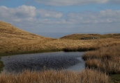
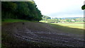
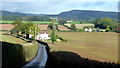
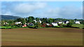
Nearby Images from Geograph Britain and Ireland:
©2014(licence)
©2014(licence)
©2014(licence)
©2012(licence)
©2010(licence)
The above images may not be of the site on this page, they are loaded from Geograph.
Please Submit an Image of this site or go out and take one for us!
Click here to see more info for this site
Nearby sites
Key: Red: member's photo, Blue: 3rd party photo, Yellow: other image, Green: no photo - please go there and take one, Grey: site destroyed
Download sites to:
KML (Google Earth)
GPX (GPS waypoints)
CSV (Garmin/Navman)
CSV (Excel)
To unlock full downloads you need to sign up as a Contributory Member. Otherwise downloads are limited to 50 sites.
Turn off the page maps and other distractions
Nearby sites listing. In the following links * = Image available
350m N 359° Carrow Hill Round Barrow Round Barrow(s) (ST43309035)
424m NW 313° Carrow Hill Round Barrow Pair Round Barrow(s) (ST42999029)
1.1km E 85° Woodcock Hill Barrow Round Barrow(s) (ST44449008)
1.9km ENE 62° Five Lanes Round Barrow (B) Round Barrow(s) (ST45019090)
1.9km ENE 61° Five Lanes Round Barrow (A) Round Barrow(s) (ST45019091)
2.2km ENE 76° Middle Hendre Round Barrow(s) (ST454905)
2.6km SSE 151° Llanfihangel Rogiet* Standing Stone (Menhir) (ST44518775)
2.8km SE 139° Llanfihangel Rogiet Churchyard Cross* Ancient Cross (ST4512087850)
2.8km SSE 163° Undy Earthwork Misc. Earthwork (ST441873)
3.0km SW 229° Wilcrick Wishing Well* Holy Well or Sacred Spring (ST4097088044)
3.2km SW 223° Wilcrick Hill Fort* Hillfort (ST411877)
3.3km NE 44° NOT SET
3.3km NW 316° Castell Prin* Hillfort (ST410924)
3.4km NNE 13° Gray Hill Cairn Cemetery* Barrow Cemetery (ST4408693273)
3.6km N 1° Gray Hill summit cairn* Round Cairn (ST43399355)
3.6km N 7° Gray Hill circle* Stone Circle (ST43809353)
3.6km E 82° Silurum Stone* Marker Stone (ST46879049)
3.6km N 7° Gray Hill stone row* Standing Stone (Menhir) (ST43769357)
3.7km E 81° Venta Silurum Settlement* Ancient Village or Settlement (ST46959056)
3.7km E 81° Cult Temple at Venta Silurum* Ancient Temple (ST4695890564)
3.8km NE 46° Llanmelin Wood* Hillfort (ST46109260)
4.1km NE 46° Llan-melin wood Earthwork Misc. Earthwork (ST463928)
4.1km N 354° Forresters' Oaks Round Barrow* Round Barrow(s) (ST42929410)
4.8km NNW 340° Llanvaches 1* Round Barrow(s) (ST41699455)
4.8km NNW 340° Llanvaches 2* Round Barrow(s) (ST41669455)
View more nearby sites and additional images


 We would like to know more about this location. Please feel free to add a brief description and any relevant information in your own language.
 Wir möchten mehr über diese Stätte erfahren. Bitte zögern Sie nicht, eine kurze Beschreibung und relevante Informationen in Deutsch hinzuzufügen.
 Nous aimerions en savoir encore un peu sur les lieux. S'il vous plaît n'hesitez pas à ajouter une courte description et tous les renseignements pertinents dans votre propre langue.
 Quisieramos informarnos un poco más de las lugares. No dude en añadir una breve descripción y otros datos relevantes en su propio idioma.