<< Our Photo Pages >> Westness Chambererd Tomb - Chambered Tomb in Scotland in Orkney
Submitted by DrewParsons on Sunday, 17 October 2010 Page Views: 5113
Neolithic and Bronze AgeSite Name: Westness Chambererd TombCountry: Scotland County: Orkney Type: Chambered Tomb
Nearest Town: Rousay Island
Map Ref: HY38402898
Latitude: 59.143127N Longitude: 3.078408W
Condition:
| 5 | Perfect |
| 4 | Almost Perfect |
| 3 | Reasonable but with some damage |
| 2 | Ruined but still recognisable as an ancient site |
| 1 | Pretty much destroyed, possibly visible as crop marks |
| 0 | No data. |
| -1 | Completely destroyed |
| 5 | Superb |
| 4 | Good |
| 3 | Ordinary |
| 2 | Not Good |
| 1 | Awful |
| 0 | No data. |
| 5 | Can be driven to, probably with disabled access |
| 4 | Short walk on a footpath |
| 3 | Requiring a bit more of a walk |
| 2 | A long walk |
| 1 | In the middle of nowhere, a nightmare to find |
| 0 | No data. |
| 5 | co-ordinates taken by GPS or official recorded co-ordinates |
| 4 | co-ordinates scaled from a detailed map |
| 3 | co-ordinates scaled from a bad map |
| 2 | co-ordinates of the nearest village |
| 1 | co-ordinates of the nearest town |
| 0 | no data |
Internal Links:
External Links:
I have visited· I would like to visit
DrewParsons has visited here
")
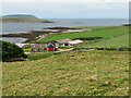
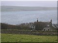
Westness Chambered Tomb is located in a paddock on Westness Farm, 20 metres west of the road from the wharf at Brinian towards Mid Howe. Its Canmore ID is: 2166 and its Canmore Site Number is: HY32NE16. The site is a mound and does not appear to have been excavated.
You may be viewing yesterday's version of this page. To see the most up to date information please register for a free account.
")
")
Do not use the above information on other web sites or publications without permission of the contributor.
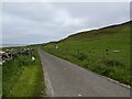
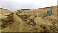
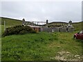
Nearby Images from Geograph Britain and Ireland:
©2023(licence)
©2020(licence)
©2023(licence)
©2021(licence)
©2007(licence)
The above images may not be of the site on this page, they are loaded from Geograph.
Please Submit an Image of this site or go out and take one for us!
Click here to see more info for this site
Nearby sites
Key: Red: member's photo, Blue: 3rd party photo, Yellow: other image, Green: no photo - please go there and take one, Grey: site destroyed
Download sites to:
KML (Google Earth)
GPX (GPS waypoints)
CSV (Garmin/Navman)
CSV (Excel)
To unlock full downloads you need to sign up as a Contributory Member. Otherwise downloads are limited to 50 sites.
Turn off the page maps and other distractions
Nearby sites listing. In the following links * = Image available
1.1km NW 307° Knowe of Swandro* Chambered Cairn (HY37532966)
1.2km SE 137° Viera Lodge Broch or Nuraghe (HY392281)
1.3km NW 306° Knowe of Rowiegar* Chambered Cairn (HY37332978)
1.8km ESE 123° Knowe of Lairo* Chambered Cairn (HY39922796)
1.9km ESE 120° Knowe of Ramsay* Chambered Cairn (HY40042800)
1.9km NW 321° Midhowe Chambered Cairn* Chambered Cairn (HY37223051)
2.0km NW 323° Midhowe Broch* Broch or Nuraghe (HY372306)
2.1km S 185° Aikerness Class I Pictish Symbol Stone (HY38182685)
2.1km S 185° Gurness* Broch or Nuraghe (HY3818926842)
2.2km NW 321° North Howe Broch* Broch or Nuraghe (HY3705130722)
2.3km SE 132° Knowe of Burrian (Frotoft)* Broch or Nuraghe (HY40062745)
2.3km ESE 115° Knowe of Yarso* Chambered Cairn (HY40482795)
2.5km SE 126° Langstane (Orkney)* Standing Stone (Menhir) (HY404275)
3.0km SW 221° Knowe of Stenso* Broch or Nuraghe (HY3639426747)
3.2km WSW 238° Knowe of Grugar* Broch or Nuraghe (HY35642730)
3.3km ESE 114° Blackhammer* Chambered Tomb (HY41422761)
3.3km NNW 342° Knowe of Dale* Misc. Earthwork (HY37423217)
3.4km WSW 247° Burgar* Broch or Nuraghe (HY352277)
3.5km ESE 119° Knowe of Hunclett* Broch or Nuraghe (HY41442722)
3.6km NNE 19° Knowe of Lingro Cairn (HY3964832378)
3.7km WSW 236° Grugar* Carving (HY353270)
3.8km WSW 251° West Broch of Burgar* Chambered Cairn (HY34822782)
3.9km S 187° Quoys Chambered Cairn Chambered Cairn (HY37822507)
4.1km E 88° Tammaskirk* Ancient Village or Settlement (HY42502907)
4.2km S 185° Redland South* Chambered Cairn (HY38002484)
View more nearby sites and additional images


 We would like to know more about this location. Please feel free to add a brief description and any relevant information in your own language.
 Wir möchten mehr über diese Stätte erfahren. Bitte zögern Sie nicht, eine kurze Beschreibung und relevante Informationen in Deutsch hinzuzufügen.
 Nous aimerions en savoir encore un peu sur les lieux. S'il vous plaît n'hesitez pas à ajouter une courte description et tous les renseignements pertinents dans votre propre langue.
 Quisieramos informarnos un poco más de las lugares. No dude en añadir una breve descripción y otros datos relevantes en su propio idioma.