<< Our Photo Pages >> Coxall Knoll - Hillfort in England in Herefordshire
Submitted by TimPrevett on Sunday, 21 July 2002 Page Views: 11591
Iron Age and Later PrehistorySite Name: Coxall KnollCountry: England County: Herefordshire Type: Hillfort
Nearest Town: Knighton Nearest Village: Brampton Bryan
Map Ref: SO366734 Landranger Map Number: 137
Latitude: 52.354980N Longitude: 2.932306W
Condition:
| 5 | Perfect |
| 4 | Almost Perfect |
| 3 | Reasonable but with some damage |
| 2 | Ruined but still recognisable as an ancient site |
| 1 | Pretty much destroyed, possibly visible as crop marks |
| 0 | No data. |
| -1 | Completely destroyed |
| 5 | Superb |
| 4 | Good |
| 3 | Ordinary |
| 2 | Not Good |
| 1 | Awful |
| 0 | No data. |
| 5 | Can be driven to, probably with disabled access |
| 4 | Short walk on a footpath |
| 3 | Requiring a bit more of a walk |
| 2 | A long walk |
| 1 | In the middle of nowhere, a nightmare to find |
| 0 | No data. |
| 5 | co-ordinates taken by GPS or official recorded co-ordinates |
| 4 | co-ordinates scaled from a detailed map |
| 3 | co-ordinates scaled from a bad map |
| 2 | co-ordinates of the nearest village |
| 1 | co-ordinates of the nearest town |
| 0 | no data |
Internal Links:
External Links:
I have visited· I would like to visit
TimPrevett has visited here
")
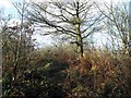
A multivallate hillfort, wooded, with possible recumbent standing stone within the ramparts. Straddles the border of Shropshire and Herefordshire.
You may be viewing yesterday's version of this page. To see the most up to date information please register for a free account.
")
")
")
Do not use the above information on other web sites or publications without permission of the contributor.
Nearby Images from Geograph Britain and Ireland:

©2012(licence)

©2012(licence)
©2013(licence)

©2012(licence)

©2012(licence)
The above images may not be of the site on this page, they are loaded from Geograph.
Please Submit an Image of this site or go out and take one for us!
Click here to see more info for this site
Nearby sites
Key: Red: member's photo, Blue: 3rd party photo, Yellow: other image, Green: no photo - please go there and take one, Grey: site destroyed
Download sites to:
KML (Google Earth)
GPX (GPS waypoints)
CSV (Garmin/Navman)
CSV (Excel)
To unlock full downloads you need to sign up as a Contributory Member. Otherwise downloads are limited to 50 sites.
Turn off the page maps and other distractions
Nearby sites listing. In the following links * = Image available
1.8km SSW 199° Brampton Bryan Lady Well* Holy Well or Sacred Spring (SO36007172)
2.8km NNW 333° Castle Ditches (Shropshire)* Ancient Village or Settlement (SO35357594)
3.5km NE 56° Leintwardine Cursus Cursus (SO39577534)
3.6km ESE 105° Brandon Camp* Hillfort (SO401724)
4.0km NW 324° Great Hagley* Standing Stone (Menhir) (SO343767)
5.4km N 356° Hopton Castle Standing Stone (Menhir) (SO36297883)
6.1km WNW 293° Caer Caradoc (Chapel Lawn)* Hillfort (SO310758)
6.2km N 5° Fairy Stone* Natural Stone / Erratic / Other Natural Feature (SO37237958)
6.8km WSW 240° Spaceguard Centre* Modern Stone Circle etc (SO3066970104)
7.0km NW 318° Fiddler's Elbow Standing Stone (Menhir) (SO32007865)
7.4km NW 315° Pen-Y-Wern Conglomerate* Standing Stone (Menhir) (SO31407871)
7.5km NW 316° Pen-Y-Wern Outlier Standing Stone (Menhir) (SO31447880)
7.6km NW 315° Pen-Y-Wern Hill* Stone Circle (SO313788)
8.1km W 262° Offa's Dyke Centre* Museum (SO2850172430)
8.6km NW 308° Clun Hill Stones* Standing Stones (SO29897873)
8.8km NW 307° Clun Hill Glacial Erratic* Natural Stone / Erratic / Other Natural Feature (SO29667881)
9.0km W 259° Jacket's Well, The Jackets, Jackets Well* Holy Well or Sacred Spring (SO2776271836)
9.1km SE 140° Pyon Wood* Hillfort (SO424664)
9.1km WNW 303° Rockhill Iron Age Enclosure* Misc. Earthwork (SO290785)
9.3km SSW 206° Stapleton Henge Henge (SO32356510)
9.5km NNW 330° Radnor Wood Camp* Hillfort (SO320817)
9.8km N 9° Burrow Hill Camp (Shropshire)* Hillfort (SO38218305)
10.2km SE 144° St John the Baptist and St Alkmund (Aymestrey)* Ancient Cross (SO4256065130)
10.2km SSW 209° St Andrew's Church (Presteigne)* Ancient Cross (SO3156864528)
10.2km SE 130° Croft Ambrey* Hillfort (SO444668)
View more nearby sites and additional images


 We would like to know more about this location. Please feel free to add a brief description and any relevant information in your own language.
 Wir möchten mehr über diese Stätte erfahren. Bitte zögern Sie nicht, eine kurze Beschreibung und relevante Informationen in Deutsch hinzuzufügen.
 Nous aimerions en savoir encore un peu sur les lieux. S'il vous plaît n'hesitez pas à ajouter une courte description et tous les renseignements pertinents dans votre propre langue.
 Quisieramos informarnos un poco más de las lugares. No dude en añadir una breve descripción y otros datos relevantes en su propio idioma.