


<< Our Photo Pages >> Clun Hill Stones - Standing Stones in England in Shropshire
Submitted by TimPrevett on Thursday, 13 January 2005 Page Views: 9354
Neolithic and Bronze AgeSite Name: Clun Hill StonesCountry: England County: Shropshire Type: Standing Stones
Nearest Town: Clun
Map Ref: SO29897873
Latitude: 52.402071N Longitude: 3.031927W
Condition:
| 5 | Perfect |
| 4 | Almost Perfect |
| 3 | Reasonable but with some damage |
| 2 | Ruined but still recognisable as an ancient site |
| 1 | Pretty much destroyed, possibly visible as crop marks |
| 0 | No data. |
| -1 | Completely destroyed |
| 5 | Superb |
| 4 | Good |
| 3 | Ordinary |
| 2 | Not Good |
| 1 | Awful |
| 0 | No data. |
| 5 | Can be driven to, probably with disabled access |
| 4 | Short walk on a footpath |
| 3 | Requiring a bit more of a walk |
| 2 | A long walk |
| 1 | In the middle of nowhere, a nightmare to find |
| 0 | No data. |
| 5 | co-ordinates taken by GPS or official recorded co-ordinates |
| 4 | co-ordinates scaled from a detailed map |
| 3 | co-ordinates scaled from a bad map |
| 2 | co-ordinates of the nearest village |
| 1 | co-ordinates of the nearest town |
| 0 | no data |
Internal Links:
External Links:
I have visited· I would like to visit
TimPrevett has visited here
")
A number of standing stones are claimed in this area; a broken stone survives in a corner of a field nearest the road at this grid reference.
Sites of stones were also recorded at
SO 2968 7904 to the east of a pair footpaths, north side of the road
SO 2950 7870 to north edge of the south side of the road
SO 2989 7850 in the south / south west of a field, south of the road
Nothing was found of these on a thorough investigation of field boundaries and corners relevant to their positions.
A possible long barrow was further west at SO 293 788; 150 loads of small stones were removed, destroying the mound, in order to fill a pit.
An iron age homestead was recorded to the east at SO 303 788; no earthworks visibly survive; the homestead to the west at Rockhill is worth a visit, sitting adjacent to a footpath; SO 290 785.
You may be viewing yesterday's version of this page. To see the most up to date information please register for a free account.
Do not use the above information on other web sites or publications without permission of the contributor.
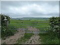
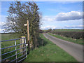
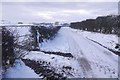
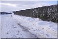
Nearby Images from Geograph Britain and Ireland:
©2021(licence)
©2009(licence)
©2018(licence)
©2018(licence)
©2021(licence)
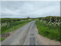
The above images may not be of the site on this page, they are loaded from Geograph.
Please Submit an Image of this site or go out and take one for us!
Click here to see more info for this site
Nearby sites
Key: Red: member's photo, Blue: 3rd party photo, Yellow: other image, Green: no photo - please go there and take one, Grey: site destroyed
Download sites to:
KML (Google Earth)
GPX (GPS waypoints)
CSV (Garmin/Navman)
CSV (Excel)
To unlock full downloads you need to sign up as a Contributory Member. Otherwise downloads are limited to 50 sites.
Turn off the page maps and other distractions
Nearby sites listing. In the following links * = Image available
243m WNW 288° Clun Hill Glacial Erratic* Natural Stone / Erratic / Other Natural Feature (SO29667881)
917m WSW 255° Rockhill Iron Age Enclosure* Misc. Earthwork (SO290785)
1.4km E 86° Pen-Y-Wern Hill* Stone Circle (SO313788)
1.5km E 90° Pen-Y-Wern Conglomerate* Standing Stone (Menhir) (SO31407871)
1.5km E 87° Pen-Y-Wern Outlier Standing Stone (Menhir) (SO31447880)
2.1km E 91° Fiddler's Elbow Standing Stone (Menhir) (SO32007865)
3.1km SSE 158° Caer Caradoc (Chapel Lawn)* Hillfort (SO310758)
3.2km WNW 283° Llanfair Hill East Standing Stone (Menhir) (SO26797950)
3.6km NNW 333° Oak Farm Bowl Barrow* Round Barrow(s) (SO283820)
3.6km NE 35° Radnor Wood Camp* Hillfort (SO320817)
4.2km NNW 327° Whitcott Keysett* Standing Stone (Menhir) (SO27648234)
4.5km W 268° Offa's Dyke west of Llanfair Hill Misc. Earthwork (SO25407862)
4.7km WNW 286° Llanfair Hill North Standing Stone (Menhir) (SO25428006)
4.8km ESE 114° Great Hagley* Standing Stone (Menhir) (SO343767)
5.7km NNE 29° Bury Ditches (Shropshire)* Hillfort (SO327837)
6.1km ESE 116° Castle Ditches (Shropshire)* Ancient Village or Settlement (SO35357594)
6.2km NW 308° Fron Camp* Hillfort (SO250826)
6.4km E 88° Hopton Castle Standing Stone (Menhir) (SO36297883)
6.4km SSW 192° Offa's Dyke Centre* Museum (SO2850172430)
7.2km SSW 196° Jacket's Well, The Jackets, Jackets Well* Holy Well or Sacred Spring (SO2776271836)
7.4km E 83° Fairy Stone* Natural Stone / Erratic / Other Natural Feature (SO37237958)
7.6km NNW 329° St Chad's Well (nr Clun)* Holy Well or Sacred Spring (SO26068529)
8.6km SE 128° Coxall Knoll* Hillfort (SO366734)
8.7km S 174° Spaceguard Centre* Modern Stone Circle etc (SO3066970104)
9.3km SE 138° Brampton Bryan Lady Well* Holy Well or Sacred Spring (SO36007172)
View more nearby sites and additional images


 We would like to know more about this location. Please feel free to add a brief description and any relevant information in your own language.
 Wir möchten mehr über diese Stätte erfahren. Bitte zögern Sie nicht, eine kurze Beschreibung und relevante Informationen in Deutsch hinzuzufügen.
 Nous aimerions en savoir encore un peu sur les lieux. S'il vous plaît n'hesitez pas à ajouter une courte description et tous les renseignements pertinents dans votre propre langue.
 Quisieramos informarnos un poco más de las lugares. No dude en añadir una breve descripción y otros datos relevantes en su propio idioma.