<< Our Photo Pages >> Warrior's Rest - Standing Stone (Menhir) in Scotland in Scottish Borders
Submitted by vicky on Sunday, 22 December 2002 Page Views: 6516
Neolithic and Bronze AgeSite Name: Warrior's Rest Alternative Name: Annan Street; Annan's StreetCountry: Scotland County: Scottish Borders Type: Standing Stone (Menhir)
Nearest Town: Selkirk Nearest Village: Warrior's Rest
Map Ref: NT35452775 Landranger Map Number: 73
Latitude: 55.539178N Longitude: 3.024398W
Condition:
| 5 | Perfect |
| 4 | Almost Perfect |
| 3 | Reasonable but with some damage |
| 2 | Ruined but still recognisable as an ancient site |
| 1 | Pretty much destroyed, possibly visible as crop marks |
| 0 | No data. |
| -1 | Completely destroyed |
| 5 | Superb |
| 4 | Good |
| 3 | Ordinary |
| 2 | Not Good |
| 1 | Awful |
| 0 | No data. |
| 5 | Can be driven to, probably with disabled access |
| 4 | Short walk on a footpath |
| 3 | Requiring a bit more of a walk |
| 2 | A long walk |
| 1 | In the middle of nowhere, a nightmare to find |
| 0 | No data. |
| 5 | co-ordinates taken by GPS or official recorded co-ordinates |
| 4 | co-ordinates scaled from a detailed map |
| 3 | co-ordinates scaled from a bad map |
| 2 | co-ordinates of the nearest village |
| 1 | co-ordinates of the nearest town |
| 0 | no data |
Be the first person to rate this site - see the 'Contribute!' box in the right hand menu.
Internal Links:
External Links:
I have visited· I would like to visit
Modern-Neolithic would like to visit
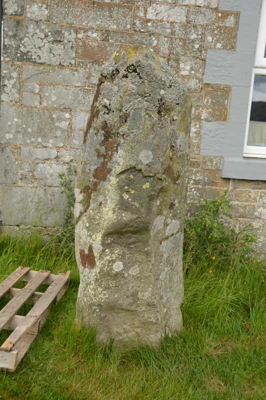
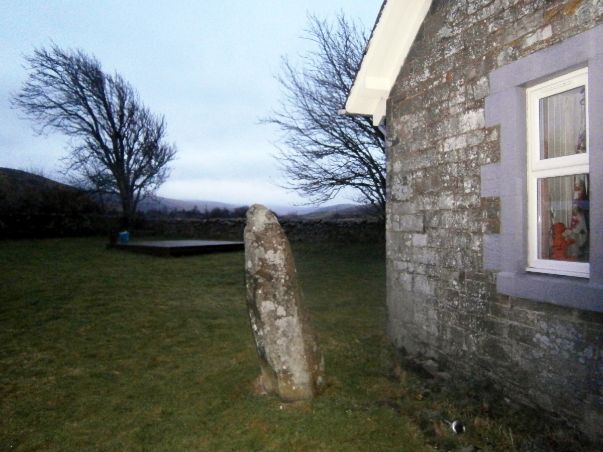
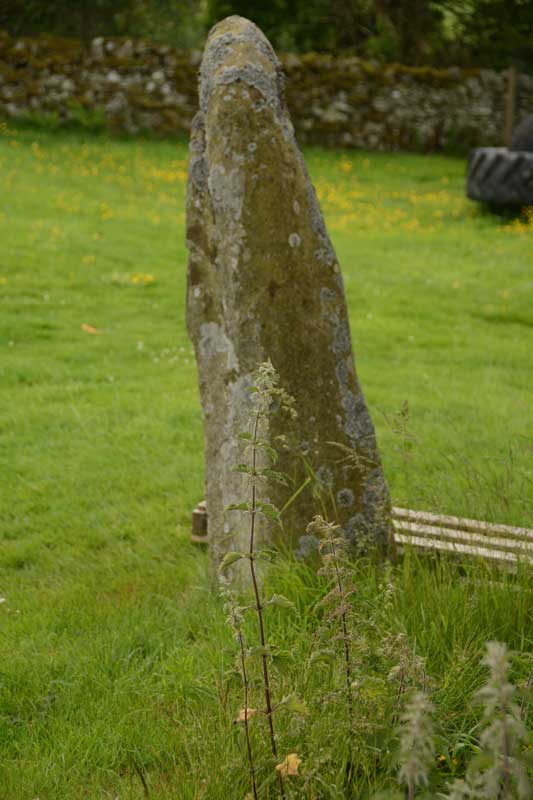
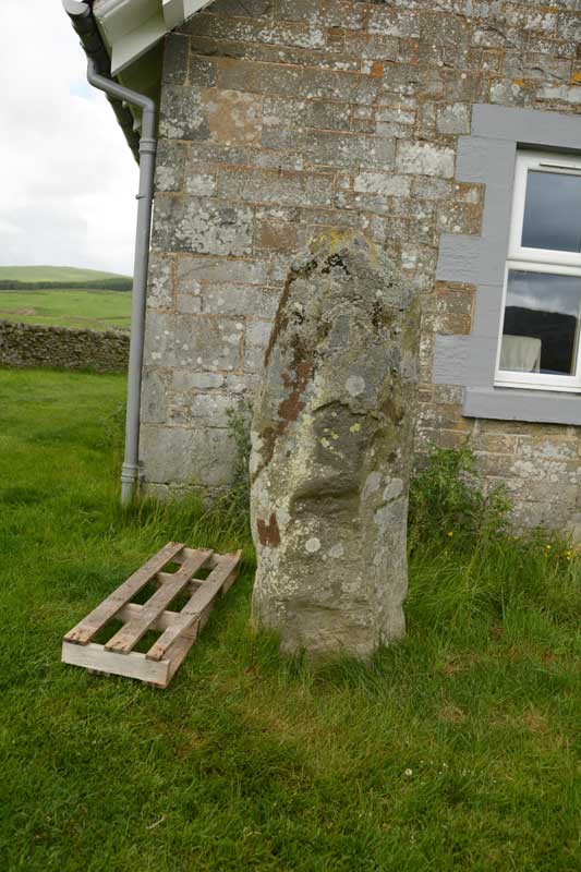
Anne T visited on 27th Jun 2015 - their rating: Cond: 3 Amb: 4 Access: 4 Warrior Stone, Yarrow, Scottish Borders: The Canmore Site (no. 53054) notes say that this stone is “at the south east corner of the cottage known as Warrior’s Rest, 300 yards west of Yarrow Church, there is a standing stone measuring 5ft 3ins in height, 5ft 9ins round the base and 4ft around the shoulder. The top is pointed.”
As the crow flies, it is just over 700 metres east of the Yarrow Stone, back towards Yarrow village. We spotted the small white signpost to Warrior’s Rest cottage at the left hand side of the road and stopped at the entrance. We couldn’t see any standing stone in the vicinity at all, even climbing the steps to the nearby war memorial just to the west of the cottage to see if we could spot anything. In the end, I walked up the track towards the cottage and spotted what appeared to be the top of a small standing stone peeking out above one of the two cars parked on the driveway.
Having come all this way, I was disappointed not to be able to see the stone, so decided to walk up and knock on the door. The curtains were drawn and the door to the garage was open, but despite knocking and calling out, I got no response, so decided to be cheeky and take a couple of photographs (and if anyone came, I’d explain). The stone literally stand a couple of feet away from the front bedroom window – whether its still in its original place and the cottage was built next to it, or the stone has been relocated next to the cottage was difficult to tell.
The Canmore notes also say there are two, previously unreported, cup marks on the eastern side of the stone, although I did quickly examine the stone for any cup marks, but didn’t see any. Usually my camera can pick up on things the eye finds difficult to differentiate at the time, but examining the photos this morning, I couldn’t see anything. I wonder now, at the time of writing, if this has been confused with the Glebe Stone, as I did see two cup marks on the eastern face of this stone.
markj99 visited on 25th Nov 2012 - their rating: Cond: 3 Amb: 4 Access: 5 Warrior's Rest Standing Stone is a yard away from the gable end of Warrior's Rest Cottage. The cottage was unoccupied when I visited so there was no-one to ask permission.
Average ratings for this site from all visit loggers: Condition: 3 Ambience: 4 Access: 4.5
Further information can be found on Canmore site no. 53054 which talks about "a group of eight stone lined graves was found from 10 to 12 yards south of this stone (1859)" - click on the link for more information. The most recent entry on the Canmore record from 2003 records: "Two previously unreported cup markings were marked on the E side of the stone, each c 20mm in diameter."
You may be viewing yesterday's version of this page. To see the most up to date information please register for a free account.

Do not use the above information on other web sites or publications without permission of the contributor.
Nearby Images from Geograph Britain and Ireland:

©2024(licence)

©2008(licence)

©2008(licence)

©2013(licence)

©2011(licence)
The above images may not be of the site on this page, they are loaded from Geograph.
Please Submit an Image of this site or go out and take one for us!
Click here to see more info for this site
Nearby sites
Key: Red: member's photo, Blue: 3rd party photo, Yellow: other image, Green: no photo - please go there and take one, Grey: site destroyed
Download sites to:
KML (Google Earth)
GPX (GPS waypoints)
CSV (Garmin/Navman)
CSV (Excel)
To unlock full downloads you need to sign up as a Contributory Member. Otherwise downloads are limited to 50 sites.
Turn off the page maps and other distractions
Nearby sites listing. In the following links * = Image available
238m SW 231° Glebe Stone* Standing Stone (Menhir) (NT3526227603)
711m WSW 244° The Yarrow Stone* Standing Stone (Menhir) (NT3480627444)
5.8km N 2° Cheese Well* Holy Well or Sacred Spring (NT35693357)
8.2km W 277° Douglas Water SE Stone Circle (NT273288)
8.2km W 277° Douglas Water NW* Stone Circle (NT273288)
8.3km E 96° Tamlane's Well (Carterhaugh)* Holy Well or Sacred Spring (NT43742681)
8.6km W 276° Bught Rig Standing Stones (NT26852876)
11.5km NE 47° Caddonlee* Hillfort (NT43963551)
11.9km E 88° Mungo's Well (Selkirk)* Holy Well or Sacred Spring (NT47342795)
12.4km E 88° Caulks Well (Selkirk)* Holy Well or Sacred Spring (NT4789127983)
12.4km NNW 333° Cardrona* Standing Stone (Menhir) (NT30003895)
13.4km S 185° Black Rig Standing Stone (Menhir) (NT34151437)
13.5km ENE 68° Rink Hill (Boleside) Hillfort (NT48023270)
15.4km NE 45° Torwoodlee* Broch or Nuraghe (NT46553847)
15.6km W 272° Manorhead Standing Stone (Menhir) (NT19862850)
15.9km SSE 148° Borthwick Mains Class I Pictish Symbol Stone (NT4372814111)
15.9km NW 305° Cademuir Hill* Hillfort (NT22473708)
16.0km NW 321° Whitestone (Peebles)* Marker Stone (NT256404)
16.5km NNW 328° Soonhope Rock Art Rock Art (NT269419)
16.7km NW 310° Kirkton Manor* Standing Stone (Menhir) (NT22693863)
17.0km W 274° Nethertown Stone Circle (NT185291)
17.6km SSE 150° Whitcastle Hill* Hillfort (NT44101245)
17.6km NE 37° Bow Castle Broch* Broch or Nuraghe (NT4613541717)
17.8km SSE 151° Whitcastle Sike* Ancient Village or Settlement (NT44011207)
18.1km NNW 331° Soonhope cairn* Chambered Cairn (NT268437)
View more nearby sites and additional images


 We would like to know more about this location. Please feel free to add a brief description and any relevant information in your own language.
 Wir möchten mehr über diese Stätte erfahren. Bitte zögern Sie nicht, eine kurze Beschreibung und relevante Informationen in Deutsch hinzuzufügen.
 Nous aimerions en savoir encore un peu sur les lieux. S'il vous plaît n'hesitez pas à ajouter une courte description et tous les renseignements pertinents dans votre propre langue.
 Quisieramos informarnos un poco más de las lugares. No dude en añadir una breve descripción y otros datos relevantes en su propio idioma.